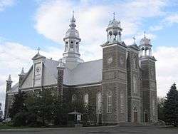
Saint-Cyrille-de-Wendover, Quebec
| Saint-Cyrille-de-Wendover | |
|---|---|
| Municipality | |
 | |
 Location within Drummond RCM. | |
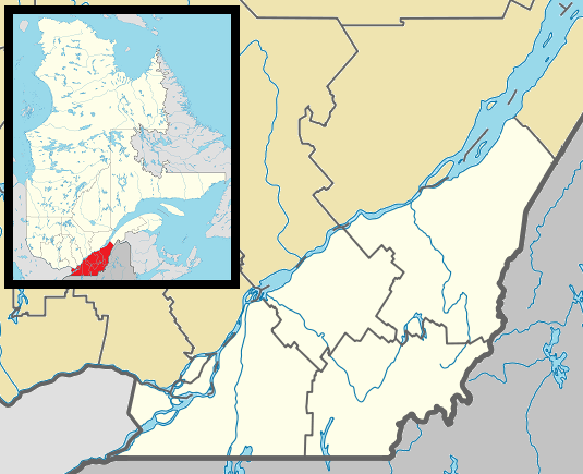 Saint-Cyrille-de-Wendover Location in southern Quebec. | |
| Coordinates: 45°56′N 72°26′W / 45.933°N 72.433°WCoordinates: 45°56′N 72°26′W / 45.933°N 72.433°W[1] | |
| Country |
|
| Province |
|
| Region | Centre-du-Québec |
| RCM | Drummond |
| Constituted | September 6, 1905 |
| Government[2][3] | |
| • Mayor | Daniel Lafond |
| • Federal riding | Drummond |
| • Prov. riding | Drummond–Bois-Francs |
| Area[2][4] | |
| • Total | 110.40 km2 (42.63 sq mi) |
| • Land | 110.30 km2 (42.59 sq mi) |
| Population (2011)[4] | |
| • Total | 4,389 |
| • Density | 39.8/km2 (103/sq mi) |
| • Pop 2006-2011 |
|
| • Dwellings | 1,671 |
| Time zone | EST (UTC−5) |
| • Summer (DST) | EDT (UTC−4) |
| Postal code(s) | J1Z 1C8 |
| Area code(s) | 819 |
| Highways |
|
| Website |
www |
Saint-Cyrille-de-Wendover is a Quebec municipality located in the Drummond Regional County Municipality just east of Drummondville in the Centre-du-Quebec region. The population as of the Canada 2011 Census was 4,389. The town is located alongside the Rivière des Saults.
The town was previously known as Saint-Cyrille which was created in 1905. It was merged in 1982 with the townships of Wendover and Simpson to form the current name. Being located in the middle of numerous townships and valleys, agriculture is a predominant activity in the municipality.
Demographics
Population
Population trend:[5]
| Census | Population | Change (%) |
|---|---|---|
| 2011 | 4,389 | |
| 2006 | 4,079 | |
| 2001 | 3,863 | |
| 1996 | 3,849 | |
| 1991 | 3,682 | N/A |
Language
Mother tongue language (2006)[6]
| Language | Population | Pct (%) |
|---|---|---|
| French only | 3,990 | 98.40% |
| English only | 15 | 0.37% |
| Both English and French | 0 | 0.00% |
| Other languages | 50 | 1.23% |
Transportation
Saint-Cyrille-de-Wendover's main transportation link is Quebec Route 122 which travels through most of the Centre-du-Quebec towards Victoriaville to the east and the Yamaska area in the west north of Autoroute 20, the main Autoroute of the province which travels a few kilometers to the north of town.
See also
References
- ↑ Reference number 135539 of the Commission de toponymie du Québec (French)
- 1 2 Ministère des Affaires municipales, des Régions et de l'Occupation du territoire: Saint-Cyrille-de-Wendover
- ↑ Parliament of Canada Federal Riding History: DRUMMOND (Quebec)
- 1 2 2011 Statistics Canada Census Profile: Saint-Cyrille-de-Wendover, Quebec
- ↑ Statistics Canada: 1996, 2001, 2006, 2011 census
- ↑ 2006 Statistics Canada Community Profile: Saint-Cyrille-de-Wendover, Quebec
External links
- Website of the municipality of Saint-Cyrille-de-Wendover
- Regional Map of the Saint-Cyrile-de-Wendover area
 |
Sainte-Brigitte-des-Saults | Notre-Dame-du-Bon-Conseil (parish) | | |
| Drummondville | |
|||
| ||||
| | ||||
| Drummondville | Saint-Lucien |
| Cities | |
|---|---|
| Municipalities | |
| Parishes | |
| Villages | |
| |