Autoroutes of Quebec
| Autoroutes of Quebec | |
|---|---|
|
Highway shields for Autoroutes 5, 20 and 410 | |
|
The current Autoroute network in Quebec | |
| System information | |
| Maintained by Transports Quebec (MTQ) | |
| Length: | 2,298.5 km[1][2] (1,428.2 mi) |
| Formed: | 1958 |
| System links | |
| Quebec provincial highways | |


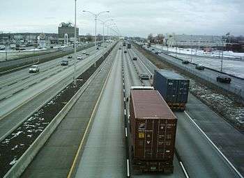
The autoroute system is a network of expressways within the province of Quebec, Canada, operating under the same principle of controlled access as the Interstate Highway System in the United States and the 400-series highways in neighbouring Ontario. The Autoroutes are the backbone of Quebec's highway system, spanning almost 2,300 km (1,429 mi). The speed limit on the Autoroutes is generally 100 km/h (62 mph) in rural areas and 70–90 km/h (43–56 mph) in urban areas.
The word autoroute is a portmanteau of auto and route, equivalent to "motorway" in English, and has become the Quebec French equivalent of "expressway". In the 1950s, when the first Autoroutes were being planned, the design documents called them autostrades, from the Italian word autostrada.[3]
Signage

Autoroutes are identified by blue-and-red shields. The red header of the shield contains a white image representing a highway overpass, and the blue lower portion of the shield contains the Autoroute's number in white, along with a fleur-de-lis, which is a provincial symbol of Quebec.
Most Autoroute and road traffic signs in the province are in French, though English is also used on federally-financed or -owned routes, such as the Bonaventure Expressway in Montreal. To surmount the language barrier, however, most signs in Quebec use pictograms and text is avoided in most cases, with the exceptions usually only being the names of control cities. Other exceptions that are posted in both languages is the illegal use of radar detectors when entering the province that reads "DÉTECTEURS DE RADAR INTERDITS/RADAR DETECTORS PROHIBITED", as well as areas where roads can be slippery due to melting ice and snow, marked "DEGEL/THAW".
Numbering system

Autoroutes are divided into three types – principal routes, deviation routes, and collector routes – and are laid out and numbered in a fashion similar to the Interstate Highway System in the United States. The principal Autoroutes are the major highways of the province, and have single- or double-digit numbers. East-west Autoroutes running parallel to the Saint Lawrence River (for example, Autoroute 20 and Autoroute 40) are assigned even numbers, while north-south Autoroutes running perpendicular to the Saint Lawrence (such as Autoroute 5 and Autoroute 15) are given odd numbers. Deviation and collector Autoroutes both feature triple-digit numbers. Deviation routes are bypasses intended for truck traffic to circumvent urban areas, and are identified by an even number prefixing the number of the nearby Autoroute that it bypasses (for example, Autoroute 440 in Laval). Collector Autoroutes, by contrast, are spur routes into urban areas, and are identified by an odd number prefixing the number of the nearby Autoroute that it branches off of (such as Autoroute 720, a spur of Autoroute 20 into downtown Montreal).
History
Quebec's first Autoroute was the Autoroute des Laurentides (Laurentian Autoroute), which opened in 1959 as a toll road. This initiative to bring freeways into Quebec was started by Maurice Duplessis, whose government saw the construction of the Laurentian Autoroute (now A-15) from Montreal to Saint-Jérôme and the first section of the Boulevard Métropolitain (A-40), which opened in 1960.
1960s
It was the Quebec Liberal government of the 1960s that saw the construction of further Autoroutes, with a grid numbering system and the introduction of the blue and red shield. The sign is inspired by the American Interstate sign. This was especially needed in light of the fact that many visitors would be flocking to Montreal by car for Expo 67. Montreal's Autoroute Décarie (A-15) and the Louis-Hippolyte Lafontaine Bridge–Tunnel were constructed for that very reason. The Autoroute des Cantons-de-l'Est (Eastern Townships Autoroute - A-10) opened in 1964, and its continuation, A-55 between Magog and Rock Island, opened in 1967, connecting with Interstate 91. What are now the A-20 (part of the Trans-Canada Highway) and the A-15 to New York (connecting with Interstate 87), originally built in the 1940s, were upgraded to expressway standards. The A-20 also connects with Highway 401 in Ontario. A-40 was extended out to Berthierville, and later to Trois-Rivières in the 1970s. Others include Autoroutes 25, 30 (southern beltway), 31, 35 (eventually connecting to Interstate 89), Autoroute Laurentienne (73), and 640 (an unfinished proposed northern beltway).
1970s
The 1970s also saw the completion of the Pierre Laporte Bridge in Quebec City, connecting the south shore of the Saint Lawrence River to the north. In addition to this, the A-73 was extended to Beauce, the A-20 was extended to Rivière-du-Loup, and the Chomedey Autoroute (A-13), the A-19 and the A-440 were constructed in Laval. Autoroutes were built (two sections of A-440, and A-740) and a few more planned in the Quebec City region, creating a dense web, which led to significant sprawl. In 1976, the Parti Québécois came to power, whose platform mandated an expansion of public transportation over the construction of more Autoroutes. Existing Autoroutes were extended (e.g., the A-40 was extended from Trois-Rivières to Quebec City) but no new Autoroutes were built.
The Autoroute des Laurentides, the Autoroute des Cantons-de-l'Est, the Autoroute de la Rive-Nord (North Shore Autoroute), and the A-13 were toll roads until the mid-1980s, when the toll barriers were removed and the province stopped collecting tolls from vehicles using the Autoroutes. The last toll booth was on the Champlain Bridge (A-10,A-15 and A-20). It was removed in 1990 because the Champlain Bridge is federal property and is thus not subject to provincial tolls.
2000s
In the 2000s, there were several high-profile failures and collapses around some Autoroutes, due to aging and crumbling infrastructure, including the Boulevard du Souvenir overpass collapse, De la Concorde overpass collapse, and most recently the Ville-Marie tunnel collapse. An online poll by Léger Marketing conducted shortly after the Viger tunnel collapse found that 88 percent of Montrealers are “worried” about the state of roads, bridges and tunnels in the city, with more than half of respondents saying they are downright “scared” to drive under an overpass (58 percent), on a bridge (54 per cent), or through a tunnel (53 per cent). McGill University’s Saeed Mirza stated that ill-advised design choices and poor-quality concrete were used in the construction rush ahead of Expo ’67 and the 1976 Olympics. In particular, the concrete used was permeable with lack of proper drainage, and these allowed chlorides from de-icing salts to corrode the steel reinforcements.[4]
Main-class autoroutes
For full articles on individual autoroutes, see the category page of Quebec Autoroutes.
Autoroute 5
| |
|---|---|
| Autoroute de la Gatineau | |
| Route information | |
| Length: | 34.0 km[1][2] (21.1 mi) |
| Existed: | 1964[2] – present |
| Major junctions | |
| North end: |
|
| South end: | King Edward Avenue, Ottawa |
| Highway system | |
| Quebec provincial highways | |
- Name: Autoroute de la Gatineau
- Description: From the Pont Cartier-MacDonald in Gatineau to Route 105 in Wakefield
- Length: 33 km (21 mi)
- History: First opened in 1964, from the bridge to Route 105 (Gatineau, Exit 5); another section opened in 2009 from chemin de la Rivière (Exit 13 to 21) to an intersection with Route 105 further north near Farm Point. In 1993 an isolated divided four-lane section of Route 366 existed in La Pêche, which was connected to the existing A-5 in October 2014, extending A-5 to 33 km in length. This section has A-5 as well as Route 366 signposts.
Autoroute 10
| |
|---|---|
| Autoroute Bonaventure, Autoroute des Cantons-de-l'Est | |
| Route information | |
| Length: | 145.1 km[2][5] (90.2 mi) |
| Existed: | 1962[2] – present |
| Major junctions | |
| West end: |
|
| East end: |
|
| Highway system | |
| Quebec provincial highways | |

- Name: Autoroute Bonaventure or Bonaventure Expressway
- Description: From the A-720 (Autoroute Ville-Marie) to Île des Sœurs in Montreal
- Length: 4.1 km (2.5 mi)
- History: First opened in 1967
- Name: Autoroute des Cantons-de-l'Est or Eastern Townships Autoroute
- Description: From the Champlain Bridge to Autoroute 610 in Sherbrooke
- Length: 143 km (89 mi)
- History: First section (Montreal-Longueuil across the Champlain Bridge) opened in 1962. Much of A-10 opened in 1964 as a toll road, with the completion of the Eastern Townships Autoroute.
- Notes: The portion east of Autoroute 55 (linking that autoroute with Route 112) was renumbered as Autoroute 610 on September 29, 2006.
- Future: The Autoroute Bonaventure will be completely reconfigured in the coming years. The Société du Havre de Montréal has proposed transforming the autoroute into an urban thoroughfare as part of a broader project to redevelop Montreal's harbourfront.[6] In addition, a current proposal to build the East-West Highway across central and northern Maine calls for the A-10 to be extended to the U.S. border at Coburn Gore where it would meet the new highway. Doing so would create a new and more direct limited-access highway link between Maine, the Maritime Provinces, and Quebec.
Autoroute 13
| |
|---|---|
| Autoroute Chomedey | |
| Route information | |
| Length: | 21.4 km[2][7] (13.3 mi) |
| Existed: | 1975[2] – present |
| Major junctions | |
| South end: |
|
| North end: |
|
| Highway system | |
| Quebec provincial highways | |
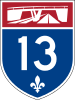
- Name: Autoroute Chomedey (originally Autoroute Mirabel)
- Description: From the A-20 in Montreal to the A-640 in Boisbriand
- Length: 21.4 km (13.3 mi)
- History: First opened in 1975, it was originally planned to extend to Mirabel International Airport but was cancelled, and likely will never be constructed past A-640.
Autoroute 15
| |
|---|---|
| Autoroute Décarie, Autoroute des Laurentides, Trans-Canada Highway | |
| Route information | |
| Length: | 164.0 km[2][7] (101.9 mi) |
| Existed: | 1958[2] – present |
| Major junctions | |
| South end: |
|
| North end: |
|
| Highway system | |
| Quebec provincial highways | |
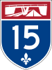
- Name: Autoroute Décarie Sud
- Description: From the United States border at Lacolle (continues as Interstate 87 in New York) to the Turcot Interchange (A-20 West) in Montreal
- Length: 62.6 km (38.9 mi)
- History: Construction of this section of the A-15 was completed in 1967
- Name: Decarie Expressway
- Description: From the Turcot interchange to the A-40 interchange in Montreal
- Length: 7.4 km (4.6 mi)
- History: the autoroute is parallel to the Decarie Boulevard (hence the name); from Côte-de-Liesse to Queen Mary Road on the south, it was built on a wide expanse of vacant land, donated to the City by the Décarie estate on the condition that only a streetcar line be established. When the streetcar system was dismantled in 1959, it was an obvious right-of-way for a highway, so the Décarie autoroute was dug there. South of Queen Mary Road, however, were a significant number of houses which were demolished. In order to avoid demolishing the Notre-Dame-de-Grâces church, the highway veers west south of Côte-Saint-Luc, and runs between Appleton and Botrel Streets, all the way to Saint Jacques Street, where it spectacularly goes from below-ground to well above ground as it intersects with Autoroutes 20 and 720 in the infamous Turcot Interchange (dubbed "Spaghetti Junction" by train crews operating the CN Rail Turcot Yard). Following the conversion from streetcar line to highway, the Décarie Estate unsuccessfully sued the city but was unable to prevail because they did not document their case well enough for the nevertheless sympathetic court.
- Name: Laurentian Autoroute
- Description: From the A-40 interchange to Route 117 in Sainte-Agathe-des-Monts
- Length: 89.4 km (55.6 mi)
- History: This segment of the A-15 is a part of the Trans-Canada Highway. First opened in 1958; the last section was completed in 1974
- Its three notorious curves in Laval/St-Jérôme were to ensure the expropriation of land that belonged to friends of premier Duplessis
- Notes: Route 117 continues northward as a four-lane divided expressway. It is possible that A-15 could be extended beyond Mont-Tremblant.
Autoroute 19
| |
|---|---|
| Autoroute Papineau | |
| Route information | |
| Length: | 10.1 km[2][7] (6.3 mi) |
| Existed: | 1970[2] – present |
| Major junctions | |
| South end: |
|
| North end: |
|
| Highway system | |
| Quebec provincial highways | |

- Name: Autoroute Papineau
- Description: boul. Henri-Bourassa in Montreal to Autoroute 440 in Laval
- Length: 10.1 km (6.3 mi)
- History: First section was opened in 1970 (boul. H-Bourassa to boul. Lévesque),the final section was completed twenty years later.
- Notes: Most of the section in Montreal is an urban arterial (Avenue Papineau). It was originally meant to be the eastern counterpart of Autoroute-15, connecting with the Jacques-Cartier Bridge, but it was decided not to gut yet another swath of housing within the City of Montreal. The portion south of Autoroute-40 no longer occurs as part of A-19.
- The extension north of A-440 was not assigned to A-19 but Route 335 north of A-440 was shifted onto it from boul. des Laurentides.
Autoroute 20
| |
|---|---|
| Autoroute Jean-Lesage, Autoroute du Souvenir, Trans-Canada Highway | |
| Route information | |
| Length: | 585.0 km[2][7] (363.5 mi) |
| Existed: | 1964[2] – present |
| Major junctions | |
| West end: |
|
| East end: |
|
| Highway system | |
| Quebec provincial highways | |
Map of the western segment of Autoroute 20 Map of the eastern segment of Autoroute 20
- Name: Autoroute du Souvenir (from Rivière-Beaudette to Turcot interchange) and Autoroute Jean-Lesage (from Boucherville to Rivière-du-Loup) (known as the Montreal-Toronto Highway throughout the West Island)
- Description: Ontario-Quebec border at Rivière-Beaudette (continues as Highway 401 in Ontario) to Boulevard Gaboury in Mont-Joli
- Length: 585 km (364 mi) - the longest Autoroute in Quebec
- History: Construction of the A-20 began in 1964. It should be noted that the A-20 is a part of the Trans-Canada Highway, from the A-25 interchange (Louis-Hippolyte Lafontaine Bridge–Tunnel) up to Autoroute 85 at Rivière-du-Loup
- Notes: Autoroute 20 is composed of two separate segments. The western segment extends from the Ontario border to L'Isle-Verte, and the eastern segment is a bypass of Rimouski, which was extended in 2003 to Luceville and in 2008 to Mont-Joli. A section of this highway from Vaudreuil-Dorion eastward to the Galipeault Bridge (approximately 4 miles or 6.4 km) is a congested arterial four lane road. It is slowly being upgraded to Autoroute standard.
- Future: There are plans to connect both segments - extending the eastern segment to Trois-Pistoles and eventually connecting with the Rimouski bypass.
- This autoroute has the peculiarity of having a railroad crossing at grade in Saint-Hyacinthe, immediately east of the Boulevard Laframboise overpass. For this particular crossing, the Code de la sécurité routière du Québec has been amended to allow buses to cross this crossing without making the customary mandatory stop. Train crews are instructed in their special operating instructions to call the Sûreté du Québec police to stop the traffic before crossing the highway.
Autoroute 25
| |
|---|---|
| Autoroute Louis-H.-La Fontaine, Trans-Canada Highway | |
| Route information | |
| Length: | 52.1 km[2][7] (32.4 mi) |
| Existed: | 1967[2] – present |
| Major junctions | |
| South end: |
|
| North end: |
|
| Highway system | |
| Quebec provincial highways | |

- Name: Autoroute Transcanadienne (or, unofficially, Autoroute Louis-Hippolyte-La Fontaine and Autoroute de Lanaudière)
- Description: The A-25 was divided into two sections: the first section connected the A-40 to the A-20 (Louis Hippolyte Lafontaine Bridge-Tunnel) and the second ran from the Pie-IX Bridge to Route 125 in Saint-Esprit. Since May 2011 these sections have been joined, and the section from Pie-IX to the new interchange lost its A-25 designation (approx. 5 km / 3.1 mi).
- Length: 52.1 km (32.4 mi)
- History: The first section was completed in 1967 and is a part of the Trans-Canada Highway while the second section was completed up to Saint-Esprit in 1999
- Future: There are long-term plans to extend A-25 all the way to Route 347 in Notre-Dame-de-la-Merci which would double its length to 100 km. A section of Route 125 is currently expressway-grade, which would form the northern end of A-25, connected by 30 km of new highway. No timeline is currently set.
Autoroute 30
| |
|---|---|
| Autoroute de l'Acier | |
| Route information | |
| Length: | 161.3 km[2][7] (100.2 mi) |
| Existed: | 1968[2] – present |
| Major junctions | |
| West end: |
|
| East end: |
|
| Highway system | |
| Quebec provincial highways | |

Map of Autoroute 530 Map of the main section Map of the easternmost section
- Name: Autoroute de l’Acier (formerly Autoroute de contournement sud de Montréal)
- Description: Currently, Autoroute 30 consists of two sections: the main route starts at Autorute 40 just west of Vaudreuil-Dorion, heads south to cross the Saint Lawrence River, then heads east to Châteauguay, detours the Kahnawake reserve and Saint-Constant then goes on to Sorel-Tracy, and the other section links Route 132 at A-55 with Bécancour
- Length: 161.2 km (100.2 mi)
- History: First segments opened in 1968, followed by more in 1971, 1972, 1975, 1977, 1982 and 1996 to form the main section from Sorel-Tracy to Autoroute 15; the Valleyfield bypass opened in 1976, the Bécancour section in 1975, and the Kahnawake bypass in 1990. A new alignment bypassing Saint-Constant south of Route 132 was built to Autoroute 15, opening in November 2010, and directly linked to the east in November 2011. Construction has been completed on the new section between Châteauguay and Vaudreuil-Dorion and joined the other part in December 2012. The existing A-30 segment south of Salaberry-de-Valleyfield has been renumbered as A-530 and connects with A-30 just south of the new A-30 bridge over the Saint Lawrence River. Now finished, A-30 provides a much needed and long-awaited southern bypass of Montreal. However, there are no current plans to build the "missing link" of A-30 between Sorel-Tracy and Bécancour.
Autoroute 31
| |
|---|---|
| Autoroute Antonio-Barrette | |
| Route information | |
| Length: | 14.0 km[2][7] (8.7 mi) |
| Existed: | 1966[2] – present |
| Major junctions | |
| South end: |
|
| North end: |
|
| Highway system | |
| Quebec provincial highways | |

- Name: Autoroute Antonio-Barrette
Autoroute 35
| |
|---|---|
| Autoroute de la Vallée-des-Forts | |
| Route information | |
| Length: | 40.0 km[2][7] (24.9 mi) |
| Existed: | 1966[2] – present |
| Major junctions | |
| South end: |
|
| North end: |
|
| Highway system | |
| Quebec provincial highways | |

- Name: Autoroute de la Vallée-des-Forts
- Description: A short Autoroute that connects Saint-Jean-sur-Richelieu and Iberville (now forming one city) to the A-10; it was briefly designated as the Autoroute de la Nouvelle-Angleterre but the name was revised before any signs were posted. A-35 ends at Route 133, which continues to the Canada/U.S. border where it connects to Interstate 89.
- Length: 40 km (25 mi)
- History: Completed to Saint-Jean-sur-Richelieu in 1967, extended to Saint-Sébastien in 2014.
- Future: A-35 will be extended to finish the freeway link to I-89 via some new alignments and upgrading of certain expressway sections of Route 133. Some have also called for a northern extension to Sorel-Tracy, although there are no current official plans for that.
Autoroute 40
| |
|---|---|
| Autoroute Félix-Leclerc, Metropolitan Expressway, Trans-Canada Highway | |
| Route information | |
| Length: | 347.0 km[2][7] (215.6 mi) |
| Existed: | 1959[2] – present |
| Major junctions | |
| West end: |
|
| East end: |
|
| Highway system | |
| Quebec provincial highways | |

- Name: Autoroute Félix-Leclerc (Autoroute Métropolitaine between A-15 in the west and boul. H.-Bourassa in Montreal in the east; Autoroute de la Rive Nord between the Rivière des Prairies and Route 341)
- Description: From the Ontario-Quebec border at Pointe-Fortune (continues as Highway 417 in Ontario) to Route 138 in Boischatel
- Length: 347.1 km (215.7 mi)
- History: The A-40 is a part of the Trans-Canada Highway from the Ontario border to the A-25 interchange. The first section of the Autoroute Métropolitaine opened in 1960. The Autoroute Métropolitaine was originally intended to be below-ground, like the Autoroute Décarie is. But as sewers run on a north-south axis, this would have called for expensive sewer rerouting below the excavation through inverted siphons. Thus, it was decided to build an elevated autoroute, with one notable exception in the Town of Mount Royal, to separate the residential suburb from the industrial area to the north.
- Future: It is envisioned that A-40 will be extended eastward, possibly as far east as Route 360 or even Route 362 in La Malbaie, as recreation in the Charlevoix area increases. There are no current official plans to extend A-40, however, and upgrades of Route 138 are more likely.
Autoroute 50
| |
|---|---|
| Autoroute de l'Outaouais, Autoroute Maurice-Richard | |
| Route information | |
| Length: | 159.0 km[2][7] (98.8 mi) |
| Existed: | 1975[2] – present |
| Major junctions | |
| West end: |
|
| East end: |
|
| Highway system | |
| Quebec provincial highways | |

- Name: Autoroute Maurice-Richard
- Description: The A-50 is a recently completed route; in the East it ends at Route 117 near Mirabel, connects the A-15 and Mirabel Airport to Route 148 at Grenville just west of Lachute, near a bridge over the Ottawa River to Hawkesbury, Ontario—this section includes an at-grade railway crossing. The A-50 starts in the west to link downtown Hull (part of Gatineau) to Thurso just east of Buckingham, and now continues east without any gaps.
- Original Planned Length: 290 km (Fort-Coulonge via Hull to Montréal).
- Revised Length: 159 km (Gatineau (Hull) to Mirabel).
- History: The western section of this Autoroute was originally named the Autoroute de l’Outaouais, as it ran within the Outaouais Region from Hull to Buckingham and follows the path of the Ottawa River (Rivière des Outaouais) on the Quebec side.
- The expressway was officially announced in 1965 to link the Outaouais and the Montréal area without crossing into Ontario, plans were altered several times to reduce the number of farms affected by the road and detoured north to connect to the planned end of A-13 (which was never completed past A-640) and to facilitate access from Ottawa-Hull to the planned International Airport at Mirabel (built and in operation from 1975 until 2004, but currently unused by travelers). The original plan called for A-50 to be extended east as A-40 near Berthierville, and for a brief period in the 1970s and early 1980s, a "super-2" section of Route 158 was signed as A-50.
- Except for the western part linking downtown Hull to Buckingham, and some short segments near Lachute and Mirabel Airport to A-15, the expressway is actually a high speed (100 km/h) 2-way road. Overpasses are built to accommodate a future divided highway but currently only one portion of the overpass has the 2-way A-50 going underneath them.
- Future: A-50 is now completed between the western side of Hull's downtown to A-15 and Route 117 at Mirabel, closing the remaining 55 km gap in the freeway between Thurso and Grenville. Slight westward extensions are also possible (but not planned), however it is very unlikely to extend beyond Aylmer (now part of Greater Gatineau) to Fort-Coulonge or the rural parts of the Pontiac in the Western Outaouais region. The road therefore starts near kilometre number 133 in the West and terminates at kilometre 292 in the East.
- Extensions opened in October and November 2008 to add some 15 km to Thurso on the west segment and some 13 km from Grenville on the east segment. Two other segments opened in August and October 2011 adding 30 km to the eastern part. Work is now finished on the last remaining segment; it opened on November 26, 2012.
Autoroute 55
| |
|---|---|
| Autoroute Joseph-Armand Bombardier, Autoroute de l'Énergie | |
| Route information | |
| Length: | 247.0 km[2][7] (153.5 mi) |
| Existed: | 1964[2] – present |
| Major junctions | |
| South end: |
|
| North end: |
|
| Highway system | |
| Quebec provincial highways | |

- Name: Autoroute Joseph-Armand-Bombardier (south of Autoroute 20) and Autoroute de l'énergie (north of Autoroute 20)
- Description: From the United States border at Stanstead (continues as Interstate 91 in Vermont) to Route 155 in Shawinigan
- Length: 247.3 km (153.7 mi)
- History: The first section of what is now the A-55 was opened in 1967, serving as a continuation of the Autoroute des Cantons-de-l'Est (Eastern Townships Autoroute) between Magog and Rock Island, connecting with Interstate 91.
- Notes: A section of A-55 south of Drummondville was planned to be part of A-51; A-55 was to continue south along the current A-955 alignment before veering west. Some sections remain a Super-2, although those are currently being twinned.
Autoroute 70
| |
|---|---|
| Autoroute du Saguenay | |
| Route information | |
| Length: | 24.2 km[2][7] (15.0 mi) |
| Existed: | 1983[2] – present |
| Major junctions | |
| West end: |
|
| East end: |
|
| Highway system | |
| Quebec provincial highways | |

- Name: Autoroute 70 (or, unofficially, Autoroute Alma-La Baie)
- Description: From Chicoutimi to Jonquière
- Length: 17 km (11 mi)
- History: Completed up to Jonquière in 2002
- Future: There are plans for Autoroute 70 to be extended from Jonquière to Alma, and eastward from Chicoutimi to La Baie, the official government construction time-table indicating of that this should be by the end of 2017.
Autoroute 73
| |
|---|---|
| Autoroute Robert-Cliche, Autoroute Laurentienne, Autoroute Henri-IV | |
| Route information | |
| Length: | 135.0 km[2][7] (83.9 mi) |
| Existed: | 1963[2] – present |
| Major junctions | |
| South end: |
|
| North end: |
|
| Highway system | |
| Quebec provincial highways | |

- Name: Autoroute Henri-IV, Autoroute Laurentienne
- Description: A short trunk route linking Quebec City to Stoneham, just north of Quebec City
- Length: 35 km (22 mi)
- History: The first section of A-73, Autoroute Laurentienne, opened in 1963.
- Long extensions to the highway between 2003 and 2013 effectively extended A-73 farther north through the Laurentians and up to the Saguenay–Lac-Saint-Jean region along the Route 175 corridor.
- Name: Autoroute Robert-Cliche
- Description: This Autoroute shares the Pierre Laporte Bridge in Quebec City from Lévis to Beauceville
- Length: 94 km (58 mi)
- History: Extended south from the Autoroute Laurentienne to Beauce in the 1970s.
- An extension to Saint-Georges was completed in 2016.
Autoroute 85
| |
|---|---|
| Autoroute Claude-Béchard, Trans-Canada Highway | |
| Route information | |
| Length: | 13.0 km[2][7] (8.1 mi) |
| Existed: | 2005[2] – present |
| Major junctions | |
| South end: |
|
| North end: |
|
| Highway system | |
| Quebec provincial highways | |

- Name: Autoroute Claude-Béchard
- Description: From Rivière-du-Loup at A-20 to the New Brunswick border south of Dégelis
- Length: 98 km (61 mi) once completed
- History: The newest Autoroute, officially designated in December 2005. Replacing Route 185. Part of the Trans-Canada Highway. A short freeway section, less than 2 km in length, had already been constructed at A-20 but only designated as Route 185. Other sections of Route 185 are being built to freeway standards (discontinuously) and A-85 shields are going up on them.
- Future: Additional construction is planned to complete A-85 to the New Brunswick border to connect with Route 2 and to fill in remaining gaps.
Spur Class Autoroutes
Autoroute 410
- Name: Autoroute Jacques-O'Bready (or, unofficially, Autoroute de l'Université)
- Description: Short spur from the A-10 to the Université de Sherbrooke
- Length: 5.3 km (3.3 mi)
- History: Completed in 1978. Renamed in 2007 after the death of Jacques O'Bready, the former mayor of Sherbrooke.
- Future: Autoroute 410 is planned to connect with Route 108 just east of Lennoxville, allowing truck traffic to completely bypass the congested town. It will pass south of the town, before connecting near the experimental farm to the east.
Autoroute 610
- Name: Autoroute Louis-Bilodeau (formerly part of Autoroute des Cantons-de-l'Est)
- Description: Links Autoroute 55 and Autoroute 10 to Route 112 in Sherbrooke.
- Length: 11 km
- History: Was part of Autoroute 10 until September 29, 2006. Renamed in 2008 in honour of Louis Bilodeau, a former local television personality.
- Future: A current proposal to build the East-West Highway across central and northern Maine calls for the A-610 (its original numbering as A-10 restored) to be extended to the U.S. border at Coburn Gore where it would meet the new highway. Doing so would create a new and more direct limited-access highway link between Maine, the Maritimes, and Montreal.
Autoroute 520
- Name: Autoroute Côte de Liesse
- Description: This route connects the A-20 and Montréal/Pierre Elliott Trudeau International Airport to the A-40/A-15 interchange
- Length: 7.8 km (4.8 mi)
- History: Completed in 1966
Autoroute 720
- Name: Autoroute Ville-Marie
- Description: This Autoroute passes under Downtown Montreal through the Ville-Marie tunnel, but the length of the route runs from the Turcot interchange up to the Jacques-Cartier Bridge. The A-720 becomes an urban boulevard called "Ville-Marie" at the bridge and later merges with rue Notre-Dame.
- Length: 8.5 km (5.3 mi)
- Expansion: A planned upgrade to rue Notre-Dame will make an urban boulevard stretch from the bridge to the A-25. A future project includes upgrading rue Souligny into the A-720 at A-25, taking the load off Notre-Dame at and across the A-25.
- History: It was originally envisioned that Autoroute 20 would extend from the Turcot Interchange, along the route of A-720, to the Louis Hippolyte Lafontaine Bridge-Tunnel but those plans were cancelled years ago. They have been resurrected recently by the Quebec provincial government despite the opposition of the Montreal city council, which favours conversion of the Notre-Dame street into an urban waterfront boulevard instead.
Autoroute 530
- Name: Autoroute 530 (no official name yet)
- Description: This route is the new designation of what was the section of A-30 bypassing Salaberry-de-Valleyfield, which has been extended east to where a new bridge across the St. Lawrence River has been constructed.
- Length: 14 km (8.7 mi)
- History: Until the end of 2012 most of the route was signed as A-30, with a short section unfinished where the A-530/A-30 interchange was built. A-530 was completed and designated in 2012.
Autoroute 730
- Name: Autoroute 730
- Description: Formerly signed as part of Autoroute 30, Autoroute 730 exists for a short stretch from the existing Autoroute 30 in Saint-Constant north to Route 132 in Sainte-Catherine.
- Length: 3.2 km (2.0 mi)
- History: A-730 was signed in November 2010 upon the completion of A-30 south of Candiac. As A-30, the highway was built in 1990 as a 2 lane bypass of Kahnawake, then twinned in 1992.
Autoroute 930
- Name: Autoroute 930
- Description: Formerly signed as part of Autoroute 30, Autoroute 930 stretches from the existing Autoroute 30 west to Route 132 in Candiac. It uses the existing interchange with Autoroute 15.
- Length: 3.2 km (2.0 mi), including the short freeway section west of A-15.
- History: A-930 was signed in early 2012 shortly after the completion of the Jean-Leman section of A-30. The highway itself was completed in 1996 as part of the A-30 extension from A-10 to A-15.
Autoroute 440 (Laval)
- Name: Autoroute Laval
- Description: From the A-13 west of Laval to the A-25 on the east side of Laval.
- Length: 18.2 km (11.3 mi)(5 km / 3.1 mi 'inherited' from temporary A-25 alignment in May 2011).
- History: Construction on this section of the A-440 was completed in 1979.
Autoroute 440 (Quebec City)
Map of Autoroute Charest Map of Autoroute Dufferin-Montmorency
- Name: Autoroute Charest, Autoroute Dufferin-Montmorency
- Description: Short spur routes in Quebec City
- Length: 12.5 km (7.8 mi)
- History: The first section of A-440, Autoroute Charest, opened in 1962 as a two-lane highway.
Autoroute 540 (Quebec City)
Map of Autoroute 540 in Quebec City
- Name: Autoroute Duplessis
- Description: Runs from the Pierre Laporte Bridge to Route 138 in Quebec City
- Length: 5.1 km (3.2 mi)
- History: Completed in 1966
Autoroute 640
- Name: Autoroute 640 (or, unofficially, Autoroute de contournement nord de Montréal)
- Description: Runs the length of the north shore of the Rivière des Mille Îles from Saint-Joseph-du-Lac to the A-40 interchange in Charlemagne
- Length: 54.8 km (34.1 mi)
- History: The first segment from Boul. des Promenades to A-15 opened in 1961.
Autoroute 740
- Name: Autoroute Robert-Bourassa since 2007 (formerly named Autoroute du Vallon)
- Description: From boul. Laurier (Quebec City) to the A-40 interchange in Quebec City.
- Length: 7.4 km (4.6 mi)
- History: Originally constructed in the 1970s
Autoroute 955
- Name: Autoroute 955 (or, unofficially, Autoroute de Saint-Albert)
- Description: From Saint-Albert to the A-20 interchange in Sainte-Eulalie
- Length: 14.7 km (9.1 mi)
- History: This short section of Autoroute was destined to become part of a much longer section of freeway, as the A-55 was supposed to follow this route south towards Warwick and Richmond, as opposed to its current alignment through Drummondville; however, this was never realised, but the short route still remains.
- Note: None of this highway is of freeway standard, so it would not even be considered a super-2.
Autoroute 573
- Name: Autoroute Henri-IV
- Description: This is an extension of A-73, which runs from the A-73/A-40 interchange to Route 369 in Quebec City
- Length: 7.8 km (4.8 mi)
- History: Completed up to Route 369 in 1998
Autoroute 973
- Name: Autoroute Laurentienne (southern section)
- Description: This short route links downtown Quebec City with the A-40/A-73 interchange. It is co-signed with Route 175.
- Length: 3.6 km (2.2 mi)
- History: Completed in 1963
Unbuilt and proposed autoroutes
Autoroute 6
- Name: Richelieu Autoroute / Autoroute Haut-Richelieu (unbuilt)
- Description: From A-15 in La Prairie to Route 235 in Farnham
- Length: Approximately 55 km (34 mi)
- History: Planned in the 1960s, A-6 was to roughly parallel Route 104. The western half of the route was canceled by the mid-1970s. The rest of the route was killed a few years later. Reconstruction of A-15 through La Prairie in the mid-2000s removed a grassy median at km 49 where ramps were to be built for a directional T-interchange to connect with A-6.
Autoroute 9
- Name: Pointe Fortune-Lachute Autoroute (unbuilt)
- Description: From A-40 in Pointe-Fortune to A-50 in Lachute
- Length: Approximately 12 km (7.5 mi)
- History: Planned in the 1960s and early 1970s, A-9 was to provide a fixed crossing over the Ottawa River. Evidence of the proposed A-9 can be found in the form of a wide median on A-40 (to accommodate a Y-interchange) just east of Exit 1 in Pointe-Fortune.
Autoroute 16
- Name: Autoroute Wilfrid-Laurier (unbuilt)
- Notes: Reserved for autoroute conversion of Boulevard Wilfrid-Laurier (Route 116).
- 9 km of Route 116 west of Autoroute 30 is of expressway standard with a 90 km/h posted speed limit.
- Notes: Reserved for autoroute conversion of Boulevard Wilfrid-Laurier (Route 116).
Autoroute 18
- Name: Autoroute des Bois-Francs (unbuilt)
- History: A-18 was planned in the early 1970s to extend east from Autoroute 55 through Victoriaville toward Autoroute 65 in Plessisville.
Autoroute 51 (former designation)
- See also: Autoroute 55
Autoroute 65
- Name: Autoroute de l'Amiante (unbuilt)
- History: A-65 was planned in the early 1970s to extend from Autoroute 20 south to Thetford Mines. It may have been planned as far south as an easterly extension of Autoroute 10 near Lambton.
Autoroute 415
- Name: Mount Royal Autoroute (referred as the Northern leg of the downtown loop) (unbuilt)
- Description: Downtown Montreal expressway loop (short spur route) that included the Decarie (A-15), Ville Marie (A-720), and Papineau (A-19) autoroutes.
- Length: 7 km (4.3 mi), 3 km (1.9 mi) of those 7 kilometres planned as a tunnel under Mount Royal.
- History: In its 1960 master highway plan, the Montreal Metropolitan Committee proposed a new 7 km (4.3 mi) long autoroute along the city's east-west street grid at the northern edge of downtown. The six-lane autoroute was forecast to handle as many as 4,500 vehicles per hour during weekday peak periods. Beginning at the Decarie Autoroute at Monkland Avenue in the Notre-Dame-de-Grâce section of the city (at the current EXIT 66 on A-15), the Mount Royal Autoroute was to extend in a northeasterly direction through Westmount underneath Mount Royal Park before emerging above ground at Rachel Street connecting to the unbuilt A-19 Montreal section of what is now Papineau Avenue.
Autoroute 430
- Name: Autoroute 430
Quebec Autoroute 540 (Vaudreuil-Dorion)(former)
Map of Autoroute 540 in Vaudreuil-Dorion
- Name: Autoroute 540
- Description: Connects the A-40 and A-20 in Vaudreuil-Dorion
- Length: 4.9 km (3.0 mi)
- History: Completed in 1967. The A-30 extension connected with and annexed it in December 2012, thereby removing the A-540 designation.
Autoroute 550 (unbuilt/proposed)
- Name: Deschênes Autoroute (unofficially Britannia-Deschênes corridor)
- Description: Eastern terminus: Autoroute de l'Outaouais (A-50); Western terminus: Britannia Bridge (unbuilt) (Ottawa/Gatineau-Aylmer border)
- Length: unknown
- History: This freeway would have served as a bypass of the City of Gatineau and would have been a link across the Ottawa River to Highway 416 in the west end of the City of Ottawa. It also would have made Autoroute 50 and Autoroute 5 movements easier. However, the Quebec Ministry of Transportation stated in 1996 that there was no need for a City of Gatineau bypass, but it is keeping the corridor for a possible future boulevard or freeway in partnership with the National Capital Commission. The plan calls for construction of a bridge (Britannia Bridge) crossing the Ottawa River.
See also
|
References
- 1 2 Ministère des Transport: "Distances routières", page 5, Les Publication du Québec, 2005
- 1 2 3 4 5 6 7 8 9 10 11 12 13 14 15 16 17 18 19 20 21 22 23 24 25 26 27 28 29 30 31 32 33 "Répertoire des autoroutes du Québec" (in French). Transports Québec. Retrieved 2008-02-23.
- ↑
- In 1900 the word autostrade was used in Aéroport intercontinental. Bassin d'Arcachon. Le Teich Editor: J. Bière (Bordeaux) gallica.bnf.fr/ark:/12148/bpt6k96147718/f15.image
- In 1924, the Italian word autostrada was coined (See www.cnrtl.fr/definition/autostrade )
- In 1924, the words auto-strade and auto-route were used in the French language in Revue d'artillerie (Nancy, Paris, etc.) 1924-01 gallica.bnf.fr/ark:/12148/bpt6k9666738n/f408.item for construction af road for exclusive use of automobile in Italie
- In 1925, the first autostrada was opened in Italy (See www.cnrtl.fr/definition/autostrade )
- In 1925, some tourist organisations become involved in debates around autoroutes; see Bulletin officiel / Union des fédérations des syndicats d'initiative de France, colonies et protectorats by the Union des fédérations des syndicats d'initiative de France Colonies et Protectorats (Paris) 1925-03 gallica.bnf.fr/ark:/12148/bpt6k5670134h/f54.item
- In 1931, an autoroute meeting (Congrés international des autoroutes) occurred, organised by an autoroute organisation (Bureau international des autoroutes); See Le Journal (Paris) 1931-09-01 Contributors: Fernand Xau and Henri Letellier 1931-09-01 (N14198). page 3 gallica.bnf.fr/ark:/12148/bpt6k76307767/f3.item
- In 1932, Paris started a project of autoroute building; See Le Journal (Paris) 1932-04-27 Contributor: Fernand Xau and Henri Letellier 1932-04-27 (N14437), page 2 gallica.bnf.fr/ark:/12148/bpt6k76299484/f2.item
- In 1935, France creates legal concepts regarding the building of autoroutes: Dictionnaire du notariat: répertoire général de droit civil et fiscal avec formules. Tome 15 / par les rédacteurs du Journal des Notaires et des Avocats Editor: Administration of the "Journal des notaires et des avocats"; Publisher: L. Maretheux (Paris) 1922–1941 gallica.bnf.fr/ark:/12148/bpt6k6268007q/f622.image
- In 1957, studies about the United States make the link between autoroutes, freeways and expressways: expressways have at-grade junctions, freeways are a kind of autoroute with restricted access at each interchange to avoid any conflict point in a sophisticated way such that the driver could be lost if he does not follow the signage; See La Technique sanitaire et municipale: hygiène, services techniques, travaux publics: journal de l'Association générale des ingénieurs, architectes et hygiénistes municipaux de France, Algérie-Tunisie, Belgique, Suisse et Grand-Duché de Luxembourg Author: Association générale des hygiénistes et techniciens municipaux Editor: Berger-Levrault (Paris) 1957-01 gallica.bnf.fr/ark:/12148/bpt6k9607718j/f28.item
- ↑ Gohier, Philippe (2011-08-23). "Montreal is falling down - Canada". Macleans.ca. Retrieved 2011-10-03.
- ↑ Ministère des transport: "Distances routière", page 12, Les Publications du Québec, 2005 (Distance between Montreal and exit 143)
- ↑ "Project Bonaventure-Phase I". Societe du Havre de Montreal. Retrieved 22 February 2012.
- 1 2 3 4 5 6 7 8 9 10 11 12 13 14 Ministère des transports, "Distances routières", page (?), Les Publications du Québec, 2005
External links
- Ministère des Transports du Québec (provincial transport ministry)
- Exitlists: An unofficial guide to the Province of Quebec Expressway system
- Steve Anderson's MontrealRoads.com
- Unofficial Autoroute 73 website
- Tripod autoroute web site