Ruoqiang County
| Ruoqiang (Qarkilik) County 若羌县 • چاقىلىق ناھىيىسى | |
|---|---|
| County | |
.png) Ruoqiang County (red) within Bayingolin Prefecture (yellow) and Xinjiang | |
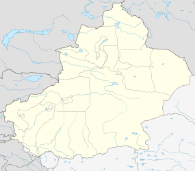 Ruoqiang Location in Xinjiang | |
| Coordinates: 39°01′N 88°10′E / 39.017°N 88.167°ECoordinates: 39°01′N 88°10′E / 39.017°N 88.167°E | |
| Country | China |
| Region | Xinjiang |
| Autonomous prefecture | Bayingolin |
| County seat | Ruoqiang Town |
| Area | |
| • Total | 198,318 km2 (76,571 sq mi) |
| Elevation | 896 m (2,940 ft) |
| Population (2002) | |
| • Total | 31,877 |
| • Density | 0.16/km2 (0.42/sq mi) |
| Time zone | China Standard (UTC+8) |
| Postal code | 841800 |
| Area code(s) | 0966 |
Ruoqiang (Qarkilik) County (simplified Chinese: 若羌县; traditional Chinese: 婼羌縣; pinyin: Ruòqiāng Xiàn, historically known as Charkliq, Chaqiliq, or Qakilik, Uyghur: چاقىلىق ناھىيىسى, Чақилиқ Наһийиси, ULY: Chaqiliq Nahiyisi) is a county in the Xinjiang Uyghur Autonomous Region, China under the administration of the Bayingolin Mongol Autonomous Prefecture. It covers an area of 198,318 square kilometres (76,571 sq mi) (about twice the size of Zhejiang province and similar to Kyrgyzstan or Senegal),[1] making it the largest county-level division in the country.[2]
As of 2005, the county had a population of 31,877, of which 18,957 (59.5%) were of Han ethnicity, while Uyghurs numbered 11,761 (36.9%).[1]
The county seat is in Ruoqiang Town. This is the location which less-detailed maps will label as "Ruoqiang". It lies at an altitude of 848 metres (2,782 ft).
History
The Kingdom of Charklik was located in what is today Ruoqiang County.
The Charkhlik Revolt took place here in 1935 when Uyghurs revolted against the Hui-dominated Tunganistan, which was controlled by the 36th Division (National Revolutionary Army). The Uyghurs were defeated.[3][4]
The county was established in 1902 but it was written as "婼羌" (Ruòqiāng) until 1959, when the present written form of "若羌" was adopted.[1] The Uyghur name of the county, "Çakilik", is transliterated in Chinese as "卡克里克" (Qiǎkèlǐkè).
Geography
Ruoqiang County ranges in latitude from 36° 00' to 41° 23' N and in longitude from 86° 45 to 93° 45' E. It borders Qiemo County to the west, Yuli County, Piqan County, and Kumul to the north, the provinces of Gansu and Qinghai to the east, and the Tibet Autonomous Region to the south.
The populated areas are located mostly along the northern foothills of the Altyn-Tagh mountain range. North of this strip of irrigated agricultural settlement is the Taklamakan Desert, south, the Altyn-Tagh and Kunlun Mountains.
The well known Lop Lake, these days usually dry, is located in the northeastern part of the county - the section officially known as Luobu Po Town (罗布泊镇), i.e., Lop Lake Town.
The southern part of the county (administratively, Qimantag Township (祁曼塔格乡), is mountainous. The high plateau between the Altyn-Tagh and the main Kunlun range (which includes the Ulugh Muztagh) is known as the Kumkol Basin: an endorheic basin, where several saline lakes are found.
The three main lakes in the Kumkol Basin are Lake Aqqikkol (also known as Achak-kum; 阿其克库勒湖; 37°05′N 88°25′E / 37.083°N 88.417°E, 4,250 m (13,940 ft) elevation), Lake Ayakum (阿牙克库木湖); 37°30′N 89°30′E / 37.500°N 89.500°E; elevation 3,876 m (12,717 ft)),[5] and Lake Jingyu (36°21′N 89°24′E / 36.350°N 89.400°E, 260 km2 (100 sq mi), 4,708 m (15,446 ft) elevation). These lakes are among the few noticeable bodies of water in this extremely arid area; the area around them is officially protected as the Altun Shan Nature Reserve.[5]
Climate
Ruoqiang has a cold desert climate (Köppen climate classification BWk) with extreme seasonal variation in temperature. The monthly 24-hour average temperature ranges from −7.4 °C (18.7 °F) in January to 27.5 °C (81.5 °F), and the annual mean is 11.7 °C (53.1 °F). Precipitation totals only 29 millimetres (1.1 in) annually, and mostly falls in summer. With monthly percent possible sunshine ranging from 63% in March to 82% in October, the area receives close to 3,100 hours of bright sunshine annually.
| Climate data for Ruoqiang (1971–2000) | |||||||||||||
|---|---|---|---|---|---|---|---|---|---|---|---|---|---|
| Month | Jan | Feb | Mar | Apr | May | Jun | Jul | Aug | Sep | Oct | Nov | Dec | Year |
| Average high °C (°F) | −0.5 (31.1) |
6.0 (42.8) |
15.1 (59.2) |
24.4 (75.9) |
29.9 (85.8) |
33.7 (92.7) |
35.6 (96.1) |
34.7 (94.5) |
29.5 (85.1) |
20.9 (69.6) |
10.0 (50) |
1.0 (33.8) |
20.0 (68.0) |
| Average low °C (°F) | −13 (9) |
−8.3 (17.1) |
−0.8 (30.6) |
7.0 (44.6) |
12.4 (54.3) |
16.6 (61.9) |
19.2 (66.6) |
17.2 (63) |
11.3 (52.3) |
3.0 (37.4) |
−4.1 (24.6) |
−10.6 (12.9) |
4.2 (39.5) |
| Average precipitation mm (inches) | 0.8 (0.031) |
0.4 (0.016) |
1.1 (0.043) |
0.9 (0.035) |
1.9 (0.075) |
5.2 (0.205) |
11.5 (0.453) |
5.4 (0.213) |
0.4 (0.016) |
0.2 (0.008) |
0.4 (0.016) |
0.8 (0.031) |
29.0 (1.142) |
| Average precipitation days (≥ 0.1 mm) | 1.1 | 0.5 | 0.5 | 0.8 | 1.2 | 2.8 | 3.0 | 1.8 | 0.5 | 0.2 | 0.2 | 0.8 | 13.4 |
| Average relative humidity (%) | 55 | 41 | 31 | 27 | 29 | 35 | 37 | 36 | 38 | 43 | 50 | 57 | 39.9 |
| Mean monthly sunshine hours | 206.4 | 202.1 | 231.0 | 255.8 | 293.7 | 299.9 | 303.3 | 306.4 | 292.1 | 284.6 | 227.9 | 193.5 | 3,096.7 |
| Percent possible sunshine | 69 | 67 | 63 | 65 | 67 | 67 | 67 | 72 | 78 | 82 | 76 | 66 | 69.9 |
| Source: China Meteorological Administration [6] | |||||||||||||
Transportation
See also
Footnotes
- 1 2 3 若羌县历史沿革. Xzqh.org. Accessed 2011-05-27 Archived January 20, 2010, at the Wayback Machine.
- ↑
- ↑ Andrew D. W. Forbes (1986). Warlords and Muslims in Chinese Central Asia: a political history of Republican Sinkiang 1911-1949. Cambridge, England: CUP Archive. p. 134. ISBN 0-521-25514-7. Retrieved 2010-06-28.
- ↑ Peter Fleming (1999). News from Tartary: A Journey from Peking to Kashmir. Evanston, Illinois, United States: Northwestern University Press. pp. 267, 281. ISBN 0-8101-6071-4.
- 1 2 Li, Bosheng (2000), "Chapter 11, Nature Conservation", in Zheng, Du; Zhang, Qingsong; Wu, Shaohong, Mountain geoecology and sustainable development of the Tibetan Plateau, Volume 57 of GeoJournal library, Springer, pp. 230–231, ISBN 0-7923-6688-3
- ↑ 中国地面国际交换站气候标准值月值数据集(1971-2000年) (in Chinese). China Meteorological Administration. Retrieved 2010-05-04.