Rowena, Oregon
| Rowena, Oregon | |
|---|---|
| Census-designated place (CDP) | |
|
Modern Rowena, Oregon along U.S. Route 30 | |
 Location of Rowena, Oregon | |
| Coordinates: 45°40′20″N 121°16′06″W / 45.6723426°N 121.2684056°WCoordinates: 45°40′20″N 121°16′06″W / 45.6723426°N 121.2684056°W | |
| Country | United States |
| State | Oregon |
| County | Wasco |
| Area | |
| • Total | 1.9 sq mi (4.8 km2) |
| • Land | 1.9 sq mi (4.8 km2) |
| • Water | 0.0 sq mi (0.0 km2) |
| Elevation | 138 ft (42 m) |
| Population (2010) | |
| • Total | 187 |
| • Density | 98.4/sq mi (40.0/km2) |
| Time zone | Pacific (PST) (UTC-8) |
| • Summer (DST) | PDT (UTC-7) |
| ZIP code | 97058 |
| Area code(s) | 458 and 541 |
| FIPS code | 41-63950[1] |
| GNIS feature ID | 1136714[2] |

Rowena is an unincorporated community in Wasco County, Oregon, United States. For statistical purposes, the United States Census Bureau has defined Rowena as a census-designated place (CDP). The census definition of the area may not precisely correspond to local understanding of the area with the same name. The population was 187 at the 2010 census.
Rowena is located west of The Dalles on the Columbia River, where the river passes through the natural feature Rowena Gap. Interstate 84 (Columbia River Highway) and U.S. Route 30 (Historic Columbia River Highway) pass through the community. Route 30 near Rowena is notable for the Rowena Loops.[3]
The origin of the name "Rowena" is disputed. Two sources say Rowena was named for H.S. Rowe, a railroad company official, in the early 1880s. Another source says it was named for a girl, Rowena, who had been living in the area at the time the community was founded. It is also possible that the name comes indirectly from Rowena, Ivanhoe's lover in the novel of the same name by Sir Walter Scott.[4]
There was once a ferry operating between Rowena and Lyle, Washington across the Columbia.[5]
The Nature Conservancy has a nature reserve on the plateau near Rowena, The Tom McCall Preserve known for its spring wildflowers. The preserve is owned and managed in cooperation with Mayer State Park.
Geography
According to the United States Census Bureau, the CDP has a total area of 1.9 square miles (4.9 km2), all land.
Demographics
As of the census[1] of 2010, there were 187 people, 77 households, and 51 families residing in the CDP. The population density was 98.4 people per square mile (30.7/km²). There were 111 housing units at an average density of 58.4 per square mile (123.1/km²). The racial makeup of the CDP was 97.9% White, 0.5% Asian, 0.5% Pacific Islander, 0.5% some other race, and 0.5% two or more races.
There were 77 households out of which 31.2% had children under the age of 18 living with them, 48.1% were married couples living together, and 33.8% were non-families. 27.3% of all households were made up of individuals and 22.1% had someone living alone who was 65 years of age or older. The average household size was 2.43 and the average family size was 2.86. The median age in the CDP was 41.2 years. Females made up 48.1% of the population and males made up 51.9%.
References
- 1 2 "American FactFinder". United States Census Bureau. Retrieved 2016-03-22.
- ↑ "US Board on Geographic Names". United States Geological Survey. 2007-10-25. Retrieved 2008-01-31.
- ↑ Historic photo of the Rowena loops on U.S. 30 from Salem Public Library
- ↑ McArthur, Lewis A.; McArthur, Lewis L. (2003) [1928]. Oregon Geographic Names (7th ed.). Portland, Oregon: Oregon Historical Society Press. p. 828. ISBN 978-0875952772.
- ↑ The Song of the Rivers
External links
Municipalities and communities of Wasco County, Oregon, United States | ||
|---|---|---|
| Cities | 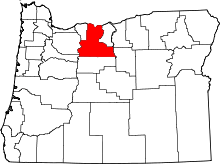 | |
| CDPs | ||
| Unincorporated communities | ||
| Indian reservation | ||
| Ghost towns | ||