Roquemaure, Quebec
| Roquemaure | |
|---|---|
| Municipality | |
 | |
 Location within Abitibi-Ouest RCM. | |
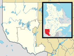 Roquemaure Location in western Quebec. | |
| Coordinates: 48°36′N 79°24′W / 48.600°N 79.400°WCoordinates: 48°36′N 79°24′W / 48.600°N 79.400°W[1] | |
| Country |
|
| Province |
|
| Region | Abitibi-Témiscamingue |
| RCM | Abitibi-Ouest |
| Settled | 1933 |
| Constituted | January 1, 1952 |
| Government[2] | |
| • Mayor | Léo Pinard |
| • Federal riding | Abitibi—Témiscamingue |
| • Prov. riding | Abitibi-Ouest |
| Area[2][3] | |
| • Total | 154.40 km2 (59.61 sq mi) |
| • Land | 120.78 km2 (46.63 sq mi) |
| Population (2011)[3] | |
| • Total | 414 |
| • Density | 3.4/km2 (9/sq mi) |
| • Pop 2006-2011 |
|
| • Dwellings | 207 |
| Time zone | EST (UTC−5) |
| • Summer (DST) | EDT (UTC−4) |
| Postal code(s) | J0Z 3K0 |
| Area code(s) | 819 |
| Highways | No major routes |
| Website |
www |
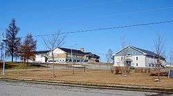
Roquemaure is a municipality in northwestern Quebec, Canada in the MRC d'Abitibi-Ouest. It covers 121.67 km² and had a population of 414 as of the Canada 2011 Census.
The municipality was incorporated on January 1, 1952.
Demographics
Population trend:[4]
- Population in 2011: 414 (2006 to 2011 population change: 3.0%)
- Population in 2006: 402
- Population in 2001: 451
- Population in 1996: 459
- Population in 1991: 455
Private dwellings occupied by usual residents: 182 (total dwellings: 207)
Mother tongue:[5]
- English as first language: 0%
- French as first language: 100%
- English and French as first language: 0%
- Other as first language: 0%
Municipal council
- Mayor: Marcel Mainville
- Councillors: Gérard Leclerc, Chantal Mainville, Guylaine Pinard, Léo Plourde, Jocelyn Poirier, Alain Tremblay
References
- ↑ Reference number 54487 of the Commission de toponymie du Québec (French)
- 1 2 "Roquemaure". Répertoire des municipalités (in French). Ministère des Affaires municipales, des Régions et de l'Occupation du territoire. Retrieved 2011-01-06.
- 1 2 "Roquemaure census profile". 2011 Census data. Statistics Canada. Retrieved 2011-01-06.
- ↑ Statistics Canada: 1996, 2001, 2006, 2011 census
- ↑ "Roquemaure community profile". 2006 Census data. Statistics Canada. Retrieved 2011-01-06.
 |
Lake Abitibi, Clerval | | ||
| Unorganized North Cochrane, Ontario | |
Gallichan | ||
| ||||
| | ||||
| Rapide-Danseur |
| Towns | |
|---|---|
| Municipalities | |
| Townships | |
| Parishes | |
| Unorganized territories | |
| |
This article is issued from Wikipedia - version of the 1/26/2014. The text is available under the Creative Commons Attribution/Share Alike but additional terms may apply for the media files.