Rivière-Ojima, Quebec
| Rivière-Ojima | |
|---|---|
| Unorganized territory | |
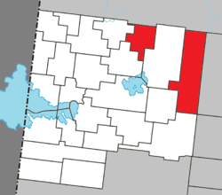 Location within Abitibi-Ouest RCM. | |
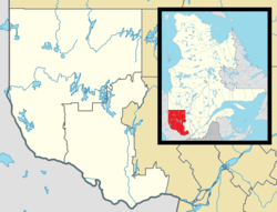 Rivière-Ojima Location in western Quebec. | |
| Coordinates: 48°50′N 78°42′W / 48.833°N 78.700°WCoordinates: 48°50′N 78°42′W / 48.833°N 78.700°W[1] | |
| Country |
|
| Province |
|
| Region | Abitibi-Témiscamingue |
| RCM | Abitibi-Ouest |
| Constituted | January 1, 1986 |
| Government[2] | |
| • Federal riding | Abitibi—Témiscamingue |
| • Prov. riding | Abitibi-Ouest |
| Area[2][3] | |
| • Total | 356.20 km2 (137.53 sq mi) |
| • Land | 356.04 km2 (137.47 sq mi) |
| Population (2011)[3] | |
| • Total | 104 |
| • Density | 0.3/km2 (0.8/sq mi) |
| • Pop 2006-2011 |
|
| • Dwellings | 51 |
| Time zone | EST (UTC−5) |
| • Summer (DST) | EDT (UTC−4) |
| Highways | No major routes |
Rivière-Ojima is an unorganized territory in the Abitibi-Témiscamingue region of Quebec, Canada. It consists of two non-contiguous areas in the Abitibi-Ouest Regional County Municipality, separated by the municipality of Authier-Nord. The communities of Languedoc (48°48′26″N 78°41′48″W / 48.80722°N 78.69667°W) and Saint-Eugène-de-Chazel (48°57′06″N 78°58′38″W / 48.95167°N 78.97722°W) are located within its boundaries.
Founded in 1949, Languedoc is the youngest rural population centre of the Abitibi and named after a region in southern France. The Parish of Saint-Etienne-de-Languedoc was formed in 1952.[4]
Demographics
Population
| Canada census – Rivière-Ojima, Quebec community profile | |||
|---|---|---|---|
| 2011 | 2006 | 2001 | |
| Population: | 104 (-17.5% from 2006) | 126 (+14.5% from 2001) | 110 (-7.6% from 1996) |
| Land area: | 356.04 km2 (137.47 sq mi) | 356.03 km2 (137.46 sq mi) | 356.03 km2 (137.46 sq mi) |
| Population density: | 0.3/km2 (0.78/sq mi) | 0.4/km2 (1.0/sq mi) | 0.3/km2 (0.78/sq mi) |
| Median age: | 50.6 (M: 54.5, F: 48.5) | 45.0 (M: 48.0, F: 38.5) | 43.8 (M: 46.0, F: 42.0) |
| Total private dwellings: | 51 | 53 | 56 |
| Median household income: | $.N/A | $.N/A | $.N/A |
| Notes: Income data for this area has been suppressed for data quality or confidentiality reasons. – References: 2011[3] 2006[5] 2001[6] | |||
| Historical Census Data - Rivière-Ojima, Quebec[7] | ||||||||||||||||||||||||||
|---|---|---|---|---|---|---|---|---|---|---|---|---|---|---|---|---|---|---|---|---|---|---|---|---|---|---|
|
|
| ||||||||||||||||||||||||
Language
| Canada Census Mother Tongue - Rivière-Ojima, Quebec[7] | ||||||||||||||||||
|---|---|---|---|---|---|---|---|---|---|---|---|---|---|---|---|---|---|---|
| Census | Total | French |
English |
French & English |
Other | |||||||||||||
| Year | Responses | Count | Trend | Pop % | Count | Trend | Pop % | Count | Trend | Pop % | Count | Trend | Pop % | |||||
| 2011 |
100 |
100 | |
100.00% | 0 | |
0.00% | 0 | |
0.00% | 0 | |
0.00% | |||||
| 2006 |
120 |
120 | |
100.00% | 0 | |
0.00% | 0 | |
0.00% | 0 | |
0.00% | |||||
| 2001 |
115 |
115 | |
100.00% | 0 | |
0.00% | 0 | |
0.00% | 0 | |
0.00% | |||||
| 1996 |
120 |
120 | n/a | 100.00% | 0 | n/a | 0.00% | 0 | n/a | 0.00% | 0 | n/a | 0.00% | |||||
See also
References
- ↑ Reference number 149739 of the Commission de toponymie du Québec (French)
- 1 2 Geographic code 87904 in the official Répertoire des municipalités (French)
- 1 2 3 "2011 Community Profiles". Canada 2011 Census. Statistics Canada. July 5, 2013. Retrieved 2014-03-30.
- ↑ "Languedoc (Village)" (in French). Commission de toponymie du Québec. Retrieved 2008-10-01.
- ↑ "2006 Community Profiles". Canada 2006 Census. Statistics Canada. March 30, 2011. Retrieved 2014-03-30.
- ↑ "2001 Community Profiles". Canada 2001 Census. Statistics Canada. February 17, 2012. Retrieved 2014-03-30.
- 1 2 Statistics Canada: 1996, 2001, 2006, 2011 census
 |
Baie-James | | ||
| Val-Saint-Gilles | |
Authier-Nord | ||
| ||||
| | ||||
| Chazel |
| |
Baie-James | | ||
| Authier-Nord | |
Lac-Chicobi | ||
| ||||
| | ||||
| Authier | Taschereau | Launay |
| Towns | |
|---|---|
| Municipalities | |
| Townships | |
| Parishes | |
| Unorganized territories | |
| |
This article is issued from Wikipedia - version of the 3/30/2014. The text is available under the Creative Commons Attribution/Share Alike but additional terms may apply for the media files.