Rodney ward
| Rodney Ward | |
|---|---|
| Local government area | |
 Rodney Ward | |
| Coordinates: 36°32′20″S 174°31′41″E / 36.539°S 174.528°ECoordinates: 36°32′20″S 174°31′41″E / 36.539°S 174.528°E | |
| Country | New Zealand |
| Island | North Island |
| Region | Auckland Region |
| Population (June 2012 est.) | |
| • Total | 57,100 |
| Extent |
Muriwai Beach to the Kowhai Coast; Helensville and Kumeu to Wellsford and Kawau Island |
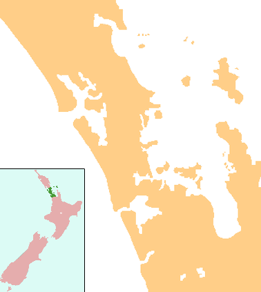
Rodney Ward is a local government area in the northernmost part of New Zealand's Auckland Region, created along with the Auckland Council in 2010.[1] The area was previously part of the Rodney District; it does not include the Hibiscus Coast, which is now in the Albany ward.
Location
Rodney stretches from the spectacular black volcanic sand beaches of Muriwai in the west to the white sands and islands of the Kowhai Coast in the east. The area includes a number of regional parks or areas of special interest. North of Orewa are the coastal Wenderholm, Mahurangi and Tawharanui Regional Parks. Cape Rodney-Okakari Point Marine Reserve, which surrounds Goat Island, was New Zealand's first marine reserve, officially opened in 1977. It covers a coastline of about 5 km (3 mi), extends out in sea by 800 m, and encompasses 5 km2 (2 sq mi), inside which all marine life is protected.
Towns in the south of the ward are becoming dormitory districts for Auckland, enjoying improved access by motorway. Further north, communities are more rural. Some have become famous for particular activities such as Puhoi and its cheese factory. Warkworth is a good base to explore the Kowhai Coast, which includes historic Kawau Island, the home of New Zealand's former Governor Sir George Grey, where Mansion House is now a museum.
The dominant feature of the western side of Rodney is Kaipara Harbour, the largest enclosed harbour in the Southern Hemisphere, with a perimeter of about 3,000 km (1,864 mi). The area was once famous for its kauri timber mills.
Kumeu, Matakana and Huapai are becoming well known for their wineries, a number of which provide sampling, cellar-door sales, and restaurants.
Population
The estimated population of Rodney Ward based on 2015 estimates is 60,000 people.
Governance
Rodney Ward is part of Auckland Council and is governed by the Mayor of Auckland, one directly elected Councillor who sits on Auckland Councils governing body, and nine elected Local Board members who sit on the Rodney Local Board.The ward is divided into four parts, each containing a number of towns and settlements:
- Kumeu subdivision: Kumeu, Helensville, Muriwai, Kaukapakapa and South Head
- Dairy Flat subdivision: Dairy Flat, Coatesville, Wainui and Waitoki
- Warkworth subdivision: Warkworth, Matakana, Leigh, Puhoi, Ahuroa, Kawau Island
- Wellsford subdivision: Wellsford, Te Arai, Pakiri, Port Albert, Tapora
The Councillors for Rodney Ward are;
- 2010 - 2013 Councillor Penny Webster
- 2013 - 2016 Councillor Penny Webster
The Rodney Local Board members are;
Kumeu Subdivision
- 2010 - 2013 Bob Howard (Chair), Warren Flauntey, Brenda Steele, Thomas Grace
- 2013 - 2016 Brenda Steele (Chair), Warren Flauntey, Phelan Pirrie, Thomas Grace
Dairy Flat Subdivision
- 2010 - 2013 John McClean
- 2013 - 2026 John McClean
Warworth Subdivision
- 2010 - 2013 Steven Garner, June Turner, Tracey Martin
- 2013 - 2016 Steven Garner, Greg Sayers, Beth Houlbrooke
Wellsford Subdivision
- 2010 - 2013 James Rolf (replaced by James Colville before term ended)
- 2013 - 2016 James Colville
References
- ↑ "Idiot's guide to the Super City". The New Zealand Herald. 14 May 2010. Retrieved 5 November 2011.
External links
- Rodney Ward at Auckland Council
- Rodney Local Board at Auckland Council