Kumeu
| Kumeu | |
|---|---|
 Kumeu | |
| Coordinates: 36°46′33″S 174°33′19″E / 36.77583°S 174.55528°E | |
| Country | New Zealand |
| Region | Auckland Region |
| District | Rodney District |
| Population (2006) | |
| • Total | 6,603 |
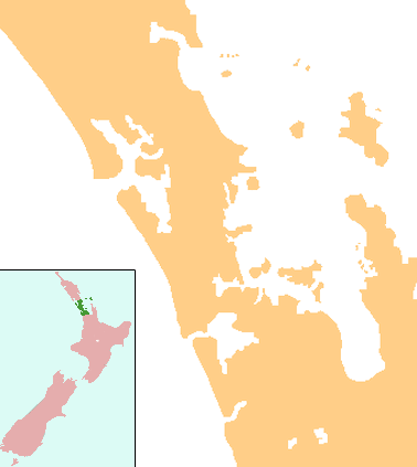
Kumeu is a small town 25 km north-west of the Auckland City centre in New Zealand. State Highway 16 and the North Auckland Line pass through the town. Huapai lies to the west, Riverhead to the north, Whenuapai to the east, West Harbour to the south-east, and Taupaki to the south.[1][2]
The population was 6,603 in the 2006 Census, an increase of 933 from 2001.[3]


Settlement and statistics
The district was originally settled by immigrants from the Dalmatian coast of Croatia, many of whom were part of traditional winegrowing families. At the 2006 Census, the median income of people in the Kumeu area unit was $30,600, compared with $26,800 for the whole Auckland Region. The unemployment rate in Kumeu was 2.9 percent, compared with 5.6 percent for Auckland.[3]
Industry
Areas surrounding the Kumeu district produce labels such as Kumeu River, Cooper's Creek and Soljans Estate Winery have gained a good reputation for their Chardonnay and Sauvignon blanc wines. The wine growing district is the main industry in both Kumeu itself and the smaller nearby settlements of Huapai and Waimauku.
- Kumeu River Wines, established in 1944.[4]
- Coopers Creek, established in 1980.[5]
- Landmark Estate, founded in 1937.[6]
- Matua Valley, established in 1966. Matua Valley closed its doors in 2016. [7]
- Nobilos was established in 1943 by Nikola Nobilo and remained family owned until the late 1990s. Now known as Nobilo Wine Group, the company is New Zealand's second largest wine company.
- Soljans Estate Winery was established in 1932 in Henderson, West Auckland. As the company grew they later moved to Kumeu in 2002 [8]
Activities
The area is popular for lifestyle block farming and equestrian pursuits. The Kumeu Agricultural and Horticultural Society hosts one of the largest annual shows in the Southern Hemisphere on 34 hectares (84 acres) of land owned by the Kumeu District Agricultural and Horticultural Society, on the second weekend in March every year. The nearby localities of Woodhill forest and Muriwai Beach means it has strong recreational interests.
Music
Since 1948 Kumeu has had a brass band, competing in many events, and playing in parades, concerts & private Functions, traditional & modern music for all occasions.[9]
The Kumeu Showgrounds are also the venue for the annual Auckland Folk Festival, a 4-day event of music, dancing and workshops, now in its 28th year.[10] The festival is generally held over the last weekend in January.
Transport
The North Auckland railway line passes through Kumeu, and for six years the town was the terminus of the isolated Kumeu-Riverhead Section railway. This line linked Kumeu to Riverhead, where ferries ran to Auckland, and operated from 1875 until 1881. In 1881, the North Auckland Line reached Kumeu, making the town a railway junction. This status lasted a mere five days; the new railway from Auckland made the line to Riverhead redundant and it was accordingly closed.
In June 2007 it was announced[11] that suburban rail services would be extended to Helensville in 2008, with temporary stations to be built at Huapai and Waimauku. The service commenced on 14 July 2008 for a one-year trial period,[12]and was then suspended permanently.
Education
Kumeu is served by Huapai District School, which is a coeducational full primary serving years 1-8 with a decile rating of 9 and a roll of 461,[13][14] and the state integrated Hare Krishna School, which is a coeducational full primary serving years 1-8 with a decile rating of 5 and a roll of 72.[15]
The majority of highschool-aged students attend schools in surrounding suburbs. The closest secondary schools are Kaipara College, Massey High School, Liston College, Albany Junior High School and St Dominic's College.
Place names
Māori place names:[16]
- Huapai – good fruit
- Kumeu – pulling the breast (action used to incite a war party)
- Muriwai – backwater or junction of streams
References
- ↑ Peter Dowling (editor) (2004). Reed New Zealand Atlas. Reed Books. map 11. ISBN 0-7900-0952-8.
- ↑ Roger Smith, GeographX (2005). The Geographic Atlas of New Zealand. Robbie Burton. map 35. ISBN 1-877333-20-4.
- 1 2 Quickstats about Kumeu
- ↑ Kumeu River History
- ↑ Coopers Creek - History
- ↑ Landmark Estate - History
- ↑ Saunders, Peter (8 April 2016). "Matua Valley winery closes in Auckland". New Zealand Winegrower.
- ↑
- ↑ Kumeu Brass - Our History
- ↑ Auckland Folk Festival
- ↑ Radio New Zealand. "Commuter train services to return to Helensville". Retrieved 2007-06-28.
- ↑ Dearnaley, Mathew (2008-07-14). "New commuter train services". New Zealand Herald. Retrieved 2008-07-14.
- ↑ "ERO - Huapai District School".
- ↑ Te Kete Ipurangi schools database: Huapai District School
- ↑ Te Kete Ipurangi schools database: Hare Krishna School
- ↑ Kumeu and Districts History
External links
- Kumeu District - The Fruit Bowl of Auckland
- History of Henderson pdf
- Kumeu Community portal
- Hare Krishna School website
Coordinates: 36°46′S 174°34′E / 36.767°S 174.567°E