Kaipara Harbour
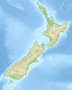
which opens into the Tasman Sea

Kaipara Harbour is a large enclosed harbour estuary complex on the north western side of the North Island of New Zealand. The northern part of the harbour is administered by the Kaipara District and the southern part is administered by the Auckland Council. The local Māori tribe is Ngāti Whātua.
By area, the Kaipara Harbour is one of the largest harbours in the world. It covers 947 square kilometres (366 sq mi) at high tide, with 409 square kilometres (158 sq mi) exposed as mudflats and sandflats at low tide.[1][2][3]
According to Māori tradition, the name Kaipara had its origins back in the 15th century when the Arawa chief, Kahumatamomoe, travelled to the Kaipara to visit his nephew at Pouto. At a feast, he was so impressed with the cooked root of the para fern, that he gave the name Kai-para to the district. "Kai" means food in the Māori language.[4]
Geography
|
|
The harbour extends for some 60 kilometres (37 mi) from north to south. Several large arms extend into the interior of the peninsula at the northeast of the harbour, one of them ending near the town of Maungaturoto, only ten kilometres (6 mi) from the Pacific Ocean coast. The harbour has extensive catchments feeding five rivers and over a hundred streams, and includes large estuaries formed by the Wairoa, Otamatea, Oruawharo, Tauhoa (Channel) and Kaipara. A number of small islands off the shoreline are connected to the mainland by mudflats at low tide.
The Kaipara Harbour is broad and mostly shallow, as it is formed from a system of drowned river valleys.[5] The harbour shoreline is convoluted by the entry of many rivers and streams, and is about 800 kilometres (500 mi) long,[6] being the drainage catchment for about 640,000 ha of land.[7]
The harbour entrance is a channel to the Tasman Sea. It narrows to a width of 6 kilometres (3.7 mi),[8] and is over 50 metres (160 ft) deep in parts. On average, Kaipara tides rise and fall 2.10 metres (6.9 ft). Spring tidal flows reach 9 km/h (5 knots) in the entrance channel and move 1,990 million cubic metres per tidal movement or 7,960 million cubic metres daily.[9]
The harbour head is a hostile place. Big waves from the Tasman Sea break over large sandbanks about five metres below the surface, two to five kilometres from the shore. The sand in these sandbanks comes mainly from the Waikato River. Sand discharged from this river is transported northward by the prevailing coastal currents. Some of this sand is carried into the Kaipara harbour entrance, but mostly cycles out again and then continues moving northwards along the west coast. The southern sandbanks at the entrance are constantly accumulating and releasing this sand.[9]
These treacherous sandbanks shift and change position, and are known locally as the graveyard. The graveyard is responsible for more shipwrecks than any other place in New Zealand, and has claimed at least 43 vessels—some say as many as 110.[10][11]
In Māori mythology, the ocean-going canoe Māhuhu voyaged from Hawaiki to New Zealand and overturned on the northern side of the entrance. It was commanded by the chief Rongomai, who drowned. His body was eaten by araara (white trevally), and his descendants to this day will not eat that type of fish.[4][12] The first European shipwreck was the Aurora, a 550-ton barque, in 1840,[13] and the most recent was the yacht Aosky in 1994.[14] Today, the remains of wrecks still become visible under certain tidal and sand conditions.
For this reason, the Kaipara is rarely used today for shipping, and no large settlements lie close to its shores, although many small communities lie along its coastline.
Ecology
The Kaipara Harbour is a productive marine ecosystem, with diverse habitats and ecotones. There are tidal reaches, intertidal mudflats and sandflats, freshwater swamps, maritime rushes, reed beds and coastal scrublands.[15] The area includes 125 square kilometres of mangrove forest.[16] with subtidal fringes of seagrass.[17]
-
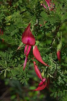
Kaka beak leaves and flowers


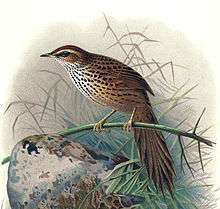

The Kaipara is a migratory bird habitat of international significance. Forty–two coastal species are known, and up to 50,000 birds are common. Rare species use the harbour for feeding during summer before returning to the Northern Hemisphere to breed, such as the bar-tailed godwit, lesser knot, and turnstone. Threatened or endangered native species, such as the North Island fernbird, fairy tern, crake, Australasian bittern, banded rail, grey‑faced petrels, banded and NZ dotterels, South Island pied oystercatcher, pied stilt, and wrybill are also present . Significant local populations of black swan, pukeko, and grey duck also breed in the area.[15]
Land habitats adjacent to the harbour support some rare botanical species, including native orchids, the king fern, and the endangered kaka beak.[15]
In particular, Papakanui Spit on the south head of the harbour entrance, a mobile sandspit, is important as a breeding and roosting area for the New Zealand dotterel and the fairy tern. It also has areas of pingao.[18] The spit was an important habitat for the Caspian tern. The birds have moved to other parts of Kaipara Harbour, possibly due to human disturbance. An air weapons range used by the New Zealand Defence Force is a short distance south of the spit.[19][20]
Human use
Māori history
Māori settlements and marae have been scattered around the harbour margins for hundreds of years. The waterways of the Kaipara provided, and still provide, Māori with resources and a ready means of moving between marae.[21]
Today most marae are associated with the Ngāti Whātua sub-tribes, Te Taoū and Te Uri-o-Hau.[21] These sub-tribes both descend from the chief Haumoewhārangi who settled on the north end of the Kaipara entrance at Poutō. He was killed in an argument about kūmara (sweet potatoes). His widow Waihekeao developed a partnership with a Tainui warrior chief, Kāwharu. Kāwharu led several destructive campaigns around Kaipara. Eventually the descendants of Waihekeao and Haumoewhārangi came to control the Kaipara Harbour. Te Uri-o-Hau was founded by Hakiputatōmuri, and controlled the northern part of Kaipara Harbour. Te Taoū was founded by Mawake, and controlled the south.[22]
European history
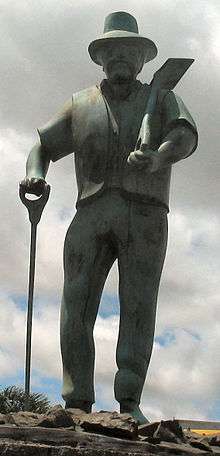
In 1839, European settlers began arriving in the Kaipara to fell and mill kauri trees and build boats for local requirements.[21] Despite the perilous bar at the harbour entrance, the Kaipara became a busy timber port from the 1860s, shipping thousands of tonnes of kauri timber and gum.[23]
The Wairoa is the main river feeding the Kaipara from the north. Thirty kilometres upstream, the town of Dargaville was established. The stretch of water to Dargaville is broad and straight and provides an easy to navigate route into what were then kauri forests in the interior. Dargaville flourished as kauri fell and mills buzzed. Immigrants from Britain and Croatia were attracted to the area. Ships up to 3,000 tons carried timber and logs out along the Wairoa to defy the bar at the harbour entrance before continuing on, usually to another New Zealand port or across the Tasman to Australia.[24]
The Kaipara River is the principal river feeding Kaipara Harbour from the south. From 1863 Helensville established itself as a timber port on this river, and provided shipping services about the Kaipara. When the timber ran out, Helensville developed sheep and dairy farms, and more recently nut plantations, vineyards and deer farms.[23]
Further south, Riverhead was an important trading link with the Kaipara and Helensville, and a centre for gum digging. Also set by a river, it milled timber and flour, and made paper. Later it turned to tobacco. From 1929 to 1933, the Riverhead State Forest was developed from 5,000 ha of exhausted gum land.[23]
As the kauri ran out, the Kaipara became a backwater.[23] After 1920 the gum and timber industries dwindled, and farming, mainly dairying, took over. In particular, there is dairying on the rich Ruāwai flats. These flats are below sea level, and are protected by a stopbank and a drainage system.[24] Coastal sawmill settlements at Tinopai, Arapaoa, Batley, Matakohe, Oneriri, Ōruawharo, Pahi, Paparoa, Tanoa and Whakapirau have become quiet backwaters. Pahi has become a launch point for houseboats and fishing. Matakohe has a museum which commemorates the kauri industry and the early Pākehā settlers.[21]
Today, Dargaville is the principle centre in the Kaipara area. Its population levelled in the 1960s. It is the country’s main kūmara (sweet potato) producer.[24]
Fisheries

.JPG)
Much of the coastal fishing industry in New Zealand depends on mangrove forests. About 80% of fish caught commercially are linked to food chains dependent on the mangroves, and at least 30 species of fish use mangrove wetlands at some stage of their life cycle.
The marine and estuarine areas in the Kaipara Harbour breed snapper, mullet, flounder, sole, kahawai, white trevally, gurnard, yellow‑eyed mullet and skates, rays and sharks.[25] The Kaipara is the largest estuarine harbour on the west coast of New Zealand and provides significant areas of suitable breeding grounds and habitats for juvenile fish. It has fewer problems with water quality than the Manukau, and is the single most significant wetland for west coast fisheries.[25]
In 2009, NIWA scientists discovered that 98 percent of snapper on the west coast of the North Island were originally juveniles from nurseries in the Kaipara. Snapper is New Zealand’s largest recreational fishery, and is also a commercial fishery with an annual export value of $32 million. The findings show how fragile some fish stocks can be, and highlights the importance of protecting natural habitats, like the Kaipara.
Native rock oysters are plentiful on the rocky shores, and the introduced Pacific oysters flourish lower in the intertidal zone. There are cockles and tuatua on the lower tidal flats, mussels from low tide on the rocks to subtidal beds closer to the mouth of the harbour, and scallops in the tidal channels.[15]
The scallop population has periodic incidences of high mortality, the causes of which have not been identified. Concerns in recent years about the size and availability of scallops have resulted in temporary closures of the scallop fisheries.[26][27]
Early versions of oyster farming occurred between the early 1900s and 1950s. Thousands of tons of rocks were placed along the shorelines to act as an additional substrate on which the natural rock oyster could grow.[15][28] In 2002, the Crown settled the historical claims of Te Uri o Hau, a hapu of the northern Kaipara Harbour. As part of the settlement, access to and the rights of the hapu to gather oysters within the existing "Maori Oyster Areas" were recognised.[29][30] In 2008, resource consent was given to Biomarine to establish New Zealand’s largest oyster farm in the Kaipara. The farm is projected to produce about NZ$30 million in annual exports and 100 new jobs.[31]
In recent years, there has been a perception amongst locals that commercial fishers have damaged fisheries in the Kaipara. Locals have been frustrated in their attempts to gain government support. The veteran filmmaker Barry Barclay has examined this in his 2005 documentary, The Kaipara affair.[21][32][33]
Sand mining
Currently (2007) about 219,000 cubic metres of sand is mined each year from the entrance and tidal deltas of the Kaipara. This sand contributes over half the sand requirements for Auckland. The sand is used in the production of concrete and asphalt, and also in drainage systems and beach nourishment. A suction pump is usually used to extract the sand from the seabed. It is pumped into a barge as a sand and water slurry. As the barge loads, shells and other objects are screened out and the sea water drained back to the sea. The availability of sea sand within the Auckland region means the road costs of transporting sand from further parts of the country are avoided.[34] Concerns about possible negative consequences of this sand mining have also been raised.[35][36]
Tidal power
|
| |
|
|
In 2008, Crest Energy, a power company, received resource consent to install about 200 underwater tidal turbines in the Kaipara Harbour, which would use the substantial tidal flows moving in and out every day near the harbour mouth to produce electricity for approximately 250,000 homes.[38]
Crest plans to place the turbines at least 30 metres deep along a ten kilometre stretch of the main channel. Historical charts show this stretch of the channel has changed little over 150 years. The output of the turbines will cycle twice daily with the predictable rise and fall of the tide. Each turbine will have a maximum output of 1.2 MW, and is expected to generate 0.75 MW averaged over time.[9][39]
The peak level of generation for the combined turbines is about 200 MW. This exceeds the projected peak electricity needs of Northland. It would have environmental benefits in offsetting annual carbon emissions from a thermal-based, gas turbine generator of 575,000 tonnes of carbon.[9] The project is costed at about $600 million and to be economic would have to be scaled up rapidly to near full capacity.[40]
However, while the Department of Conservation has approved the project, and has made substantial environmental monitoring conditions part of the consent, the project also has objectors on the grounds of claimed influences on the local ecosystems and charter fishing (see the section above on fisheries). Appeals before the Environment Court are still likely.[41]
Management issues
Management of the Kaipara Harbour does not have a central administration. Management is distributed among the Kaipara District Council, Auckland Council, Northland Regional Council, the Department of Conservation's Northland and Auckland section, and the Ministry of Fisheries.[7]
The Ministry of Fishing allocates quota for the north west region of New Zealand as a whole, but does not tailor quota specifically for the Kaipara. Local iwi feel they are not sufficiently involved in management issues, and to further compound matters, the local iwi is split between Te Uri-o-Hau in the northern part and Te Taoū in the southern part.
Ecological management and environmental issues are discussed in the Ecology section.
Environmental issues
As of 2011, the environmental state of the harbour has been called as "nearing crisis" and "in significant decline", with shrinking fish and shellfish stocks, more sedimentation, declining water quality and competition for resource use and development being noted as the main issues, with "ninety-nine per cent of the rivers in the catchment [are] polluted".[7]
As part of the worldwide trend, there is a decline in biodiversity within the Kaipara.[42] The timber industry removed most of the native forest. Much of the kauri and kahikatea forest, and scrub and riparian vegetation, has been replaced with farm and urban areas. Mangrove forests and wetlands have been "reclaimed". Soil erosion has increased on the land and sedimentation in the harbour. Shellfish abundance has declined, especially toheroa, scallops, tuatua, cockles and pipi. Finfish like mullet, snapper, kanae and school shark have diminished.[42]
Habitat fragmentation has also occurred. Natural vegetation in the Kaipara catchments have been reduced to islands of wetlands and forest in man-made landscapes—separated by urban areas, roads, exotic forests and pastures. More information is needed on biodiversity in the Kaipara Harbour and habitats in associated coastal areas. A recent pilot survey found that habitats in the estuaries are still extensive, but ninety percent of land cover is no longer indigenous wetland or vegetation. Even if the key existing areas were to be protected, further buffers and corridors that give better connection between the natural areas would be needed to encourage the recovery of biodiversity.[42]
Timeline
- c. 1300: The Maori chief Rongomai arrives in his canoe Māhuhu from Hawaiki, and is drowned at the harbour entrance.
- 1807 or 1808: Ngapuhi fight Ngāti Whātua, Te-Uri-o-Hau and Te Roroa iwi at the battle of Moremonui on the west coast of Northland, the first battle in which Maori used muskets.
- 1839: European settlers begin arriving to fell and mill kauri trees.
- 1840: The Aurora, a 550-ton barque, is the first European ship to be wrecked at the entrance.
- 1860s: The timber industry is established.
- 1899: The timber industry peaks.
- c. 1939: Timber trade ends, and the area becomes a backwater.
- 2002: Crown settles historical claims of Te Uri o Hau
- 2005: Filmmaker Barry Barclay makes his documentary, The Kaipara Affair.
- 2008: Biomarine receives resource consent to establish an oyster farm
- 2008: Crest Energy receives resource consent to install tidal turbines
See also
References
- ↑ Heath, RA (1975) Stability of some New Zealand coastal inlets. New Zealand Journal of Marine and Freshwater Research, 9 (4):449-57.
- ↑ Fahy, F; Irving, P and John, S (1990) Coastal Resource Inventory First Order Survey. Department of Conservation.
- ↑ Robertson, B; Gillespie, P; Asher, R; Frisk, S; Keeley, N; Hopkins, G; Thompson, S and Tuckey, B (2002) Estuarine Environmental Assessment and Monitoring: A National Protocol. Prepared for Supporting Councils and The Ministry for the Environmental Sustainable Management Fund. Contract No. 5096.
- 1 2 Byrne, Brian (2002). The Unknown Kaipara. p. 4. ISBN 0-473-08831-2.
- ↑ Hume, T. M. & Herdendorf, CE (1988) A geomorphic classification of estuaries and its application to coastal resource management - a New Zealand example. Ocean and Shoreline Management, 11 :249-274.
- ↑ Kaipara - Kumeu Catchment Management Plan
- 1 2 3 "Kaipara facing 'ecological crisis'". The New Zealand Herald. 24 June 2011. Retrieved 29 June 2011.
- ↑ Haggit T, Mead S, and Bellingham M (2008) Kaipara Harbour Environmental Information Review ARC Technical Publication TP 354.
- 1 2 3 4 Bellve, AR; Austin, G and Woods, B (2007) Pathway to energy generation from marine tidal currents in New Zealand's Kaipara Harbour University of Auckland.
- ↑ Gerard Hutching. Shipwrecks: Graveyard harbours Te Ara - the Encyclopedia of New Zealand, updated 31 Mar 2008.
- ↑ King, Amanda (16 October 2008). "Would you call this a school of fish?." Howick and Pakuranga Times. Retrieved on 7 November 2008.
- ↑ "Poutō, Kaipara Harbour heads". Te Ara Encyclopedia of New Zealand.
- ↑ Brett, Henry (1928), White Wings (volume II) The Aurora The Brett Printing Company
- ↑ "Upper Kaipara Harbour". Te Ara Encyclopedia of New Zealand.
- 1 2 3 4 5 Kaipara Harbour
- ↑ Kaukapakapa River Estuary Environment end Effects of Discharge Chp 6, Page 1. 2007. Rodney Power Station
- ↑ Mangroves and Seagrasses Treasures of the Sea.
- ↑ South spit Kaipara Forest and Bird
- ↑ Bombs boom at Kaipara NZ Airforce.
- ↑ Appendix B: Significant Natural Heritage Areas and Values Regional Policy Statement, Auckland Regional Council.
- 1 2 3 4 5 Claudia Orange. Northland places:Upper Kaipara Harbour Te Ara - the Encyclopedia of New Zealand, updated 8-May-2008
- ↑ Rāwiri Taonui. Ngāti Whātua: The tribes of Ngāti Whātua Te Ara - the Encyclopedia of New Zealand, updated 28-Oct-2008.
- 1 2 3 4 McClure, Margaret (8 May 2008). "Auckland places: Kaipara Harbour and kauri towns". Te Ara - the Encyclopedia of New Zealand.
- 1 2 3 Claudia Orange. Northland places: Dargaville and the Northern Wairoa Te Ara - the Encyclopedia of New Zealand, updated 8-May-2008
- 1 2 Department of Conservation (1990) Coastal resource inventory: First order survey - Northland conservancy. Department of Conservation, Wellington.
- ↑ Kaipara Harbour scallop fishery needs more time to build
- ↑ "Scallops under threat". Stuff.co.nz. 14 October 2008. Retrieved 8 October 2011.
- ↑ Variety In Brief: Praise for New Zealand The New Zealand Railways Magazine, 1938, 13(9)
- ↑ Management of Oyster Reserves in the Kaipara Harbour
- ↑ Thompson, Wayne (7 July 2005). "Cleaner Kaipara water could produce best oysters in world". The New Zealand Herald. Retrieved 8 October 2011.
- ↑ Oyster Farm for Kaipara
- ↑ The Kaipara affair NZ International Film Festival.
- ↑ The Kaipara Affair The Film Archives.
- ↑ Sand mining on the East Coast and in the Kaipara Harbour Auckland Regional Council
- ↑ Kiwis Against Seabed Mining
- ↑ Mining the sea sand
- 1 2 Photo gallery of Kaipere Harbour – Crest Energy.
- ↑ Crest Energy
- ↑ FAQ Crest Energy
- ↑ Harnessing the power of the sea Energy NZ, Vol 1, No 1, Winter 2007.
- ↑ Harnessing tidal power not all smooth sailing - The Business Herald (insert of the The New Zealand Herald), Friday 29 August 2008, Page 22
- 1 2 3 Management issues. Integrated Kaipara Harbour Management Group.
Further reading
- Diggle, E and Diggle, KGL (2007 8th ed) New Zealand Shipwrecks: Over 200 Years of Disasters at Sea. Hachette Livre. ISBN 978-1-86971-093-4
- Haggit T, Mead S and M Bellingham (2008) Review of Environmental Information on the Kaipara Harbour ARC Technical Publication TP 354 (9 parts).
- Kaipara Harbour
- Paulin CD and Paul LJ (2006) "The Kaipara mullet fishery: nineteenth-century management issues revisited" Tuhinga, 17: 1–26.
- Scott, Dick (1988) Seven Lives on Salt River. Hodder & Stoughton/Southern Cross. ISBN 978-0-340-49296-3 (explores seven early families who lived on the shores of the Pahi and Arapāoa rivers).
External links
- Integrated Kaipara Harbour Management Group
- Te Tiaki Mahinga Kai – coalition of Māori environmental guardians supporting the management of customary fishing areas.
- Kaipara lighthouse 1884, NZ
Coordinates: 36°25′S 174°13′E / 36.417°S 174.217°E