Richland City, Indiana
| Richland City, Indiana | |
|---|---|
| Town | |
|
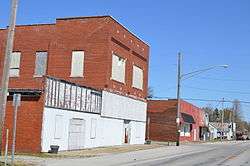
Main Street at Adams Street | |
 Richland City, Indiana | |
| Coordinates: 37°56′43″N 87°10′04″W / 37.94528°N 87.16778°WCoordinates: 37°56′43″N 87°10′04″W / 37.94528°N 87.16778°W | |
| Country | United States |
| State | Indiana |
| County | Spencer |
| Township | Luce |
| Area[1] | |
| • Total | 0.52 sq mi (1.35 km2) |
| • Land | 0.52 sq mi (1.35 km2) |
| • Water | 0 sq mi (0 km2) |
| Elevation[2] | 390 ft (120 m) |
| Population (2010)[3] | |
| • Total | 425 |
| • Estimate (2012[4]) | 417 |
| • Density | 817.3/sq mi (315.6/km2) |
| ZIP code | 47634 |
| FIPS code | 18-64255[5] |
| GNIS feature ID | 441965 |
Richland City is a town in Luce Township, Spencer County, Indiana.[6] Until 2008, it was an unincorporated community; the town's residents voted to incorporate in the November 2008 general election. The population was 425 at the 2010 census.
The town is developing plans to offer certain services to its residents. Police protection will not be provided by the town, but through an arrangement with the Spencer County Sheriff's Department.
History
Richland City was laid out in 1861.[7] The town was so named on account of their fertile soil.[8]
The first post office was established in 1862, under the name Lake. It was renamed Richland in 1921, and has still been operating since.[9]
Geography
Richland City is located at 37°56′43″N 87°10′04″W / 37.94528°N 87.16778°W.
According to the United States Census Bureau, the town has a total area of 0.52 square miles (1.35 km2), all land.[1]
Demographics
| Historical population | |||
|---|---|---|---|
| Census | Pop. | %± | |
| 2010 | 425 | — | |
| Est. 2015 | 407 | [10] | −4.2% |
2010 census
As of the census[3] of 2010, there were 425 people, 170 households, and 121 families residing in the town. The population density was 817.3 inhabitants per square mile (315.6/km2). There were 194 housing units at an average density of 373.1 per square mile (144.1/km2). The racial makeup of the town was 98.6% White, 0.2% African American, 0.5% Native American, and 0.7% from two or more races. Hispanic or Latino of any race were 1.2% of the population.
There were 170 households of which 41.2% had children under the age of 18 living with them, 56.5% were married couples living together, 9.4% had a female householder with no husband present, 5.3% had a male householder with no wife present, and 28.8% were non-families. 23.5% of all households were made up of individuals and 11.1% had someone living alone who was 65 years of age or older. The average household size was 2.50 and the average family size was 2.99.
The median age in the town was 35.2 years. 28% of residents were under the age of 18; 5.7% were between the ages of 18 and 24; 25.8% were from 25 to 44; 28.5% were from 45 to 64; and 12% were 65 years of age or older. The gender makeup of the town was 50.1% male and 49.9% female.
References
- 1 2 "Places: Indiana". 2010 Census Gazetteer Files. United States Census Bureau. Retrieved 2012-04-21. External link in
|work=(help) - ↑ "US Board on Geographic Names". United States Geological Survey. 2007-10-25. Retrieved 2008-01-31.
- 1 2 "American FactFinder". United States Census Bureau. Retrieved 2012-12-11.
- ↑ "Population Estimates". United States Census Bureau. Archived from the original on June 17, 2013. Retrieved 2013-06-25.
- ↑ "American FactFinder". United States Census Bureau. Retrieved 2008-01-31.
- ↑ "Richland City, Indiana". Geographic Names Information System. United States Geological Survey. Retrieved 2016-07-09.
- ↑ History of Warrick, Spencer, and Perry Counties, Indiana: From the Earliest Time to the Present. Goodspeed. 1885. p. 361.
- ↑ Baker, Ronald L. (October 1995). From Needmore to Prosperity: Hoosier Place Names in Folklore and History. Indiana University Press. p. 279. ISBN 978-0-253-32866-3.
...name is for rich farmland in the area.
- ↑ "Spencer County". Jim Forte Postal History. Retrieved July 9, 2016.
- ↑ "Annual Estimates of the Resident Population for Incorporated Places: April 1, 2010 to July 1, 2015". Retrieved June 4, 2016.
- ↑ "Census of Population and Housing". Census.gov. Archived from the original on May 11, 2015. Retrieved June 4, 2015.