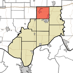
Carter Township, Spencer County, Indiana
| Carter Township | |
|---|---|
| Township | |
 | |
| Coordinates: 38°09′21″N 86°57′32″W / 38.15583°N 86.95889°WCoordinates: 38°09′21″N 86°57′32″W / 38.15583°N 86.95889°W | |
| Country | United States |
| State | Indiana |
| County | Spencer |
| Government | |
| • Type | Indiana township |
| Area | |
| • Total | 36.09 sq mi (93.5 km2) |
| • Land | 35.84 sq mi (92.8 km2) |
| • Water | 0.26 sq mi (0.7 km2) |
| Elevation[1] | 528 ft (161 m) |
| Population (2010) | |
| • Total | 3,258 |
| • Density | 90.9/sq mi (35.1/km2) |
| FIPS code | 18-10576[2] |
| GNIS feature ID | 453161 |
Carter Township is one of nine townships in Spencer County, Indiana. As of the 2010 census, its population was 3,258 and it contained 1,327 housing units.[3]
History
Carter Township was named for Thomas Carter, a county commissioner.[4]
Geography
According to the 2010 census, the township has a total area of 36.09 square miles (93.5 km2), of which 35.84 square miles (92.8 km2) (or 99.31%) is land and 0.26 square miles (0.67 km2) (or 0.72%) is water.[3]
Cities and towns
Unincorperated towns
References
- ↑ "US Board on Geographic Names". United States Geological Survey. 2007-10-25. Retrieved 2008-01-31.
- ↑ "American FactFinder". United States Census Bureau. Archived from the original on 2013-09-11. Retrieved 2008-01-31.
- 1 2 "Population, Housing Units, Area, and Density: 2010 - County -- County Subdivision and Place -- 2010 Census Summary File 1". United States Census. Retrieved 2013-05-10.
- ↑ History of Warrick, Spencer, and Perry Counties, Indiana: From the Earliest Time to the Present. Goodspeed. 1885. p. 272.
External links
This article is issued from Wikipedia - version of the 11/16/2016. The text is available under the Creative Commons Attribution/Share Alike but additional terms may apply for the media files.