West Sale Airport
| West Sale Airport | |||||||||||||||||||
|---|---|---|---|---|---|---|---|---|---|---|---|---|---|---|---|---|---|---|---|
| IATA: SXE – ICAO: YWSL | |||||||||||||||||||
| Summary | |||||||||||||||||||
| Airport type | Public | ||||||||||||||||||
| Operator | Wellington Shire Council | ||||||||||||||||||
| Location | Sale, Victoria | ||||||||||||||||||
| Elevation AMSL | 72 ft / 22 m | ||||||||||||||||||
| Coordinates | 38°05′30″S 146°57′55″E / 38.09167°S 146.96528°ECoordinates: 38°05′30″S 146°57′55″E / 38.09167°S 146.96528°E | ||||||||||||||||||
| Map | |||||||||||||||||||
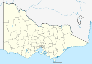 YWSL Location in Victoria | |||||||||||||||||||
| Runways | |||||||||||||||||||
| |||||||||||||||||||
West Sale Airport (IATA: SXE, ICAO: YWSL) is located about 5 nautical miles (9.3 km; 5.8 mi) west[1] of Sale, Victoria, Australia, off the Princes Highway.
During World War II, the aerodrome was requisitioned by the Royal Australian Air Force in 1941. Known as RAAF Base West Sale and RAAF Station West Sale, the aerodrome was home to No. 3 Bombing and Gunnery School and Air Gunnery School until December 1945, when the aerodrome was handed back to its owners.
Since 1991 there have been 11 Grumman S-2 Tracker anti-submarine aircraft formerly of the Royal Australian Navy stored at the airport.[2]
The Gippsland Armed Forces Museum is located at West Sale Airport.[3]
See also
References
- 1 2 YWSL – West Sale (PDF). AIP En Route Supplement from Airservices Australia, effective 10 November 2016, Aeronautical Chart
- ↑ FORMER ROYAL AUSTRALIAN NAVY (RAN) – FLEET AIR ARM (FAA) GRUMMAN S-2E/G TRACKERS STILL WAITING FOR THEIR FATE TO BE DECIDED February 2016 Down Under Aviation News Retrieved August 29, 2016
- ↑ Contact - Gippsland Armed Forces Museum Retrieved 4 April, 2016
This article is issued from Wikipedia - version of the 12/4/2016. The text is available under the Creative Commons Attribution/Share Alike but additional terms may apply for the media files.