Geelong Airport
| Geelong Airport | |||||||||||||||
|---|---|---|---|---|---|---|---|---|---|---|---|---|---|---|---|
|
IATA: | |||||||||||||||
| Summary | |||||||||||||||
| Airport type | Public | ||||||||||||||
| Serves | Geelong | ||||||||||||||
| Location | Grovedale | ||||||||||||||
| Elevation AMSL | 140 ft / 43 m | ||||||||||||||
| Coordinates | 38°13′31″S 144°19′59″E / 38.22528°S 144.33306°ECoordinates: 38°13′31″S 144°19′59″E / 38.22528°S 144.33306°E | ||||||||||||||
| Map | |||||||||||||||
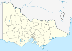 YGLG Location in Victoria | |||||||||||||||
| Runways | |||||||||||||||
| |||||||||||||||
|
Reference[1]YGLG – Perth (PDF). AIP En Route Supplement from Airservices Australia, effective 10 November 2016 | |||||||||||||||
Geelong Airport (IATA: GEX, ICAO: YGLG) was a small airfield specifically for light aircraft located in Mount Duneed, Victoria, Australia. It was primarily used for scenic flights and private aircraft, and was located in the local government area of the City of Greater Geelong.
The airport contained two gravel/tarmac runways: north/south and east/west. Though commercial airlines had attempted to fly services to Geelong in the past, they chose to use the more developed airport at Avalon Airport, located to the north on the Melbourne side of the city. Operations from Avalon also proved to be unsuccessful. Other airports in the area are at Barwon Heads (ICAO: YBRS), the Torquay Airport at 365 Blackgate Road, Torquay and Tiger Moth World at 325 Blackgate Rd.
The site is also used to record wind and weather measurements for the area.[2] Geelong airport was sold to property developers to allow for the expansion of the urban sprawl of Geelong. The airport closed 31 December 2011.[3]