Melton Airfield
| Melton Airfield | |||||||||||||||||||
|---|---|---|---|---|---|---|---|---|---|---|---|---|---|---|---|---|---|---|---|
| IATA: none – ICAO: YMEL | |||||||||||||||||||
| Summary | |||||||||||||||||||
| Airport type | Private | ||||||||||||||||||
| Operator | E. Reeve | ||||||||||||||||||
| Location | Melton, Victoria | ||||||||||||||||||
| Elevation AMSL | 670 ft / 204 m | ||||||||||||||||||
| Coordinates | 37°37′18″S 144°33′54″E / 37.62167°S 144.56500°ECoordinates: 37°37′18″S 144°33′54″E / 37.62167°S 144.56500°E | ||||||||||||||||||
| Map | |||||||||||||||||||
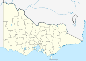 YMEL Location in Victoria | |||||||||||||||||||
| Runways | |||||||||||||||||||
| |||||||||||||||||||
Melton Airfield (ICAO: YMEL) is a small grass strip airfield located approximately 5 km (3.1 mi) north of the city centre of Melton in the City of Melton, Victoria, Australia. It is located at the intersection of Coburns Road and Diggers Rest - Coimadai Road. The small grass airstrip runs approximately east-west. The airfield is home to the Melton Air Services.[2] It has four hangars and parking for light aircraft, an office and vehicle parking.
The airfield was originally begun by Mr. Terry Fogarty Snr. and in the early days known as "Fogarty's Field". Mr. Terry Fogarty Jnr. served as a flying instructor there for many years.[3]
See also
References
- ↑ YMEL – Melton (PDF). AIP En Route Supplement from Airservices Australia, effective 10 November 2016
- ↑ Melton Air Services
- ↑ Melton Air Services - About Us
This article is issued from Wikipedia - version of the 12/4/2016. The text is available under the Creative Commons Attribution/Share Alike but additional terms may apply for the media files.