Priddy
| Priddy | |
 Priddy Green |
|
 Priddy |
|
| Population | 624 (2011)[1] |
|---|---|
| OS grid reference | ST527508 |
| District | Mendip |
| Shire county | Somerset |
| Region | South West |
| Country | England |
| Sovereign state | United Kingdom |
| Post town | WELLS |
| Postcode district | BA5 |
| Dialling code | 01749 |
| Police | Avon and Somerset |
| Fire | Devon and Somerset |
| Ambulance | South Western |
| EU Parliament | South West England |
| UK Parliament | Wells |
Coordinates: 51°15′15″N 2°40′38″W / 51.2543°N 2.6771°W
Priddy is a village in Somerset, England in the Mendip Hills, close to East Harptree and 5 miles (8 km) north-west of Wells. It is in the local government district of Mendip.
The village lies in a small hollow near the summit of the Mendip range of hills, at an elevation of nearly 1,000 feet (300 m) above sea-level, and has evidence of occupation since neolithic times.[2] There are also the remains of lead mining activities[3] and caves in the limestone beneath the village.
It is the venue for the annual Folk Festival and Sheep Fair, which has been held here since 1348.
Etymology
Priddy, with medieval variations of spellings such as Predy, Priddie, Pridi, Pridia, Pridie and Prydde, is a name that has been ascribed to the Welsh influence that pre-dated the arrival of the Saxon English. It has been particularly attributed to pridd (= "earth"). This might be suggestive of the Iron Age mining activities. The Latin words pratum (= a meadow) and praedium (= a farm) have given rise to such Alpine names as Preda and Prada and it has been suggested that they are also the root for the cymric words prydd, pryddion meaning "production", as with a fertile meadow. "Priddy" could just mean "meadow land".[4]
An alternative explanation is 'The high water' from the Celtic prid and the Old English ea,[5] and another alternative suggests it could come from the Welsh word preiddiau, pronounced preidhye, meaning flock or herd.[6]
History
In 1977 a Mesolithic hut site was excavated at Priddy.[7] Nearby are the Priddy Circles a Stone circle or Henge monument, which appears to be contemporary with Stonehenge, i.e. Neolithic circa 2180 BC.[8] The North Hill location of two round barrow cemeteries, Ashen Hill and Priddy Nine-Barrows which are neighbours of the Circles, would seem to imply that the area to the north-east of Priddy held ritual significance into the Bronze Age.[9] South of the village at Deer Leap is a Bronze age burial mound and the remains of a medieval settlement of Ramspit. Drove Cottage Henge is a Neolithic ceremonial location to the east of the village.[10]
Lead was being worked as far back as 300 to 200 BC.[11] The area east and north-west of the village shows extensive patches of "gruffy ground". The word "gruffy" derives from the grooves that were formed where the lead ore was extracted from veins near the surface. The relatively easy opencast extraction of lead was a strong attraction for the Romans. Lead ingots found in the neighbourhood have been dated to AD 49.[4][12] The ruins of St Cuthbert's Leadworks which closed in 1908 can still be seen.[13][14] Although the village is not mentioned in the Domesday Book it appears to be the subject of a lost Saxon charter of the late 7th or 8th century.[9]
The parish was part of the hundred of Wells Forum.[15]
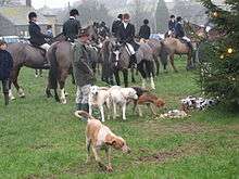
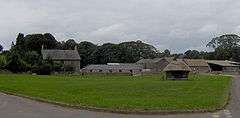
Since the 1920s, the kennels for the Mendip Farmers' Hunt fox hounds have been based near the village, but the hunt was planning to relocate them to Chewton Mendip,[16] a move which is faced significant local opposition.[17][18] The group starts a number of fox hunts from the village green, including one on Boxing Day.[19] In 2014 a decision was made by Mendip District Council to allow the development of the kennels in the village.[20]
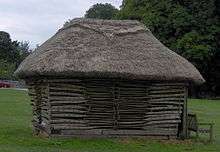
In April 2013 the stack of sheep hurdles on the green was set alight in an arson attack.[21] In July 2013, locals remade The Hurdles.
Governance
The parish council has responsibility for local issues, including setting an annual precept (local rate) to cover the council’s operating costs and producing annual accounts for public scrutiny. The parish council evaluates local planning applications and works with the local police, district council officers, and neighbourhood watch groups on matters of crime, security, and traffic. The parish council's role also includes initiating projects for the maintenance and repair of parish facilities, as well as consulting with the district council on the maintenance, repair, and improvement of highways, drainage, footpaths, public transport, and street cleaning. Conservation matters (including trees and listed buildings) and environmental issues are also the responsibility of the council.
The village falls within the Non-metropolitan district of Mendip, which was formed on 1 April 1974 under the Local Government Act 1972, having previously been part of Wells Rural District,[22] which is responsible for local planning and building control, local roads, council housing, environmental health, markets and fairs, refuse collection and recycling, cemeteries and crematoria, leisure services, parks, and tourism.
Somerset County Council is responsible for running the largest and most expensive local services such as education, social services, libraries, main roads, public transport, policing and fire services, trading standards, waste disposal and strategic planning.
It is also part of the Wells county constituency represented in the House of Commons of the Parliament of the United Kingdom. It elects one Member of Parliament (MP) by the first past the post system of election, and part of the South West England constituency of the European Parliament which elects seven MEPs using the d'Hondt method of party-list proportional representation.
Geography
Priddy Pools, a Site of Special Scientific Interest (SSSI), were originally formed when the Romans started mining lead in the area. Priddy Caves are also an SSSI with the entrance to Swildon's Hole just outside the village. Priddy Mineries is a Nature Reserve as is Chancellor's Farm. The other caves of the Mendip Hills in and around Priddy include: Eastwater Cavern, Hunter's Hole, St Cuthbert's Swallet, and Wigmore Swallet.
Religious sites

The Church of St Lawrence dates from the 13th century, with some rebuilding in the 15th century and was restored in 1881–1888; it is a Grade I listed building.[23] The three bells in the church were augmented to five in 1997. The church includes a medieval altar frontal.[24] According to supporters of the theory that Jesus of Nazareth visited Britain during his childhood, Priddy was the place where he traded metals with local miners.[25][26][27]
References
- ↑ "Priddy Parish". Neighbourhood Statistics. Office for National Statistics. Retrieved 1 January 2014.
- ↑ "The Southern Regions". Mendip AONB. Retrieved 18 August 2009.
- ↑ "Lead mining on the Mendip Hills". Mendip AONB. Retrieved 18 August 2009.
- 1 2 "About Priddy". Priddy Folk Festival. Archived from the original on 2 July 2006. Retrieved 17 July 2006.
- ↑ Robinson, Stephen (1992). Somerset Place Names. Wimborne, Dorset: The Dovecote Press Ltd. ISBN 1-874336-03-2.
- ↑ "Autumn newsletter 2007" (PDF). Mendip Hills AONB. Retrieved 25 September 2007.
- ↑ Havinden, Michael. The Somerset Landscape. The making of the English landscape. London: Hodder and Stoughton. p. 47. ISBN 0-340-20116-9.
- ↑ Dunning, Robert (1983). A History of Somerset. Chichester, West Sussex: Phillimore & Co. ISBN 0-85033-461-6.
- 1 2 "Mendip Hills: An Archaeological Survey of the Area of Outstanding Natural Beauty" (PDF). Somerset County Council Archaeological Projects. Retrieved 28 October 2006.
- ↑ "Mendip Hills". English Heritage. Retrieved 2 January 2011.
- ↑ "Priddy Mineries". Wildlife Trusts Somerset. Retrieved 17 July 2006.
- ↑ Gough, J.W. (1967). The mines of Mendip. Newton Abbot, Devon: David & Charles.
- ↑ Atthill, Robin (1976). Mendip: A new study. Newton Abbot, Devon: David & Charles. ISBN 0-7153-7297-1.
- ↑ Toulson, Shirley (1984). The Mendip Hills: A Threatened Landscape. London: Victor Gollancz. ISBN 0-575-03453-X.
- ↑ "Somerset Hundreds". GENUKI. Retrieved 12 September 2011.
- ↑ "Fox hunt kennels plan for Chewton Mendip opposed". BBC News. 16 June 2010. Retrieved 28 June 2010.
- ↑ "Anti-kennel campaign worried over new plan". Western Daily Press. This is Somerset. 17 December 2010. Retrieved 23 July 2014.
- ↑ "Fox hunt kennels plan for Chewton Mendip opposed". BBC. Retrieved 23 July 2014.
- ↑ "Boxing Day Meets 2008". Masters of Foxhounds Association (MFHA). Retrieved 28 June 2010.
- ↑ "Decision made on Mendip Farmers' Hunt kennels in Priddy". Wells Journal. 21 July 2014. Retrieved 23 July 2014.
- ↑ "Priddy sheep hurdle store is destroyed by fire". BBC News. Retrieved 30 April 2013.
- ↑ "Wells RD". A vision of Britain Through Time. University of Portsmouth. Retrieved 4 January 2014.
- ↑ "Church of St Lawrence". Images of England. Retrieved 17 July 2006.
- ↑ Reid, Robert Douglas (1979). Some buildings of Mendip. The Mendip Society. ISBN 0-905459-16-4.
- ↑ SWanson, Vern G. (2006). Dynasty of the Holy Grail: Mormonism's Sacred Bloodline. Cedar Fort. p. 39. ISBN 9781555178239.
- ↑ Price, Dennis (2010). The Missing Years of Jesus: The Extraordinary Evidence that Jesus Visited the British Isles. Hay House. pp. 89–92. ISBN 9781848504189.
- ↑ Lewis, Glyn S. (2008). Did Jesus Come to Britain?: An Investigation Into the Traditions That Christ Visited Cornwall and Somerset. Clairview Books. pp. 58–59. ISBN 9781905570157.
External links
| Wikimedia Commons has media related to Priddy. |
- Map of Priddy circa 1900
- Priddy Primary School
- Rowberrow Barrows (Nr Priddy) report from CHERT CBA South West (2007) Retrieved on 4 December 2008.
- Priddy at DMOZ
