Portage, Ohio
| Portage, Ohio | |
|---|---|
| Village | |
|
Portage, Ohio is bisected by State Route 25, sometimes known as South Dixie Highway. | |
 Location of Portage, Ohio | |
 Location of Portage in Wood County | |
| Coordinates: 41°19′34″N 83°38′59″W / 41.32611°N 83.64972°WCoordinates: 41°19′34″N 83°38′59″W / 41.32611°N 83.64972°W | |
| Country | United States |
| State | Ohio |
| County | Wood |
| Government | |
| • Mayor | William Mark Wolford |
| Area[1] | |
| • Total | 1.49 sq mi (3.86 km2) |
| • Land | 1.49 sq mi (3.86 km2) |
| • Water | 0 sq mi (0 km2) |
| Elevation[2] | 686 ft (209 m) |
| Population (2010)[3] | |
| • Total | 438 |
| • Estimate (2012[4]) | 442 |
| • Density | 294.0/sq mi (113.5/km2) |
| Time zone | Eastern (EST) (UTC-5) |
| • Summer (DST) | EDT (UTC-4) |
| ZIP code | 43451 |
| Area code(s) | 419 |
| FIPS code | 39-64108[5] |
| GNIS feature ID | 1061566[2] |

Portage is a village in Wood County, Ohio, United States. The population was 438 at the 2010 census.
History
Portage was platted in 1836.[6] The village takes its name from the nearby Portage River.[7] A post office called Portage has been in operation since 1829.[8] Portage was incorporated as a village in 1857.[9]
Geography
Portage is located at 41°19′34″N 83°38′59″W / 41.32611°N 83.64972°W (41.326157, -83.649646).[10]
According to the United States Census Bureau, the village has a total area of 1.49 square miles (3.86 km2), all land.[1]
Demographics
| Historical population | |||
|---|---|---|---|
| Census | Pop. | %± | |
| 1880 | 304 | — | |
| 1890 | 438 | 44.1% | |
| 1900 | 546 | 24.7% | |
| 1910 | 450 | −17.6% | |
| 1920 | 408 | −9.3% | |
| 1930 | 432 | 5.9% | |
| 1940 | 408 | −5.6% | |
| 1950 | 437 | 7.1% | |
| 1960 | 420 | −3.9% | |
| 1970 | 494 | 17.6% | |
| 1980 | 479 | −3.0% | |
| 1990 | 469 | −2.1% | |
| 2000 | 428 | −8.7% | |
| 2010 | 438 | 2.3% | |
| Est. 2015 | 451 | [11] | 3.0% |
2010 census
As of the census[3] of 2010, there were 438 people, 164 households, and 105 families residing in the village. The population density was 294.0 inhabitants per square mile (113.5/km2). There were 174 housing units at an average density of 116.8 per square mile (45.1/km2). The racial makeup of the village was 94.1% White, 1.4% African American, 0.5% Native American, 0.5% Pacific Islander, 3.0% from other races, and 0.7% from two or more races. Hispanic or Latino of any race were 7.8% of the population.
There were 164 households of which 30.5% had children under the age of 18 living with them, 51.2% were married couples living together, 8.5% had a female householder with no husband present, 4.3% had a male householder with no wife present, and 36.0% were non-families. 27.4% of all households were made up of individuals and 7.9% had someone living alone who was 65 years of age or older. The average household size was 2.50 and the average family size was 3.06.
The median age in the village was 38 years. 20.5% of residents were under the age of 18; 9.7% were between the ages of 18 and 24; 27.9% were from 25 to 44; 33.1% were from 45 to 64; and 8.9% were 65 years of age or older. The gender makeup of the village was 49.8% male and 50.2% female.
2000 census
As of the census[5] of 2000, there were 428 people, 153 households, and 108 families residing in the village. The population density was 286.0 people per square mile (110.2/km²). There were 166 housing units at an average density of 110.9 per square mile (42.7/km²). The racial makeup of the village was 91.59% White, 1.17% African American, 0.70% Native American, 3.74% from other races, and 2.80% from two or more races. Hispanic or Latino of any race were 9.81% of the population.
There were 153 households out of which 35.3% had children under the age of 18 living with them, 62.1% were married couples living together, 7.2% had a female householder with no husband present, and 28.8% were non-families. 22.9% of all households were made up of individuals and 7.2% had someone living alone who was 65 years of age or older. The average household size was 2.63 and the average family size was 3.12.
In the village the population was spread out with 25.9% under the age of 18, 8.2% from 18 to 24, 34.1% from 25 to 44, 22.4% from 45 to 64, and 9.3% who were 65 years of age or older. The median age was 38 years. For every 100 females there were 106.8 males. For every 100 females age 18 and over, there were 105.8 males.
The median income for a household in the village was $37,031, and the median income for a family was $43,125. Males had a median income of $35,227 versus $22,321 for females. The per capita income for the village was $15,698. About 3.9% of families and 10.4% of the population were below the poverty line, including 5.5% of those under age 18 and none of those age 65 or over.
Notable people
- Dan Abbott, baseball player
- Herman Keiser, a professional golfer
- Darwin Phelps, a Republican member of the U.S. House of Representatives from Pennsylvania
- Don Carlos Seitz, a newspaper manager
Current Elected Officials
Mayor: William Wolford
Council: Michael Brinkman
Council: Carl Crawford
Council: Kristen Hidinger
Council: Marcia Wolford
Council: Rose Yoder [13]
References
- 1 2 "US Gazetteer files 2010". United States Census Bureau. Retrieved 2013-01-06.
- 1 2 "US Board on Geographic Names". United States Geological Survey. 2007-10-25. Retrieved 2008-01-31.
- 1 2 "American FactFinder". United States Census Bureau. Retrieved 2013-01-06.
- ↑ "Population Estimates". United States Census Bureau. Retrieved 2013-06-17.
- 1 2 "American FactFinder". United States Census Bureau. Retrieved 2008-01-31.
- ↑ Leeson, Michael A. (1897). Commemorative Historical and Biographical Record of Wood County, Ohio: Its Past and Present, Early Settlement and Development. J.H. Beers & Company. p. 393.
- ↑ Overman, William Daniel (1958). Ohio Town Names. Akron, OH: Atlantic Press. p. 113.
- ↑ "Wood County". Jim Forte Postal History. Retrieved 11 January 2016.
- ↑ "Cities, Townships, & Villages". Wood County Government. Archived from the original on June 6, 2015. Retrieved 11 January 2016.
- ↑ "US Gazetteer files: 2010, 2000, and 1990". United States Census Bureau. 2011-02-12. Retrieved 2011-04-23.
- ↑ "Annual Estimates of the Resident Population for Incorporated Places: April 1, 2010 to July 1, 2015". Retrieved July 2, 2016.
- ↑ "Census of Population and Housing". Census.gov. Retrieved June 4, 2015.
- ↑ "Office Holder Details" (PDF). Retrieved June 7, 2016.
Municipalities and communities of Wood County, Ohio, United States | ||
|---|---|---|
| Cities | 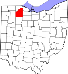 | |
| Villages | ||
| Townships | ||
| CDPs | ||
| Other unincorporated communities | ||
| Footnotes | ‡This populated place also has portions in an adjacent county or counties | |