Pooraka, South Australia
| Pooraka Adelaide, South Australia | |||||||||||||
|---|---|---|---|---|---|---|---|---|---|---|---|---|---|
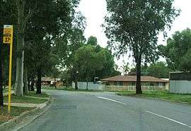 Street in Pooraka | |||||||||||||
| Postcode(s) | 5095 | ||||||||||||
| Location | 12 km (7 mi) N of Adelaide city centre | ||||||||||||
| LGA(s) | City of Salisbury | ||||||||||||
| State electorate(s) | |||||||||||||
| Federal Division(s) | Makin | ||||||||||||
| |||||||||||||
Pooraka (postcode: 5095) is a suburb in Adelaide, South Australia. It is around 11-12 km north of the central business district.
Pooraka East Post Office opened on 1 December 1965 and closed in 1986.[1]
History
The origin of the name Pooraka is obscure. Originally known as "Dry Creek" after the name of the local post office, in 1916, the District Council of Yatala renamed the suburb Pooraka, which they believed to be an Indigenous Kaurna word meaning "dry creek," however, the name bears no resemblance to the Kaurna words for 'dry' or 'creek'. Pooraka, with the same spelling, has been identified as an Indigenous New South Wales name for the 'turpentine tree' which is not found in South Australia.[2]
References
- ↑ Premier Postal History. "Post Office List". Premier Postal Auctions. Retrieved 26 May 2011.
- ↑ Amery, Rob. "Reclaiming through renaming: The reinstatement of Kaurna toponyms in Adelaide and the Adelaide plains" (PDF). Australian National University. Retrieved 11 August 2013.
Coordinates: 34°49′28″S 138°37′37″E / 34.82444°S 138.62694°E