Waterloo Corner, South Australia
| Waterloo Corner Adelaide, South Australia | |||||||||||||
|---|---|---|---|---|---|---|---|---|---|---|---|---|---|
 House on Port Wakefield Road, Waterloo Corner | |||||||||||||
 Waterloo Corner | |||||||||||||
| Coordinates | 34°43′S 138°35′E / 34.717°S 138.583°ECoordinates: 34°43′S 138°35′E / 34.717°S 138.583°E | ||||||||||||
| Population | |||||||||||||
| Postcode(s) | 5110 | ||||||||||||
| LGA(s) | |||||||||||||
| State electorate(s) | Taylor | ||||||||||||
| Federal Division(s) | Wakefield and Port Adelaide | ||||||||||||
| |||||||||||||
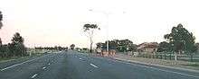
Port Wakefield Road. Waterloo Corner is on the left hand side
Waterloo Corner is a rural/urban suburb approximately 22 kilometres north of Adelaide, the capital city of South Australia. Most of the land is used for agricultural purposes, including wheat, olives, grapes and tomatoes. Port Wakefield Road, and thus a lot of heavy freight, traverses the suburb.
Waterloo Corner Post Office closed in 1972.[3]
References
- ↑ Australian Bureau of Statistics (31 October 2012). "Waterloo Corner (State Suburb)". 2011 Census QuickStats. Retrieved 14 February 2015.
- ↑ Australian Bureau of Statistics (25 October 2007). "Waterloo Corner (State Suburb)". 2006 Census QuickStats. Retrieved 14 February 2015.
- ↑ Premier Postal History. "Post Office List". Premier Postal Auctions. Retrieved 26 May 2011.
This article is issued from Wikipedia - version of the 2/16/2015. The text is available under the Creative Commons Attribution/Share Alike but additional terms may apply for the media files.