Polk, Ohio
| Polk, Ohio | |
|---|---|
| Village | |
|
| |
 Location of Polk, Ohio | |
 Location of Polk in Ashland County | |
| Coordinates: 40°56′44″N 82°13′3″W / 40.94556°N 82.21750°WCoordinates: 40°56′44″N 82°13′3″W / 40.94556°N 82.21750°W | |
| Country | United States |
| State | Ohio |
| County | Ashland |
| Area[1] | |
| • Total | 1.03 sq mi (2.67 km2) |
| • Land | 1.01 sq mi (2.62 km2) |
| • Water | 0.02 sq mi (0.05 km2) |
| Elevation[2] | 1,270 ft (387 m) |
| Population (2010)[3] | |
| • Total | 336 |
| • Estimate (2012[4]) | 337 |
| • Density | 332.7/sq mi (128.5/km2) |
| Time zone | Eastern (EST) (UTC-5) |
| • Summer (DST) | EDT (UTC-4) |
| ZIP code | 44866 |
| Area code(s) | 419 |
| FIPS code | 39-63996[5] |
| GNIS feature ID | 1061562[2] |

Polk is a village in Ashland County, Ohio, United States. The population was 336 at the 2010 census.
History
Polk was laid out in 1849.[6] A post office called Polk has been in operation since 1846.[7]
Geography
Polk is located at 40°56′44″N 82°13′3″W / 40.94556°N 82.21750°W (40.945541, -82.217374).[8]
According to the United States Census Bureau, the village has a total area of 1.03 square miles (2.67 km2), of which 1.01 square miles (2.62 km2) is land and 0.02 square miles (0.05 km2) is water.[1]
Notable people
Polk was the birthplace of Tully "Topsy" Hartsel, a Major League Baseball outfielder and World War II major general Stanley Eric Reinhart.
Demographics
| Historical population | |||
|---|---|---|---|
| Census | Pop. | %± | |
| 1880 | 335 | — | |
| 1890 | 264 | −21.2% | |
| 1900 | 232 | −12.1% | |
| 1910 | 250 | 7.8% | |
| 1920 | 263 | 5.2% | |
| 1930 | 274 | 4.2% | |
| 1940 | 275 | 0.4% | |
| 1950 | 332 | 20.7% | |
| 1960 | 358 | 7.8% | |
| 1970 | 435 | 21.5% | |
| 1980 | 351 | −19.3% | |
| 1990 | 355 | 1.1% | |
| 2000 | 357 | 0.6% | |
| 2010 | 336 | −5.9% | |
| Est. 2015 | 339 | [9] | 0.9% |
2010 census
As of the census[3] of 2010, there were 336 people, 129 households, and 87 families residing in the village. The population density was 332.7 inhabitants per square mile (128.5/km2). There were 136 housing units at an average density of 134.7 per square mile (52.0/km2). The racial makeup of the village was 97.0% White, 0.3% African American, 0.9% from other races, and 1.8% from two or more races. Hispanic or Latino of any race were 2.4% of the population.
There were 129 households of which 34.9% had children under the age of 18 living with them, 52.7% were married couples living together, 8.5% had a female householder with no husband present, 6.2% had a male householder with no wife present, and 32.6% were non-families. 27.9% of all households were made up of individuals and 11.7% had someone living alone who was 65 years of age or older. The average household size was 2.60 and the average family size was 3.10.
The median age in the village was 39.3 years. 27.1% of residents were under the age of 18; 3.8% were between the ages of 18 and 24; 30.1% were from 25 to 44; 27.6% were from 45 to 64; and 11.3% were 65 years of age or older. The gender makeup of the village was 47.6% male and 52.4% female.
2000 census
As of the census[5] of 2000, there were 357 people, 124 households, and 103 families residing in the village. The population density was 354.1 people per square mile (136.5/km²). There were 127 housing units at an average density of 126.0 per square mile (48.5/km²). The racial makeup of the village was 98.60% White, 0.56% Native American, and 0.84% from two or more races.
There were 124 households out of which 37.9% had children under the age of 18 living with them, 68.5% were married couples living together, 8.1% had a female householder with no husband present, and 16.9% were non-families. 13.7% of all households were made up of individuals and 6.5% had someone living alone who was 65 years of age or older. The average household size was 2.88 and the average family size was 3.12.
In the village the population was spread out with 26.6% under the age of 18, 10.4% from 18 to 24, 30.3% from 25 to 44, 21.6% from 45 to 64, and 11.2% who were 65 years of age or older. The median age was 34 years. For every 100 females there were 87.9 males. For every 100 females age 18 and over, there were 91.2 males.
The median income for a household in the village was $41,875, and the median income for a family was $43,750. Males had a median income of $30,583 versus $21,250 for females. The per capita income for the village was $16,159. About 4.0% of families and 5.0% of the population were below the poverty line, including 10.5% of those under age 18 and 10.9% of those age 65 or over.
References
- 1 2 "US Gazetteer files 2010". United States Census Bureau. Retrieved 2013-01-06.
- 1 2 "US Board on Geographic Names". United States Geological Survey. 2007-10-25. Retrieved 2008-01-31.
- 1 2 "American FactFinder". United States Census Bureau. Retrieved 2013-01-06.
- ↑ "Population Estimates". United States Census Bureau. Retrieved 2013-06-17.
- 1 2 "American FactFinder". United States Census Bureau. Retrieved 2008-01-31.
- ↑ Baughman, Abraham J. (1909). History of Ashland County, Ohio, Volume 1. S. J. Clarke Publishing Company. p. 174.
- ↑ "Ashland County". Jim Forte Postal History. Retrieved 27 December 2015.
- ↑ "US Gazetteer files: 2010, 2000, and 1990". United States Census Bureau. 2011-02-12. Retrieved 2011-04-23.
- ↑ "Annual Estimates of the Resident Population for Incorporated Places: April 1, 2010 to July 1, 2015". Retrieved July 2, 2016.
- ↑ "Census of Population and Housing". Census.gov. Retrieved June 4, 2015.
Municipalities and communities of Ashland County, Ohio, United States | ||
|---|---|---|
| City | 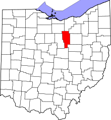 | |
| Villages | ||
| Townships | ||
| CDP | ||
| Unincorporated communities | ||
| Footnotes | ‡This populated place also has portions in an adjacent county or counties | |