Ashland, Ohio
| City of Ashland | |
|---|---|
| City | |
|
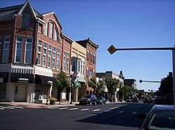
East Main Street, downtown | |
| Motto: "Someplace Special"[1] | |
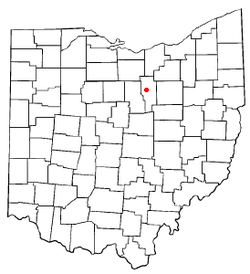 Location of Ashland, Ohio | |
 Location of Ashland in Ashland County | |
| Coordinates: 40°52′1″N 82°18′55″W / 40.86694°N 82.31528°WCoordinates: 40°52′1″N 82°18′55″W / 40.86694°N 82.31528°W | |
| Country | United States |
| State | Ohio |
| County | Ashland |
| Government | |
| • Mayor | Glen P. Stewart[2] |
| Area[3] | |
| • Total | 11.23 sq mi (29.09 km2) |
| • Land | 11.17 sq mi (28.93 km2) |
| • Water | 0.06 sq mi (0.16 km2) |
| Elevation[4] | 1,066 ft (325 m) |
| Population (2010)[5] | |
| • Total | 20,362 |
| • Estimate (2012[6]) | 20,320 |
| • Density | 1,822.9/sq mi (703.8/km2) |
| Time zone | Eastern (EST) (UTC-5) |
| • Summer (DST) | EDT (UTC-4) |
| ZIP code | 44805 |
| Area code(s) | 419, 567 |
| FIPS code | 39-02568[7] |
| GNIS feature ID | 1060832[4] |
| Website | City of Ashland, Ohio |
Ashland is a city in and the county seat of Ashland County, Ohio, United States.[8] The population was 20,362 at the 2010 census. It is the center of the Ashland Micropolitan Statistical Area (as defined by the United States Census Bureau in 2003).
Ashland is well known in the state for its "welcome sign" that proclaims the city to be "The World Headquarters of Nice People."[9]
Ashland was designated a Tree City USA by the National Arbor Day Foundation.
History
Ashland was laid out by Daniel Carter in 1815. Ashland was originally called Uniontown, but in 1822 the city was compelled to adopt a new name because another city in Ohio was already named Uniontown. The new name of Ashland was selected by supporters of the Kentucky congressman Henry Clay, from Ashland, his estate near Lexington.[10][11]
Later, "Henry Clay High School" was considered as a name for what is now known as Ashland High School.
In the mid-1800s, Ashland pioneers traveled to Oregon, naming a settlement after the town.
Geography
Ashland is located at 40°52′1″N 82°18′55″W / 40.86694°N 82.31528°W (40.867016, -82.315146).[12]
According to the 2010 census, the city has a total area of 11.23 square miles (29.1 km2), of which 11.17 square miles (28.9 km2) (or 99.47%) is land and 0.06 square miles (0.16 km2) (or 0.53%) is water.[13]
The city contains 85.6 miles (137.8 km) of streets, one hospital, one fire station, one police station, and five parks.
Demographics
| Historical population | |||
|---|---|---|---|
| Census | Pop. | %± | |
| 1850 | 1,264 | — | |
| 1860 | 1,748 | 38.3% | |
| 1870 | 2,601 | 48.8% | |
| 1880 | 3,004 | 15.5% | |
| 1890 | 3,568 | 18.8% | |
| 1900 | 4,087 | 14.5% | |
| 1910 | 6,795 | 66.3% | |
| 1920 | 9,249 | 36.1% | |
| 1930 | 11,141 | 20.5% | |
| 1940 | 12,453 | 11.8% | |
| 1950 | 14,287 | 14.7% | |
| 1960 | 17,419 | 21.9% | |
| 1970 | 19,872 | 14.1% | |
| 1980 | 20,252 | 1.9% | |
| 1990 | 20,079 | −0.9% | |
| 2000 | 21,249 | 5.8% | |
| 2010 | 21,780 | 2.5% | |
| Est. 2015 | 20,317 | [14] | −6.7% |
2010 census
As of the census[5] of 2010, there were 20,362 people, 8,063 households, and 4,813 families residing in the city. The population density was 1,822.9 inhabitants per square mile (703.8/km2). There were 8,914 housing units at an average density of 798.0 per square mile (308.1/km2). The racial makeup of the city was 95.8% White, 1.4% African American, 0.1% Native American, 1.0% Asian, 0.1% Pacific Islander, 0.3% from other races, and 1.3% from two or more races. Hispanic or Latino of any race were 1.2% of the population.
There were 8,063 households of which 28.2% had children under the age of 18 living with them, 43.2% were married couples living together, 12.1% had a female householder with no husband present, 4.4% had a male householder with no wife present, and 40.3% were non-families. 34.2% of all households were made up of individuals and 15.9% had someone living alone who was 65 years of age or older. The average household size was 2.28 and the average family size was 2.91.
The median age in the city was 36.1 years. 21% of residents were under the age of 18; 15.7% were between the ages of 18 and 24; 22.5% were from 25 to 44; 23.1% were from 45 to 64; and 17.7% were 65 years of age or older. The gender makeup of the city was 46.8% male and 53.2% female.
2000 census
As of the census[7] of 2000, there were 21,249 people, 8,327 households, and 5,262 families residing in the city. The population density was 2,051.5 people per square mile (791.9/km²). There were 8,870 housing units at an average density of 856.4/sq mi (330.6/km²). The racial makeup of the city was 96.35% White, 1.19% African American, 0.13% Native American, 1.05% Asian, 0.05% Pacific Islander, 0.32% from other races, and 0.91% from two or more races. Hispanic or Latino of any race were 0.85% of the population.
There were 8,327 households out of which 29.1% had children under the age of 18 living with them, 48.3% were married couples living together, 11.4% had a female householder with no husband present, and 36.8% were non-families. 31.8% of all households were made up of individuals and 13.8% had someone living alone who was 65 years of age or older. The average household size was 2.32 and the average family size was 2.92.
In the city the population was spread out with 22.6% under the age of 18, 15.4% from 18 to 24, 25.1% from 25 to 44, 20.3% from 45 to 64, and 16.6% who were 65 years of age or older. The median age was 35 years. For every 100 females there were 87.2 males. For every 100 females age 18 and over, there were 82.0 males.
The median income for a household in the city was $34,250, and the median income for a family was $42,755. Males had a median income of $33,634 versus $21,781 for females. The per capita income for the city was $16,760. About 7.9% of families and 10.5% of the population were below the poverty line, including 13.7% of those under age 18 and 9.1% of those age 65 or over.
Government
The city is governed by a mayor, Glen P. Stewart, and a five-person city council.
Transportation
The Ashland County Airport is located three nautical miles (3.5 mi, 5.6 km) northeast of Ashland's central business district.[16]
Education

Ashland Public Schools enroll 3,717 students in public primary and secondary schools.[17] The district operates five public schools, including three elementary schools, one middle school, one high school. Other than public schools, the city is home to Ashland Christian School, St. Edward Catholic School, a US Dept. of Education Blue Ribbon School of Excellence, and Ashland Montessori School.
The city is home to Ashland University and Ashland Theological Seminary. Both were established by the Brethren Church—an Evangelical Protestant church in the Anabaptist tradition which is headquartered in Ashland.
Notable people
- William B. Allison, U.S. Congressman from Iowa[18]
- Rolla Kent Beattie, botanist[19]
- Jessica Canseco, ex-wife of former baseball player José Canseco
- Ernest Cline, American Screenwriter[20]
- Mary Hannah Fulton, medical missionary in China
- Joseph F. Holson, toxicologist and President of WIL Research Laboratories
- James P. Latta, U.S. Representative from Nebraska[21]
- Ronnie Martin, musician
- Fred Martinelli, Hall of Fame College Football Coach
- Joseph D. Moody, president of the Southern California Dental Association and president of the Historical Society of Southern California
- Eric Musselman, NBA coach
- Thomas F. Olin, Chairman of Archway Cookies, Incorporated. (Named Ashland, Ohio’s first “Citizen of the Year” in 1991)[22][23][24]
- Tim Richmond, NASCAR driver, Indianapolis 500 Rookie of the year
- John Roseboro, Major League Baseball catcher and coach[25]
- Edmund G. Ross, Governor of the New Mexico Territory
- Tim Seder, Arena Football League kicker[26]
- Alfred P. Swineford, Member of the Michigan House of Representatives from 1871 to 1872.
- Matt Underwood, Cleveland Indians broadcaster[27]
- Ron Zook, American football player and coach
References
- ↑ "City of Ashland, Ohio". City of Ashland, Ohio. Retrieved August 24, 2012.
- ↑ "Mayor's Office". City of Ashland OH. Retrieved 2008-01-19.
- ↑ "US Gazetteer files 2010". United States Census Bureau. Archived from the original on 2012-01-24. Retrieved 2013-01-06.
- 1 2 "US Board on Geographic Names". United States Geological Survey. 2007-10-25. Retrieved 2008-01-31.
- 1 2 "American FactFinder". United States Census Bureau. Retrieved 2013-01-06.
- ↑ "Population Estimates". United States Census Bureau. Archived from the original on 2013-06-17. Retrieved 2013-06-17.
- 1 2 "American FactFinder". United States Census Bureau. Archived from the original on 2013-09-11. Retrieved 2008-01-31.
- ↑ "Find a County". National Association of Counties. Archived from the original on 2011-05-31. Retrieved 2011-06-07.
- ↑ "Ashland, Ohio". cbsnews.com. Retrieved August 24, 2012.
- ↑ Baughman, Abraham J. (1909). History of Ashland County, Ohio, Volume 1. S. J. Clarke Publishing Company. p. 171.
- ↑ Overman, William Daniel (1958). Ohio Town Names. Akron, OH: Atlantic Press. p. 6.
- ↑ "US Gazetteer files: 2010, 2000, and 1990". United States Census Bureau. 2011-02-12. Retrieved 2011-04-23.
- ↑ "2010 Census U.S. Gazetteer Files for Places – Ohio". United States Census. Archived from the original on 2016-07-02. Retrieved 2012-10-19.
- ↑ "Annual Estimates of the Resident Population for Incorporated Places: April 1, 2010 to July 1, 2015". Retrieved July 2, 2016.
- ↑ "Census of Population and Housing". Census.gov. Archived from the original on May 11, 2015. Retrieved June 4, 2015.
- ↑ FAA Airport Master Record for 3G4 (Form 5010 PDF). Federal Aviation Administration. Effective 30 June 2011.
- ↑ greatschools. "Ashland City School District Profile". Retrieved 2013-12-04.
- ↑ "ALLISON, William Boyd, (1829 - 1908)". Biographical Directory of the United States Congress. Retrieved December 21, 2012.
- ↑ Rolla Kent Beattie at the SIA archives.
- ↑ John R. Alden. "Ernest Cline's smart 'Ready Player One' makes cybernerds fun", Cleveland Plain Dealer, August 22, 2011.
- ↑ "LATTA, James Polk, (1844 - 1911)". Biographical Directory of the United States Congress. Retrieved 21 December 2012.
- ↑ "AU Library Friends honor Thomas Olin", Ashland Times Gazette, March 20, 1991.
- ↑ "Archway chairman is 'Citizen of Year'", The Collegian (Ashland University), March 14, 1991.
- ↑ "Thomas F. Olin: A reference archive of articles, press releases, news stories, photographs, and other documents reflecting the business and civic accomplishments of Thomas F. Olin".
- ↑ "Johnny Roseboro Stats". Baseball Almanac. Retrieved December 21, 2012.
- ↑ Tim Seder profile at NFL.com
- ↑ Ashland County Sports Hall of Fame: Matt Underwood
External links
| Wikimedia Commons has media related to Ashland, Ohio. |
- City website
- Ashland Chamber of Commerce
- Ashland Area Convention and Visitors Bureau
-
 Ashland travel guide from Wikivoyage
 - Ashland University
Municipalities and communities of Ashland County, Ohio, United States | ||
|---|---|---|
| City | 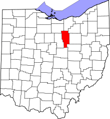 | |
| Villages | ||
| Townships | ||
| CDP | ||
| Unincorporated communities | ||
| Footnotes | ‡This populated place also has portions in an adjacent county or counties | |