Perry Township, Ashland County, Ohio
| Perry Township, Ashland County, Ohio | |
|---|---|
| Township | |
|
James A. Garfield recruited township men to Company O of the 42nd Ohio Infantry | |
 Location of Perry Township in Ashland County | |
| Coordinates: 40°51′44″N 82°10′2″W / 40.86222°N 82.16722°WCoordinates: 40°51′44″N 82°10′2″W / 40.86222°N 82.16722°W | |
| Country | United States |
| State | Ohio |
| County | Ashland |
| Area | |
| • Total | 30.4 sq mi (78.8 km2) |
| • Land | 30.3 sq mi (78.5 km2) |
| • Water | 0.1 sq mi (0.3 km2) |
| Elevation[1] | 1,175 ft (358 m) |
| Population (2010) | |
| • Total | 1,990 |
| • Density | 66/sq mi (25.4/km2) |
| Time zone | Eastern (EST) (UTC-5) |
| • Summer (DST) | EDT (UTC-4) |
| FIPS code | 39-61756[2] |
| GNIS feature ID | 1085713[1] |

Perry Township is one of the fifteen townships of Ashland County, Ohio, United States. As of the 2010 census the population was 1,990.[3]
Geography
Located in the eastern part of the county, it borders the following townships:
- Jackson Township - north
- Congress Township, Wayne County - northeast corner
- Chester Township, Wayne County - east
- Plain Township, Wayne County - southeast corner
- Mohican Township - south
- Vermillion Township - southwest corner
- Montgomery Township - west
No municipalities are located in Perry Township.
Name and history
Perry Township was organized in 1814.[4]
It is one of twenty-six Perry Townships statewide.[5]
Government
The township is governed by a three-member board of trustees, who are elected in November of odd-numbered years to a four-year term beginning on the following January 1. Two are elected in the year after the presidential election and one is elected in the year before it. There is also an elected township fiscal officer,[6] who serves a four-year term beginning on April 1 of the year after the election, which is held in November of the year before the presidential election. Vacancies in the fiscal officership or on the board of trustees are filled by the remaining trustees.
References
- 1 2 "US Board on Geographic Names". United States Geological Survey. 2007-10-25. Retrieved 2008-01-31.
- ↑ "American FactFinder". United States Census Bureau. Retrieved 2008-01-31.
- ↑ "Geographic Identifiers: 2010 Demographic Profile Data (G001): Perry township, Ashland County, Ohio". U.S. Census Bureau, American Factfinder. Retrieved July 8, 2013.
- ↑ Baughman, Abraham J. (1909). History of Ashland County, Ohio, Volume 1. S. J. Clarke Publishing Company. p. 152.
- ↑ "Detailed map of Ohio" (PDF). United States Census Bureau. 2000. Retrieved 2007-02-16.
- ↑ §503.24, §505.01, and §507.01 of the Ohio Revised Code. Accessed 4/30/2009.
External links
Municipalities and communities of Ashland County, Ohio, United States | ||
|---|---|---|
| City | 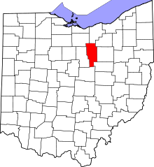 | |
| Villages | ||
| Townships | ||
| CDP | ||
| Unincorporated communities | ||
| Footnotes | ‡This populated place also has portions in an adjacent county or counties | |