Piercefield, New York
| Piercefield, New York | |
|---|---|
| Town | |
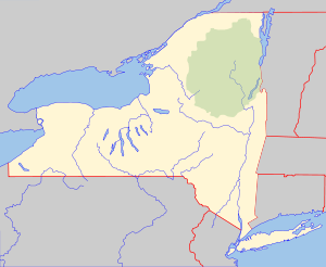 Piercefield, New York Location within the state of New York | |
| Coordinates: 44°13′56″N 74°34′35″W / 44.23222°N 74.57639°W | |
| Country | United States |
| State | New York |
| County | St. Lawrence |
| Area | |
| • Total | 111.1 sq mi (287.7 km2) |
| • Land | 104.3 sq mi (270.1 km2) |
| • Water | 6.8 sq mi (17.6 km2) |
| Elevation | 1,640 ft (500 m) |
| Population (2010) | |
| • Total | 310 |
| Time zone | Eastern (EST) (UTC-5) |
| • Summer (DST) | EDT (UTC-4) |
| FIPS code | 36-57716 |
| GNIS feature ID | 0979364 |
Piercefield is a town in St. Lawrence County, New York, United States. The population was 310 at the 2010 census.
The Town of Piercefield is in the southeast corner of the county and is southeast of Canton.
History
The town was established in 1801 before the creation of St. Lawrence County. The 1933 closing of the International Paper factory led to an economic downturn in the town.
Residents of the area included Abbot Augustus Low who resided in an area known as Horseshoe.
The Arab Mountain Fire Observation Station and Childwold Memorial Presbyterian Church are listed on the National Register of Historic Places.[1]
Geography
According to the United States Census Bureau, the town has a total area of 111.1 square miles (288 km2), of which, 104.3 square miles (270 km2) of it is land and 6.8 square miles (18 km2) of it (6.12%) is water.
The east town line is the border of Franklin County and the south town line is the border of Hamilton County.
The town is within the Adirondack Park.
The Raquette River flows through the town, and the southwest part of Tupper Lake is inside the town.
New York State Route 3 is a highway connecting the north and south parts of the town. New York State Route 421 is a short highway in the southeast part of Piercefield.
Demographics
| Historical population | |||
|---|---|---|---|
| Census | Pop. | %± | |
| 1910 | 770 | — | |
| 1920 | 1,454 | 88.8% | |
| 1930 | 1,330 | −8.5% | |
| 1940 | 667 | −49.8% | |
| 1950 | 554 | −16.9% | |
| 1960 | 420 | −24.2% | |
| 1970 | 422 | 0.5% | |
| 1980 | 365 | −13.5% | |
| 1990 | 285 | −21.9% | |
| 2000 | 305 | 7.0% | |
| 2010 | 310 | 1.6% | |
| Est. 2014 | 304 | [2] | −1.9% |
As of the census[4] of 2000, there were 305 people, 136 households, and 88 families residing in the town. The population density was 2.9 people per square mile (1.1/km²). There were 417 housing units at an average density of 4.0 per square mile (1.5/km²). The racial makeup of the town was 97.70% White, 0.33% Native American, 0.66% Asian, 0.33% from other races, and 0.98% from two or more races. Hispanic or Latino of any race were 0.98% of the population.
There were 136 households out of which 22.1% had children under the age of 18 living with them, 55.9% were married couples living together, 5.9% had a female householder with no husband present, and 34.6% were non-families. 29.4% of all households were made up of individuals and 14.0% had someone living alone who was 65 years of age or older. The average household size was 2.24 and the average family size was 2.78.
In the town the population was spread out with 20.0% under the age of 18, 3.6% from 18 to 24, 25.2% from 25 to 44, 32.5% from 45 to 64, and 18.7% who were 65 years of age or older. The median age was 46 years. For every 100 females there were 103.3 males. For every 100 females age 18 and over, there were 100.0 males.
The median income for a household in the town was $34,643, and the median income for a family was $36,250. Males had a median income of $24,583 versus $27,083 for females. The per capita income for the town was $16,635. About 7.8% of families and 8.3% of the population were below the poverty line, including 10.1% of those under the age of eighteen and 9.8% of those sixty five or over.

Communities and locations in Piercefield
- Catamount Pond – A lake adjacent to Gale.
- Childwold – A hamlet northwest of Piercefield village on NY-3, near the west town line.
- Childwood Station – A location south of Piercefield village.
- Conifer-- A hamlet southwest of Piercefield village.
- Eagle Crag Lake – A small lake west of the Mount Arab community.
- Gale – A hamlet on NY-3, northwest of Piercefield village.
- Horseshoe – A hamlet in the southwest part of the town, southwest of Mount Arab.
- Mount Arab – (1) A hamlet in the south part of the town, south of conifer, and (2) An elevation south of Piercefield village, famous for hiking.
- Mount Arab Lake – A small lake northwest of the Mount Arab community.
- Mount Arab Station – A location north of Mount Arab.
- Piercefield – The hamlet of Piercefield is on NY_3 by the Raquette River and Piercefield Flow near the center of the town.
- Piercefield Flow – A lake formed in a wide section of the Raquette River.
- Trout Pond – A lake by the south town line.
References
- ↑ National Park Service (2009-03-13). "National Register Information System". National Register of Historic Places. National Park Service.
- ↑ "Annual Estimates of the Resident Population for Incorporated Places: April 1, 2010 to July 1, 2014". Retrieved June 4, 2015.
- ↑ "Census of Population and Housing". Census.gov. Retrieved June 4, 2015.
- ↑ "American FactFinder". United States Census Bureau. Retrieved 2008-01-31.
External links
Coordinates: 44°13′55″N 74°34′11″W / 44.23194°N 74.56972°W
Municipalities and communities of St. Lawrence County, New York, United States | ||
|---|---|---|
| City | 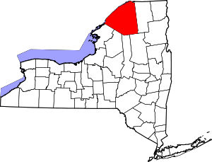 | |
| Towns | ||
| Villages | ||
| CDPs |
| |
| Hamlets | ||