Massena (village), New York
| Massena, New York | |
|---|---|
| Village | |
 Massena, New York Location within the state of New York | |
| Coordinates: 44°55′49″N 74°53′27″W / 44.93028°N 74.89083°WCoordinates: 44°55′49″N 74°53′27″W / 44.93028°N 74.89083°W | |
| Country | United States |
| State | New York |
| County | St. Lawrence |
| Government | |
| • Mayor | Tim Currier |
| Area | |
| • Total | 4.7 sq mi (12.2 km2) |
| • Land | 4.5 sq mi (11.7 km2) |
| • Water | 0.2 sq mi (0.5 km2) |
| Elevation | 230 ft (70 m) |
| Population (2010)[1] | |
| • Total | 10,936 |
| Time zone | Eastern (EST) (UTC-5) |
| • Summer (DST) | EDT (UTC-4) |
| FIPS code | 36-46019 |
| GNIS feature ID | 0976634 |
| Website | http://www.massenaworks.com |
Massena is a village in St. Lawrence County, New York, United States. The population was 10,936 at the 2010 census. The village is named after André Masséna, one of Napoleon's generals.
The Village of Massena is at the southwestern town line of the Town of Massena, with a small southeastern section of the community spilling into the Town of Louisville, and a tiny portion in the Town of Norfolk. The village is located near the northern county border.
History
The village was first settled circa 1803. Part of its early growth was based on neighboring medicinal springs. André Masséna was one of the original eighteen Marshals of France created by Napoleon.
Massena is the hometown of Baseball Hall of Fame member Bid McPhee, who was born there in 1859. Voice actor Hal Smith spent a significant part of his early years living in Massena. He graduated from the Massena High School in 1936.
In 1928, Massena was the site of a blood libel against its small Jewish community.[2] Its history has been recorded by the town's longstanding newspaper, The Courier-Observer, formerly named The Massena Observer.
Throughout the mid 20th century, Massena experienced enormous growth due to the construction of the Franklin D. Roosevelt power project and the Eisenhower locks which helped connect the Atlantic Ocean to the Great Lakes via the St. Lawrence River. Massena established itself as the manufacturing center of St. Lawrence county with Aluminum Company Of America (Alcoa) plant, Reynolds Metals plant (now Alcoa) and a General Motors Powertrain plant (dismantled in 2011). The Alcoa East plant was temporarily idled in 2009, but began to restart pot lines in January 2011.
The village has experienced a decline in population in recent decades largely due to its eroding industrial base and incomes. The unemployment and crime rates for the village had doubled in the past decade. The village tax rates have gone up a whopping 52 percent since 2004. The government blames it on growing employee union increased pay demands and pension funds.
Many of the Main Street's storefronts of downtown remain vacant. Some of the abandoned buildings along Water Street have been torn down as well. Various vacant homes throughout the town have burned or also been torn down. Furthermore, the St. Lawrence Centre Mall, once a thriving shopping center, has seen nearly 90% of its stores close their doors at the mall, while many simply left the town altogether. The crime rate of Massena has gone up dramatically in the past 10 years with a current war on drugs being fought by former police chief and current village mayor Tim Currier. An effort to change the community into a productive and positive direction has been started since 2013.
The Robinson Bay Archeological District was listed on the National Register of Historic Places in 1977.[3]
Geography
According to the United States Census Bureau, the village has a total area of 4.7 square miles (12.2 km²), of which 4.5 square miles (11.7 km²) is land and 0.2 square mile (0.5 km²) (3.82%) is water.
The village is located on the banks of the Grasse River and the Raquette River and on the shore of the St. Lawrence River. Robert Moses State Park is located northeast of the village. The Eisenhower Lock System is located around the area before the State Park, was established in 1954 and has been running since.
East-west highway New York State Route 37B intersects New York State Route 37 in the village, and both intersect New York State Route 420, a north-south highway.
Demographics
| Historical population | |||
|---|---|---|---|
| Census | Pop. | %± | |
| 1870 | 483 | — | |
| 1890 | 1,049 | — | |
| 1900 | 2,032 | 93.7% | |
| 1910 | 2,951 | 45.2% | |
| 1920 | 5,993 | 103.1% | |
| 1930 | 10,637 | 77.5% | |
| 1940 | 11,328 | 6.5% | |
| 1950 | 13,137 | 16.0% | |
| 1960 | 15,478 | 17.8% | |
| 1970 | 14,042 | −9.3% | |
| 1980 | 12,851 | −8.5% | |
| 1990 | 11,719 | −8.8% | |
| 2000 | 11,209 | −4.4% | |
| 2010 | 10,936 | −2.4% | |
| Est. 2015 | 10,629 | [4] | −2.8% |
As of the census[6] of 2000, there were 12,209 people, 4,793 households, and 2,938 families residing in the village. The population density was 2,472.5 people per square mile (955.4/km²). There were 5,103 housing units at an average density of 1,125.6 per square mile (434.9/km²). The racial makeup of the village was 95.49% White, 0.36% Black or African American, 2.11% Native American, 0.73% Asian, 0.04% Pacific Islander, 0.24% from other races, and 1.03% from two or more races. Hispanic or Latino of any race were 1.19% of the population.
There were 4,793 households out of which 29.4% had children under the age of 18 living with them, 45.3% were married couples living together, 12.0% had a female householder with no husband present, and 38.7% were non-families. 32.7% of all households were made up of individuals and 15.0% had someone living alone who was 65 years of age or older. The average household size was 2.29 and the average family size was 2.89.
In the village, the population was spread out with 24.1% under the age of 18, 7.0% from 18 to 24, 27.4% from 25 to 44, 22.6% from 45 to 64, and 18.9% who were 65 years of age or older. The median age was 40 years. For every 100 females, there were 88.4 males. For every 100 females age 18 and over, there were 84.1 males.
The median income for a household in the village was $30,783, and the median income for a family was $39,919. Males had a median income of $37,552 versus $19,892 for females. The per capita income for the village was $17,709. About 14.2% of families and 17.6% of the population were below the poverty line, including 23.2% of those under age 18 and 11.7% of those age 65 or over.
Radio
References
- ↑ "US Census Bureau".
- ↑ Jacobs, Samuel J. (Fall 1979). "The Blood Libel Case at Massena—a Reminiscence and a Review". Judaism: A Quarterly Journal of Jewish Life and Thought. 28 (4): 465–474.;
Levine, Yitzchok (October 7, 2008). "An American Blood Libel — It Did Happen!" (pdf). Hamodia. Retrieved 2008-10-07. - ↑ National Park Service (2009-03-13). "National Register Information System". National Register of Historic Places. National Park Service.
- ↑ "Annual Estimates of the Resident Population for Incorporated Places: April 1, 2010 to July 1, 2015". Retrieved July 2, 2016.
- ↑ "Census of Population and Housing". Census.gov. Retrieved June 4, 2015.
- ↑ "American FactFinder". United States Census Bureau. Retrieved 2008-01-31.
External links
| Wikivoyage has a travel guide for Massena. |
- Massena webpage
- Massena Fire Department
- Massena area information/links
- Massena local portal/links
- Massena Historic Map
Municipalities and communities of St. Lawrence County, New York, United States | ||
|---|---|---|
| City | 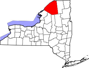 | |
| Towns | ||
| Villages | ||
| CDPs |
| |
| Hamlets | ||