Phagwara
| Phagwara | |
|---|---|
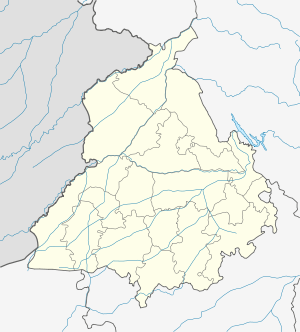 Phagwara  Phagwara Location in Punjab, India | |
| Coordinates: 31°13′N 75°46′E / 31.22°N 75.77°ECoordinates: 31°13′N 75°46′E / 31.22°N 75.77°E | |
| Country |
|
| State | Punjab |
| District | Kapurthala |
| Elevation | 234 m (768 ft) |
| Population (2011)[1] | |
| • Total | 97,864 |
| Time zone | IST (UTC+5:30) |
| PIN | 144401 & 144402 (satnampura area) |
| Telephone code | 01824 |
| Vehicle registration | PB 36 & PB 09 |
Phagwara is a city and it recently became municipal corporation in Kapurthala district in North India, in the central part of Punjab. The city is internationally recognized because a large NRI (Non-resident Indian) population belongs to this city. Before Phagwara was merged with Kapurthala district, it was a part of Jalandhar district.It falls in the Jalandhar Revenue Division
Location
Phagwara lies on the Delhi–Amritsar national highway NH01 and is also served by the rail link between Delhi and Amritsar. It is located between the two big cities of Ludhiana and Jalandhar. Phagwara is 76 miles away from Chandigarh and 220 miles (355 km) from Delhi. Phagwara railway station is a junction, with rail and road links to other cities as well. Most major trains stop here, e.g. the Shatabdi Express. Some Famous Markets are Gaushalla Bazar, basan wala bazar and Guru Hargobind Nagar Market.just on the outskirts of city.
Geography
Phagwara is located at 31°08′N 75°28′E / 31.13°N 75.47°E.[2] It has an average elevation of 234 metres (767 feet).
Schools in Phagwara
There are well established schools like :St. Joseph's Convent School, Kamla Nehru Public School, Swami Sant Das Public School, Cambridge International School, Saffron Public School Jain Model School, New Sunflower High School, Guru Harkrishan National Model Ser. Sec. School, Bachpan a play school in Phagwara.
Demographics
As per provisional data of 2011 census Phagwara urban agglomeration had a population of 117,954, out of which males were 62,171 and females were 55,783. The literacy rate was 87.43 per cent.[3]
As of 2001 India census,[4] Phagwara had a population of 95,626. Males constitute 54% of the population and females 46%. Phagwara has an average literacy rate of 81%, higher than the national average of 59.5%: male literacy is 80%, and female literacy is 73%. In Phagwara, 10% of the population is under 6 years of age.
Scheduled Caste population in Phagwara is over 49.15%[5]
History
Phagwara was built by Shah Jahan as a market town. Over time, some people of Phagwara started farming and Phagwara took on a rural character. Phagwara Sharki covers the original rural Phagwara, which now is only covered by the area surrounding Sukhchainiana Gurdwara (Sukhchain Nagar) where some people continue to farm the land.In 1772 it became Part of the Ahluwalia Sikh Dynasty of Kapurthala. The Sixth Sikh Guru, Shri Guru Hargobind Sahib Ji visited this place in 1635 after winning the battle of Kartarpur and Palahi. Phagu, a great devotee of Guru Ji used to reside here. When Phagu came to know that Guru Ji had come after fighting against Mughals and thought that Mughals might be following him, he was worried and did not serve Guru Ji. Guru Ji said," Phagu Da Warra, Bahron Mitha Andron Khara". Therefore, Phagwara got its name from "Phagu-Da-Warra". Narur is the famous and big village in Phagwara. Jama Masjid was built by then Maharaj Kapurthala. Its main door is facing towards east in Mohalla Atishbazan and other west side door is on Gaushala road.
Notable residents or former residents
- Inder Singh Football Player (Arjun Award Winner)
Main Villages of Phagwara Tehsil
- Madhopur
- Indna Kalaske
- Manawali(Dhak Maan)(Maan)
- Bhullarai
- Chachoki
- Brahmpur
- Lakhpur
- Maheru
- Jagpalpur
- Ranipur(kaboaan)
- Palahi
- Mayopatti
- Narur
- Panchhat
- Gandhwan
- Athouli
- Nihalgarh (Nawa Pind)
- Jagat Pur Jattan
- Pandwa
- Sangatpur
- Chak Prema
- Dhadday
- Dhadoli
- Bir Dhadoli
- Rawal Pindi.
- Khatti
- Rampur Sunra
- Malikhpur
- Domeli
- Babeli
- Prem Pura
- Khera, Nangal
- Bhanoki
- Bir Puadh
- Rehana Jattan
- Khangura
- Chak Hakim
- Virk(Bohodipur)
- Mouli
- Chaheru
- Ucha Pind
- Hadiabad
- Khalwara
- Dhak Pandori
- Chak Hakim
- Darvesh Pind
References
- ↑ "Census of India Search details". censusindia.gov.in. Retrieved 10 May 2015.
- ↑ "Falling Rain Genomics, Inc - Phagwara".
- ↑ "Urban Agglomerations/Cities having population 1 lakh and above" (PDF). Provisional Population Totals, Census of India 2011. Retrieved 2012-07-07.
- ↑ "Census of India 2001: Data from the 2001 Census, including cities, villages and towns (Provisional)". Census Commission of India. Archived from the original on 2004-06-16. Retrieved 2008-11-01.
- ↑ "State-wise, District-wise List of Blocks with >40% but less than 50% SC population". Retrieved 12 July 2012.