Pariaman
| Pariaman | ||
|---|---|---|
| City | ||
| Other transcription(s) | ||
| • Jawi | ڤريامن | |
| ||
| Motto: Sabiduak Sadayuang | ||
 Location of Pariaman in Indonesia | ||
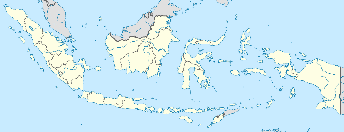 Pariaman Location of Pariaman in Indonesia | ||
| Coordinates: 0°37′35″S 100°7′4″E / 0.62639°S 100.11778°E | ||
| Country | Indonesia | |
| Province | West Sumatra | |
| Area | ||
| • Total | 73.36 km2 (28.32 sq mi) | |
| Population (2014) | ||
| • Total | 83,151 | |
| • Density | 1,100/km2 (2,900/sq mi) | |
| Time zone | WIB (UTC+7) | |
| Area code(s) | +62 751 | |
| Website | www.kotapariaman.go.id | |

Pariaman (Jawi: ڤريامن), is a coastal city in West Sumatra, Indonesia. Pariaman has 83,151 inhabitants in 2014, an area of 73.36 km2 (28 sq mi) and a 12 km (7 mi) coastline. "Pariaman" means "safe area".
History
According to the limited early sources available, by the sixteenth century Pariaman was an important port city serving the Minangkabau settlements in the interior highlands of central west Sumatra. Traders from western India and later from Europe visited the port, trading in pepper, gold, and other products of the interior. In the early seventeenth century the port came under control of the Sultanate of Aceh, to the north; an Acehnese governor was stationed in the town. The port formally came under Dutch control in 1663 by treaty with Aceh. In 1671 the Dutch built a lodge here and later, around 1684, a fort. Continuing clashes with local rulers and competition with other European trading companies resulted in the port being abandoned by the Dutch in 1770. By the early twentieth century the port was less prominent on the coast, as Padang, just to the south, was the focus of Dutch activities in western Sumatra and had a railroad link to the interior.[1][2]
After Indonesian independence, Pariaman was a naval headquarters for a province called Central Sumatra. It became an autonomous city on 11 Apr 2002.

Administration
The city is administratively divided into four districts (kecamatan): Pariaman Selatan, Pariaman Tengah, Pariaman Timur and Pariaman Utara. The four districts are of similar area; about one-half of the city's population lives in Pariaman Tengah. The city is surrounded by the rural regency (kabupaten) of Padang Pariaman.
Economy
The contemporary economy is primarily agricultural with 79% of land in farming. Minangkabau International Airport, West Sumatra's major airport, is located near the city.
Culture
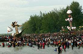
Although the population of Pariaman is predominantly Sunni, a famous and popular festival of Shia origin named Tabuik (from Arabic "tabut" meaning coffin), is held annually in the city every 10 Muharram, the Day of Ashura. This practice was brought to the city in 1818, when ex-British soldiers from India settled in Pariaman. They had been disbanded when the British handed the area back to the Netherlands as part of the Anglo-Dutch Treaty of 1814.[3]
The Tabuik festival commemorates the martyrdom of the grandsons of Muhammad, Hasan ibn Ali and Hussein ibn Ali. The Buraq, a purported winged horse that took Muhammad on his night-long journey to heavens, i.e., the Mi'raj, plays a role in the Tabuik. It presumably represents the white horse of the Imam Hussein at the Battle of Karbala, but is portrayed with a woman's head, wings, a broad tail and carrying a coffin.[3]
In the festival, two such effigies or "Tabuik", one for Hasan and one for Hussein, are carried through the city. Named Tabuik Pasa and Tabuik Subarang, they are swayed accompanied by tambur music and tasa drums. In the afternoon, both Tabuik are moved to the coast and before sunset they are immersed into the sea.
References
- ↑ Tsuyoshi Kato (1980). Rantau Pariaman: the world of Minangkabau coastal merchants in the nineteenth century. Journal of Asian Studies 39(4):729-752
- ↑ Dobbin, Christine (1977). Economic change in Minangkabau as a factor in the rise of the Padri movement, 1784-1830. Indonesia 23(1):1-38.
- 1 2 "Taking in Pariaman's Unique Seaside Culture". Jakarta Post. Retrieved 14 April 2012.
External links
- (Indonesian) Government of Pariaman
Coordinates: 0°37′35″S 100°07′04″E / 0.62639°S 100.11778°E