Ongar, Essex
| Ongar | |
 Ongar |
|
| Area | 9.02 km2 (3.48 sq mi) |
|---|---|
| Population | 6,069 (2001)[1] 6,251 (2011)[2] |
| – density | 673/km2 (1,740/sq mi) |
| OS grid reference | TL555035 |
| – London | 21 mi (34 km) SW |
| Civil parish | Ongar |
| District | Epping Forest District |
| Shire county | Essex |
| Region | East |
| Country | England |
| Sovereign state | United Kingdom |
| Post town | Ongar |
| Postcode district | CM5 |
| Dialling code | 01277 |
| Police | Essex |
| Fire | Essex |
| Ambulance | East of England |
| EU Parliament | East of England |
| UK Parliament | Brentwood and Ongar |
| Website | Ongar Town Council |
Coordinates: 51°42′11″N 0°14′38″E / 51.703°N 0.244°E
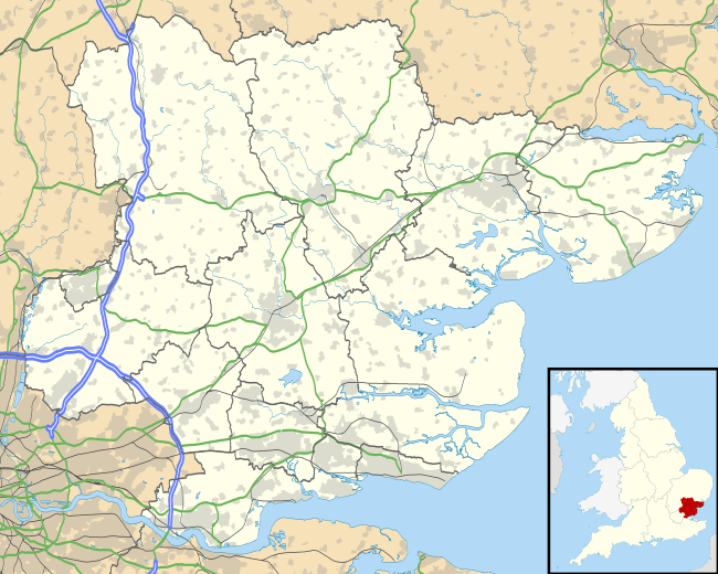
Ongar is a civil parish in the Epping Forest District in Essex, England. Other than the town of Chipping Ongar it also includes Greensted, Greensted Green, Marden Ash and Shelley. The local council of the parish is Ongar Town Council. Located approximately 21 miles northeast of London, it is a partially developed upon parish with large sections of open land.
History
The name "Ongar" means "grass land".[3] The parish was created in 1965 as an amalgamation of the Chipping Ongar, Greenstead and Shelley civil parishes in the Epping and Ongar Rural District.[4] In 1974 the parish became part of Epping Forest District.
In 2016 EastEnders characters Jack and Ronnie viewed a house in Ongar.
Government
Ongar Town Council is the local authority for the civil parish. The parish council offices are located in Chipping Ongar.
Geography
The civil parish includes the following settlements:
The shape of the parish is an inverted "L" running from Greensted in the west to Marden Ash to the east, then north to include Chipping Ongar and then Shelley. Ongar is a post town in the CM postcode area.
Demography
As at the 2001 census the population was 6,069 and 51.7% female. There are 2,494 households, with an average household size of 2.43. The population has decreased by 8% since 1991, the largest drop in the district.[1]
Education
The Ongar area is served by five primary schools (Chipping Ongar, Shelley, High Ongar, Fyfield Dr. Walkers and Moreton) and one secondary school, The Ongar Academy, which opened in September 2015.[5]
Transport
Since the closure of the Central line between Epping and Chipping Ongar in 1994, there is no longer a daily commuter train service in the parish. The nearest London Underground service to the parish is Epping which is served by the Central line. The closest National Rail service is from Brentwood, which is served by the Shenfield Metro and is operated by Abellio Greater Anglia.
The former Ongar London Underground station now forms part of the heritage Epping Ongar Railway.
Radio
There was a longwave transmitter at Ongar.
References
- 1 2 Epping Forest District Key Facts: 2001 Census
- ↑ "Civil Parish population 2011". Neighbourhood Statistics. Office for National Statistics. Retrieved 1 September 2016.
- ↑ ""A History of the County of Essex: Volume 4: Ongar Hundred" by W. R. Powell (Ed), 1956, pp. 155-158 - Chipping Ongar". british-history.ac.uk. 2012. Retrieved 7 April 2013.
- ↑ http://www.visionofbritain.org.uk/unit_page.jsp?u_id=10074174
- ↑ "35 new free schools providing more than 22,000 places announced". GOV.UK. Retrieved 12 March 2016.