High Laver
| High Laver | |
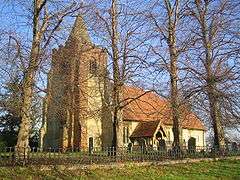 All Saints Church |
|
 High Laver |
|
| Population | 493 (2011)[1] |
|---|---|
| OS grid reference | TL526087 |
| Civil parish | High Laver |
| District | Epping Forest |
| Shire county | Essex |
| Region | East |
| Country | England |
| Sovereign state | United Kingdom |
| Post town | ONGAR |
| Postcode district | CM5 |
| Dialling code | 01277 |
| Police | Essex |
| Fire | Essex |
| Ambulance | East of England |
| EU Parliament | East of England |
Coordinates: 51°45′22″N 0°12′43″E / 51.756°N 0.212°E
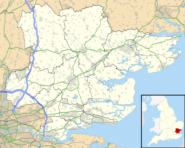
High Laver is a village and civil parish in the Epping Forest district of the County of Essex, England. The parish is noted for its association with the philosopher John Locke.
History
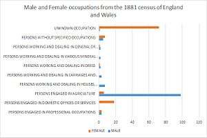
High Laver is historically a rural agricultural parish, predominantly arable. In 1086 there were 1428 acres of arable land, woodland for 200 pigs and 37½ acres of meadow. The 1881 census data collected indicates that the majority of the male population were employed in agriculture.[2][3]
High Laver school was founded 1866 with accommodation for 75 children. At one point the school breached its capacity with a total of 132 pupils attending. Pupils of High Laver today typically attend Magdalen Laver school, west from High Laver.[4]
When John Locke, British philosopher, died in 1704, he was buried at High Laver where he had lived in the household of Sir Francis Masham since 1691. In 1887 John Bartholomew, Gazetteer of the British Isles wrote: "Laver, High, par., Essex, in NW. of co., 4 m. NW. of Ongar, 1891 ac., pop. 477; the churchyard contains the grave of John Locke (1632–1704), the philosopher".[5]
Geography
High Laver village is situated 4 miles (6.4 km) east of Harlow and 1.4 miles (2.2 km) north-west of Moreton.[6] The land is nearly 300 ft. (90 m.) above sea-level in the south-west, about 250 ft. (75 m.) in the north and 230 ft. (70 m.) in the east.[7]
Demography
"In 1801 the population was 346. By 1851 it had grown to 534. It was a little below this level until the last decade of the century when there was a sharp decline to 386. In the first half of the 20th century it rose gradually to 463 in 1951"[8]
According to 2011 census data High Laver had a population of 493 persons across 200 households.[9] Within High Laver 260 persons out of the 493 who participated in the 2011 census aged 16 to 74 are in employment.[10] The 1881 census data indicates that the majority of the Male population of High Laver were employed in agriculture, this is typical of Parishes at this time due to the surrounding countryside being ideal for farming. 2011 census data indicates that 260 16- to 74-year-olds are in employment out of the total population of 493.[11] The demographics in High Laver are fairly uneven according to the 2011 census data; the data indicates that the largest demographic are the 45 to 59's.[12]


Landmarks
"All Saints church in High Laver consists of a nave, chancel, west tower, south porch, and North Vestry".[14] The church was constructed from flint and rubble during the late 12th century; there also remains evidence that some Roman bricks and tiles were used as they are visible among the Chancel walls, and also the North wall of the Nave.[15] Over the years there has been refurbishment and maintenance on the church. "In the 15th or 16th century the roofs of the chancel and nave, which are ceiled in except for the plates and tie-beams, were renewed".[16] Within the tower there is a font with an octagonal bowl which dates from the 14th century.[17] "Outside the south wall of the nave is the brick altar tomb of John Locke (1704). A mural tablet, originally above the tomb, was moved inside the church for preservation in 1932".[18]
Transport
The main road from Ongar to Harlow which is a key transport route enters the parish at High Laver Bridge.[19] High Laver lies near junction seven of the M11 motorway.[20] There are three bus services that run through the parish, four days a week.[21] The nearest train stationis Harlow Town.[22]
Gallery
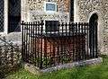 John Locke's tomb
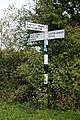 Fingerpost in High Laver parish
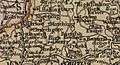 19th Century Ordnance Survey Map of High Laver
 Faggotters Farm, High Laver
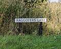 Faggoters Lane sign, High Laver
References
- ↑ http://www.eppingforestdc.gov.uk/council_services/planning/census/highlaverandlittlelaver.asp
- ↑ "HIGH LAVER". British History Online. Victoria County History,. Retrieved 21 March 2015.
- ↑ "History of the agriculture of High Laver". British History Online. British History Online. Retrieved 24 April 2015.
- ↑ "Information on the School that was in High Laver". British History Online. British History Online. Retrieved 24 April 2015.
- ↑ Bartholomew, John (1887). Gazetteer of the British Isles. High Laver: Bartholomew. Retrieved 27 January 2015.
- ↑ "An introduction to High Laver". British History Online. British History online. Retrieved 22 April 2015.
- ↑ "High Laver". British History Online. Victoria County History. Retrieved 21 March 2015.
- ↑ "Information on population change in High Laver". British History Online. British History Online. Retrieved 26 April 2015.
- ↑ "Neighbourhood Statistics". Office for National Statistics. Office for national statistics. Retrieved 24 March 2015.
- ↑ "Neighbourhood Statistics, Amount of employed persons in High Laver according to 2011 census data". Office for National Statistics. Office for national statistics. Retrieved 24 March 2015.
- ↑ "Neighbourhood Statistics: Information from the 2011 census data". Office for National Statistics. Office for National Statistics. Retrieved 22 April 2015.
- ↑ "The Demographics of High Laver from 2011 Census data". Office for National Statistics. Office for National Statistics. Retrieved 22 April 2015.
- ↑ "Occupation data classified into the 23 1881 'orders', plus SeA vision of Britain through Time". A vision of Britain. Vision of Britain. Retrieved 25 March 2015.
- ↑ "Information on All saints church". British History Online. British History Online. Retrieved 26 April 2015.
- ↑ "High Laver All Saints Church, a history of the Church". The united benefits of the Lavers and Matching. The united benefits of the Lavers and Matching. Retrieved 29 March 2015.
- ↑ "Details into the roof refurbishment work". British History Online. British History Online. Retrieved 26 April 2015.
- ↑ "The Font in High Laver All Saints Church". British History Online. British history online. Retrieved 26 April 2015.
- ↑ "Information on John Locke Tomb". British History Online. British History Online. Retrieved 26 April 2015.
- ↑ "High Laver". British-History. Retrieved 14 February 2015.
- ↑ "Junction seven of the M11 distance from High Lave". Google Maps. Google. Retrieved 24 April 2015.
- ↑ "Bus timetables and routes for High Laver". Travel Search. Travel search. Retrieved 24 April 2015.
- ↑ "The nearest train station to High Laver is Harlow Town". Google Maps. Google. Retrieved 24 April 2015.
External links
![]() Media related to High Laver at Wikimedia Commons
Media related to High Laver at Wikimedia Commons