Old U.S. Route 71 (Greenland, Arkansas)
|
Old US 71, Greenland Segment | |
|
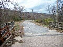
Old Highway 71 looking west from the truss bridge over the west fork of the White River | |
| Nearest city | Greenland, Arkansas |
|---|---|
| Area | 1.8 acres (0.73 ha) |
| Built | 1930 |
| Built by | Porter Construction Company (pavement); Maxwell Construction Company (bridges) |
| MPS | Arkansas Highway History and Architecture MPS |
| NRHP Reference # | 04001041[1] |
| Added to NRHP | September 24, 2004 |
Old US 71 – Greenland Segment is a former alignment of U.S. Route 71 (US 71) near Greenland in Washington County, Arkansas. The roadway of about 0.75 miles (1.21 km) is a 1930 construction and was the main travel route in the county upon construction until US 71 bypassed this alignment in 1980.
History
Little River County began to grow with the coming of the railroad in the late nineteenth century. The St. Louis–San Francisco Railway (Frisco) came through the area in the 1870s and communities began forming quickly in the newly accessible area. Influential Fayetteville businessmen persuaded the railroad to come through the city rather than a western alignment through Prairie Grove.[2] Rugby was founded in 1882, renamed Staunton, and would become Greenland by 1909.
Improvements came when the wagon road through the area was redesignated as part of the Jefferson Highway. Convict labor combined with a compulsory five days of labor required by law at the time to improve the gravel roadway. Now a route of national importance, the Jefferson Highway was eligible for inclusion in a federal paving program, and bridges were contracted through the state highway commission.[3] The federal designation of US 71 came when Arkansas designated a state highway system in 1926.
After construction
The route served as the main route between Fort Smith and Fayetteville. The high volume of traffic has caused the entire US 71 routing between Fort Smith and Fayetteville to be bypassed by Interstate 540 (I-540). This segment remains today as a drivable county road, Washington County Route 1194.[4]
See also
- Old U.S. Route 71 (Ashdown, Arkansas)
- Old U.S. Route 71 (Jenny Lind, Arkansas)
- Old U.S. Route 71 (Little River approach) across the Little River in Sevier County
- Old U.S. Route 71 (Ogden, Arkansas)
- Old U.S. Route 71 (Wilton, Arkansas)
- National Register of Historic Places listings in Washington County, Arkansas
References
- ↑ National Park Service (2010-07-09). "National Register Information System". National Register of Historic Places. National Park Service.
- ↑ "The Railroad". Washington County History. Springdale, Arkansas: Shiloh Museum of Ozark History. 1989. p. 237.
- ↑ "Old U.S. 71, Greenland Segment, Greenland, Washington County". Arkansas Historic Preservation Program. 2008. Retrieved December 1, 2011.
- ↑ General Highway Map, Washington County, Arkansas (PDF) (Map). 1:62500. Cartography by Planning and Research Division. Little Rock, Arkansas: Arkansas State Highway and Transportation Department. 2008. Retrieved December 1, 2011.
| Topics | |
|---|---|
| Lists by states |
|
| Lists by insular areas | |
| Lists by associated states | |
| Other areas | |
| |