Odelouca River
| Odelouca River (Riberia de Odelouca) | |
.JPG) | |
| Country | Portugal |
|---|---|
| Region | Algarve |
| District | Albufeira |
| Mouth | Into the Atlantic at Portimão via the Arade River |
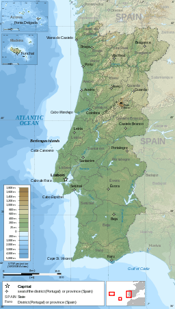 Red Dot = Odelouca Valley | |
| Wikimedia Commons has media related to Odelouca River. |
River Odelouca is a river in the Portuguese region of the Algarve. The river is a tributary of the Arade River.[1][2]
Description
The Odelouca headwater sources are a number of small streams and brooks rising from springs between the Serra de Monchique and the Serra do Caldeirão. The rivers riparian margins are a dense and at times, lush with vegetation. These woody flanks are populated by Narrow leaf Ash, Willows, Poplar and Alder trees. In the lower reaches of the river can be found Tamarix and Oleander. Many of these riparian zones were lost following the construction of the Barragem de Odelouca. From it headwater sources the river runs for approximately 83.7 kilometres (52.0 mi) until its confluence with the Arade River west of the town of Silves.[3]
Barragem de Odelouca
Work began in 2002 on a project to dam the river north of its confluence with the Monchique River. The dam was built as to provide public water supplies for the surrounding municipalities. The dam was built in an important area of Algarve ecological and environmental importance and was opposed by the European Economic Community. The overwhelming need for water in the summer by the local population necessitate it construction despite the opposition. As part of agreements to allow construction, Conservation and environmental programmes were implemented to try to lessen the environmental impact of the Dam. The dam was inaugurated and commissioned for service in June 2012. The dam is 76.0 metres (249.3 ft) high[4] and is constructed of earth and forms a lake behind which, when full, is 1.6 kilometres (0.99 mi) long and 418.0 metres (1,371.4 ft) at its widest point. The lake holds 100 million cubic metres (81,000 acre·ft) of water.
Ecological restoration schemes
Following the loss of habitats and environments following the filling of the dam measures have been taken to compensate for the losses. Restoration has been carried out along a 180-hectare (450-acre) stretch of the left bank of the river with the aim of encouraging the population of the endangered Iberian lynx[5] and the Bonelli's eagle. This work also includes the National Centre for the Captive Breeding of the Iberian lynx.[6][7]
References
- ↑ The Algarve. Sheet Map showing the course of the River Odelouca and its Confluences (Before the dam construction). Rough guides – Penguin Group. 2010. ISBN 9781848364981.
- ↑ "49-D Silves". Listing of the Map on Stanford’s website. Stanfords Bookshop. Retrieved 15 September 2014.
- ↑ "49-D Silves". Sheet map scale 1:50 000 Carta Corografica De Portugal – 49D Map showing the confluence with the Arade River. Instituto Geografico Portugues. ISBN 9789728867119.
- ↑ "Odelouca Dam". Details and specifications of the Dam. Cenor Consulting Engineers 2013. Retrieved 15 September 2014.
- ↑ "Projecto Lynx". Details about the project to breed Lynx. Copyright 2013 by Projecto Lynx. Retrieved 18 September 2014.
- ↑ "Cubs born in Iberian lynx breeding centre in Portugal". Details of the success of the breeding centre. Fauna & Flora International (FFI). Retrieved 18 September 2014.
- ↑ "Information on the Iberian lynx breeding centre in Portugal". Details of the success of the breeding centre. Ex-situ Lince Ibérico / Iberian Lynx Ex-situ Conservation Programme Conservation Program. Retrieved 2 February 2015.
Rivers and Streams of the Algarve | ||
|---|---|---|
 | ||
Coordinates: 37°10′35″N 8°29′08″W / 37.1764°N 8.4856°W