Algarve
| Algarve | |
| Distrito de Faro | |
| Region | |
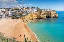
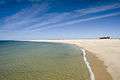
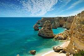 Algarve's typical coast near Lagoa | |
| Name origin: algarve from Arabic: الغرب the west | |
| Country | Portugal |
|---|---|
| Region | Algarve |
| Capital | Faro |
| - elevation | 11 m (36 ft) |
| - coordinates | PT 37°0′52″N 7°56′7″W / 37.01444°N 7.93528°WCoordinates: PT 37°0′52″N 7°56′7″W / 37.01444°N 7.93528°W |
| Highest point | Fóia |
| - elevation | 902 m (2,959 ft) |
| Lowest point | Sea level |
| - location | Atlantic Ocean |
| - elevation | 0 m (0 ft) |
| Area | 4,996.80 km2 (1,929 sq mi) |
| Population | 451,006 (2011) |
| Density | 90/km2 (233/sq mi) |
| Timezone | WET (UTC+0) |
| - summer (DST) | WEST (UTC+1) |
| NUTS | PT15 |
| GDP (PPP) | 2013 estimate |
| - Total | € 9.274 billion[1] |
| - Per capita | € 20,900[1] |
| GDP (nominal) | 2013 estimate |
| - Total | € 7.232 billion[2] |
| - Per capita | € 16,300[1] |
 Location of the Algarve Region in context of the national borders
| |
| Wikimedia Commons: Algarve | |
| Website: amal | |
| Statistics from INE (2005); geographic detail from Instituto Geográfico Português (2010) | |
The Algarve (Portuguese pronunciation: [aɫˈɡaɾv(ɨ)], from Arabic: الغرب al-Gharb "the West") is the southernmost region of continental Portugal. It has an area of 4,997 square kilometres (1,929 sq mi)[3] with 451,006[4] permanent inhabitants, and incorporates 16 municipalities.[5] The region has as its administrative centre in the city of Faro, where both the region's international airport (FAO) and public university, University of Algarve, are located. Tourism and related activities are extensive and make up the bulk of the Algarve's summer economy. Production of food, which includes fish and other seafood, fruit, oranges, carob beans, figs and almonds, is also economically important in the region. The Algarve is the most popular tourist destination in Portugal, and one of the most popular in Europe. Its population triples to nearly 1.5 million people in the peak holiday season thanks to seasonal residents, and receives an average of 7 million foreign tourists each year. In total, including national visitors, almost 10 million people visit the Algarve annually.
The Algarve is currently the third richest region in Portugal, after Lisbon and Madeira, with a GDP per capita 86% of the European Union average.[6]
History


Human presence in southern Portugal dates back to the Paleolithic and Neolithic periods. The presence of megalithic stones in the area of Vila do Bispo attests to this presence.
The Cynetes, influenced by Tartessos, were established by the sixth century BC in the region of the Algarve. They would be strongly influenced by the Celtici. The Phoenicians had established trading ports along the coast circa 1000 BC. The Carthaginians founded Portus Hanibalis—known today as Portimão—in about 550 BC. The Roman Republic spread through the Iberian Peninsula in the second century BC and many Roman ruins can still be seen in the region, notably in Lagos. Roman bath complexes and fish salting tanks have been found near the shore in several locations, for example the ones near Vilamoura and Praia da Luz.
In the 5th century the Visigoths took control of the Algarve until the beginning of the Umayyad conquest of Hispania in 711. When the Moors conquered Lagos in 716, it was named Zawaia. Faro, which the Christian residents had called Santa Maria, was renamed Faraon, which means "settlement of the knights." Due to the conquest of the Iberian Peninsula, the region was called Gharb Al-Andalus: Gharb means "the west", while al-Andalus is the Arabic name for the Iberian Peninsula. For several years, the town of Silves was the capital of the region.
In the mid-13th century, during the Reconquista, the Kingdom of Portugal conquered the region in a series of successful military campaigns against the Moors. Al-Gharb became the Kingdom of the Algarve, but battles with Muslim forces persisted. It was not until the early 14th century that the Portuguese finally secured the region against the subsequent Muslim attempts to recapture the area. King Afonso III of Portugal started calling himself King of Portugal and the Algarve. After 1471, with the conquest of several territories in the Maghreb - the area considered an extension of the Algarve - Afonso V of Portugal began fashioning himself "King of Portugal and the Algarve", referring to the European and African possessions.
Prior to the independence of Brazil, the United Kingdom of Portugal, Brazil and the Algarves (1815–1822) was an official designation for Portugal which also alluded to the Algarve. Portuguese monarchs continued used this title until the proclamation of the First Portuguese Republic in 1910. Between 1595 and 1808, the Algarve was a semi-autonomous area of Portugal with its own governor, as well as a separate taxation system..
In the 15th century, Prince Henry the Navigator based himself near Lagos and conducted various maritime expeditions which established the colonies that comprised the Portuguese Empire. It was also from Lagos that Gil Eanes set sail in 1434 to become the first seafarer to round Cape Bojador in West Africa. The voyages of discovery brought Lagos fame and fortune. Trade flourished and Lagos became the capital of the historical province of Algarve in 1577 and remained so until the year of the fabled 1755 Lisbon earthquake. The earthquake damaged many areas in the Algarve and an accompanying tsunami destroyed or damaged coastal fortresses, while coastal towns and villages were heavily damaged except Faro, which was protected by the sandy banks of Ria Formosa lagoon. In Lagos, the waves reached the top of the city walls. For many Portuguese coastal regions, including the Algarve, the destructive effects of the tsunami were more disastrous than those of the earthquake proper.
In 1807, while Jean-Andoche Junot led the first Napoleonic invasion in the north of Portugal, the Algarve was occupied by Spanish troops under Manuel Godoy. Beginning in 1808, and after subsequent battles in various towns and villages, the region was the first to drive out the Spanish occupiers.
The establishment First Portuguese Republic in 1910 marked the end of the Kingdom of Portugal and the Algarve.
Geography

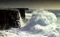
The Algarve covers 4997 square km,[3] extending just south of the Tagus valley to the southern coast of the Iberian Peninsula. Its highest point is Fóia, 902 metres (2,959 ft), in the mountain range of Monchique. It also includes some islands and islets. The region is also the home of the Ria Formosa lagoon, a nature reserve of over 170 square kilometres and a stopping place for hundreds of different birds. The length of the south-facing coastline is approximately 155 kilometres. Beyond the westernmost point of Cape St. Vincent it stretches a further 50 kilometres to the north. The coastline is notable for picturesque limestone caves and grottoes, particularly around Lagos, which are accessible by powerboat.
Climate
The maximum recorded temperatures in the Algarve fluctuate between 25 °C (77 °F) in winter and 48 °C (118 °F) in summer, with the temperature rarely falling below zero in the winter months. The winter of 2008–09 was exceptionally cold and wet. Temperatures below 0 °C (32 °F) were recorded in coastal areas for the first time in many years.
| Climate data for Faro | |||||||||||||
|---|---|---|---|---|---|---|---|---|---|---|---|---|---|
| Month | Jan | Feb | Mar | Apr | May | Jun | Jul | Aug | Sep | Oct | Nov | Dec | Year |
| Record high °C (°F) | 21.9 (71.4) |
24.7 (76.5) |
28.9 (84) |
30.1 (86.2) |
33.6 (92.5) |
37.1 (98.8) |
44.3 (111.7) |
39.6 (103.3) |
37.4 (99.3) |
33.3 (91.9) |
28.6 (83.5) |
24.0 (75.2) |
44.3 (111.7) |
| Average high °C (°F) | 16.1 (61) |
16.9 (62.4) |
19.1 (66.4) |
20.4 (68.7) |
22.8 (73) |
26.4 (79.5) |
29.2 (84.6) |
28.8 (83.8) |
26.6 (79.9) |
23.2 (73.8) |
19.6 (67.3) |
17.0 (62.6) |
22.2 (72) |
| Daily mean °C (°F) | 12.0 (53.6) |
12.8 (55) |
14.8 (58.6) |
16.1 (61) |
18.4 (65.1) |
21.9 (71.4) |
24.2 (75.6) |
24.1 (75.4) |
22.3 (72.1) |
19.3 (66.7) |
15.7 (60.3) |
13.3 (55.9) |
17.9 (64.2) |
| Average low °C (°F) | 7.9 (46.2) |
8.7 (47.7) |
10.5 (50.9) |
11.8 (53.2) |
14.0 (57.2) |
17.3 (63.1) |
19.1 (66.4) |
19.4 (66.9) |
18.0 (64.4) |
15.3 (59.5) |
11.7 (53.1) |
9.6 (49.3) |
13.6 (56.5) |
| Record low °C (°F) | −1.2 (29.8) |
−1.2 (29.8) |
2.3 (36.1) |
3.6 (38.5) |
6.7 (44.1) |
8.0 (46.4) |
11.9 (53.4) |
13.1 (55.6) |
9.9 (49.8) |
7.8 (46) |
2.7 (36.9) |
1.2 (34.2) |
−1.2 (29.8) |
| Average precipitation mm (inches) | 59.3 (2.335) |
52.0 (2.047) |
39.4 (1.551) |
38.6 (1.52) |
21.7 (0.854) |
4.3 (0.169) |
1.8 (0.071) |
3.9 (0.154) |
23.2 (0.913) |
60.1 (2.366) |
90.4 (3.559) |
114.1 (4.492) |
508.8 (20.031) |
| Average precipitation days (≥ 0.1 mm) | 12 | 13 | 9 | 10 | 7 | 4 | 1 | 1 | 3 | 9 | 10 | 11 | 90 |
| Mean monthly sunshine hours | 170.5 | 165.2 | 232.5 | 252.0 | 313.1 | 333.0 | 368.9 | 353.4 | 273.0 | 226.3 | 183.0 | 167.4 | 3,038.3 |
| Source: Instituto de Meteorologia,[7] World Meteorological Organization[8] (precipitation days), Hong Kong Observatory[9](sunshine hours) | |||||||||||||

%2C_by_Klugschnacker_in_Wikipedia_(86).JPG)
Human geography
There are about 450,000 permanent inhabitants (90 residents per square kilometre) in the area, although this figure increases to over a million people at the height of summer, due to an influx of tourists. The Algarve has several cities, towns and villages: the region's capital is the city of Faro, while other cities include Albufeira, Lagoa, Lagos, Loulé, Olhão, Portimão, Quarteira, Silves, Tavira, and Vila Real de Santo António, in addition to various summer retreats such as Vilamoura, Praia da Rocha, Armação de Pêra, Alvor, Monte Gordo, Tavira, and Sagres.
Before 2004, the Faro District was the administrative unit governing the Algarve. In 2004 the Greater Metropolitan Area of the Algarve was formed, which was converted into an intermunicipal community in 2008.[10] Algarve is also a NUTS II and NUTS III statistical region. The intermunicipal community of Algarve is subdivided into 16 municipalities:[5]
| Municipality | Population (2011)[4] | Area (km²)[3] |
|---|---|---|
| Albufeira | 40,828 | 140.66 |
| Alcoutim | 2,917 | 575.36 |
| Aljezur | 5,884 | 323.50 |
| Castro Marim | 6,747 | 300.84 |
| Faro | 64,560 | 202.57 |
| Lagoa | 22,975 | 88.25 |
| Lagos | 31,049 | 212.99 |
| Loulé | 70,622 | 763.67 |
| Monchique | 6,045 | 395.30 |
| Olhão | 45,396 | 130.86 |
| Portimão | 55,614 | 182.06 |
| São Brás de Alportel | 10,662 | 153.37 |
| Silves | 37,126 | 680.06 |
| Tavira | 26,167 | 606.97 |
| Vila do Bispo | 5,258 | 179.06 |
| Vila Real de Santo António | 19,156 | 61.25 |
| Total | 451,006 | 4996.80 |
Economy


Agricultural products of the region include fig, almond, orange, carob bean, strawberry tree and cork oak. Horticulture is important and the region's landscape was known for the large areas of land covered with plastic greenhouses which are used for that end. Fishing and aquaculture are important activities in the coastal area of Algarve, with sardines, soles, cyprinids, gilt-head bream and various seafood, including the grooved carpet shell, being the major productions. Algarve's wines are also renowned. There are four wines in the region which have Protected Designation of Origin (Denominação de Origem Controlada – DOC): Lagoa DOC, Lagos DOC, Portimão DOC and Tavira DOC. Food processing, cement and construction, are the main industries. Tourism related activities are extensive and make the bulk of Algarve's economy during summer time. The Algarve's economy has always been closely linked to the sea, and fishing has been an important activity since ancient times. Only since the 1960s, has the region embraced tourism, which has become its most important economic activity.
Development
Since the 1960s, Algarve has been experiencing a large development due to the need to accommodate its visitors. The region started the construction of better infrastructures, mainly roads, sanitation, power grids, telecommunications, hospitals and better housing. Due to the austerity measures introduced in 2011, tolls have been introduced on the main motorway that crosses the region which is hoped will offset the expense of its construction. It also started the construction of a huge variety of hotels, resorts, golf courses (which are considered to be some of the best in Europe) and villas. All this led to a huge development in the region, especially for locals who had previously lived in poorer circumstances. Today, Algarve is amongst the regions in Portugal with best quality of life and safety. And it's one of the many reasons why millions of tourists, mostly European, choose this sunny part of Portugal as their holiday destination.
Tourism
In the 1960s the Algarve became a very popular destination for tourists, mainly from the United Kingdom. It has since become a common destination for people from Germany, the Netherlands and Ireland. Many of these tourists own their own property in the region. There are Algarve-based publications and newspapers written in English specifically for this community.
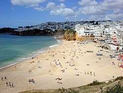
Tourist attractions in the region include its beaches, Mediterranean climate, safety, cuisine and relatively low costs. Well-known beaches in the Algarve range from Marinha Beach to Armação de Pêra. A well-known spa town is Caldas de Monchique. In addition to its natural features and beaches, the Algarve has invested in the creation of a network of golf courses.
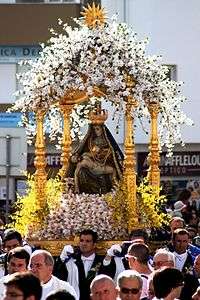
The Algarve is also popular for religious tourism, notably pilgrimages to the Sanctuary of Our Lady of Piety (best known as the Sovereign Mother), a Marian shrine dedicated to the patron saint of Loulé, that attract thousands of pilgrims of the Catholic faithful to the city, or with the international pilgrimages to the apparitions site of Our Lady Mother of Goodness occurred near São Marcos da Serra.
Algarve's mild climate has attracted interest from Northern Europeans wishing to have a holiday home or residence in the region. Being a region of Portugal, and therefore in the European Union, any EU citizen has the right to freely buy property and reside with little formality in the Algarve.[11] British expatriates, followed by German, Dutch and Scandinavians, are among the largest groups wishing to own a home in this sunny region of Portugal.
Tourism plays an important role in the economy of the Algarve. A large number of seasonal job opportunities are tourism-related and are fulfilled by thousands of immigrant workers from other countries. In March 2007, the Portuguese economic minister, Manuel Pinho, announced the creation of the "Allgarve" brand, as a part of a strategical promotion of the Algarve as a tourism destination for foreign citizens.[12] According to World Travel Awards, Algarve is the Europe's Leading Golf Destination 2013 and 2014.[13][14] There are over 25 top-class courses in the Algarve, most of which were designed by legendary names such as Nick Faldo, Seve Ballesteros, Jack Nicklaus and Christy O'Connor Jnr.
Accommodation
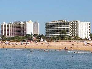
Accommodation in the Algarve ranges from high rise resorts in places like Albufeira to traditional guesthouses, located in the small towns and villages surrounding the Algarve coast. Over the past 50 years the Algarve has seen an increase in development, particularly from non-Portuguese developers. Over the past few years many tourists visiting the Algarve have moved away from the resorts, and have chosen the comfort of a traditional Algarve guesthouse, many of these run by ex-pats from England, the Netherlands, and Germany who have escaped to the Algarve for a higher quality of life.
Education
The University of Algarve, headquartered in Faro with an extension in Portimão, is a public university which awards all academic degrees in fields ranging from marine biology to economics to environmental engineering. There are also several higher education private institutions, state-run and private secondary education schools, including a number of international schools, and a wide network of kindergartens and primary schools.
Sports
The Algarve has many sports clubs, including football teams (S.C. Olhanense, Portimonense S.C.) which play in the first, second and third lay tiers of professional football. S.C. Farense is the most successful football club in the Algarve and play in the LigaPro.
Team Tavira is a noted Portuguese cycling team. The major stadium in the Algarve is the Estádio Algarve, where SC Farense and Louletano D.C. play their home matches.
The region is also host to the annual Algarve Cup, an invitational tournament for national teams in women's association football.
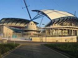
The Algarve International Circuit, a 4.692 kilometres (2.915 mi) race circuit, is located in Portimão.
Culture

.jpg)
The Algarve is famous for its pottery and ceramics, particularly hand-painted pottery and azulejos, which are painted, tin-glazed ceramic tiles. There are numerous ceramics and pottery outlets throughout the Algarve. For working potteries and ceramics workshops the main, or best-known, pottery centers are located in the towns of Almancil, Porches and Loulé, but there are many other potteries and workshops in the Algarve region.
Notable citizens
- Aníbal Cavaco Silva (former Portuguese president and prime minister)
- Adelino da Palma Carlos (former Portuguese prime minister)
- António Aleixo (poet)
- António Calvário (singer)
- Bartolomeu Dias (navigator)
- Bonnie Tyler (singer)
- Cliff Richard (singer)
- Carlos Brito (politician and writer)
- Diogo Rodrigues (explorer of the Indian Ocean)
- Duarte Pacheco (former Minister of Public Education and Public Works and Communications and Mayor of Lisbon)
- Francisco Barreto (soldier and explorer; an officer in Morocco, viceroy of Portuguese India, he was tasked with an expedition to southeast Africa in search of legendary gold mines.)
- Gil Eannes (navigator)
- Helena Vieira (soprano)
- João de Deus (poet)
- João Moutinho (football player)
- João Vaz Corte-Real (claimed by some accounts to have been a pre-Columbian explorer of a land called New Land of the Codfish, possibly part of North America)
- José Mendes Cabeçadas (former Portuguese president and prime minister)
- José Miguel Júdice (journalist)
- José Saramago (writer, Nobel Laureate)
- Júlio Dantas (writer, physician)
- Lídia Jorge (writer)
- Luís Guilherme (singer)
- Manuel Teixeira Gomes (former Portuguese president and writer)
- Maria Barroso (actress, wife of former Portuguese president and prime minister Mário Soares)
- Maria Cavaco Silva (wife of present Portuguese president and former prime minister)
- Maria das Dores Formosinho Vieira (wife of former Portuguese President and Prime Minister José Mendes Cabeçadas)
- Maria José Rodrigues Ritta (wife of former Portuguese president Jorge Sampaio)
- Maria Margarida Pinto Ribeiro de Sousa Uva (wife of José Manuel Barroso, President of the European Commission and former Prime Minister of Portugal)
- Nuno Júdice (poet)
- Nuno Krus Abecassis (former Mayor of Lisbon)
- Clive Dunn, British film and television actor (Dad's Army), from the 1980s until his death in 2012.
- Patrick Swift (Artist. Lived in Algarve from 1962 until his death in 1983. Founded Porches Pottery/Olaria Algarve.)
- Katherine Swift (Artist and ceramicist. Worked at Porches Pottery and founded Estudio Destra in Silves.)
- Tomaz Cabreira (former minister of finance)
Gallery
-

The city of Tavira
-
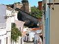
The historic centre of Lagos
-
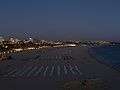
Portimão at night
-
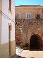
A street in Silves
-
Partial view of Carvoeiro
-
A beach in Albufeira
-
_(5469253558).jpg)
The city of Vila Real de Santo António
-
Marina beach in Vilamoura
-
Typical view of the Algarve coast
-

Beach in Quarteira
-

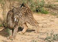
Shepherd and sheep near Lagos
-
Desert island near Faro
-
Sagres Point, in the extreme of continental Portugal
-

Loulé's municipal market
-
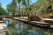
The bog fountain in Alte
-
.jpg)
The open fields of Algarve

See also
References
- 1 2 3 "EU Regions" (PDF). Eurostat.
- ↑ "Regiões de Portugal". AICEP.
- 1 2 3 Direção-Geral do Território
- 1 2 "Statistics Portugal". ine.pt.
- 1 2 "Law nr. 75/2013" (pdf). Diário da República (in Portuguese). Assembly of the Republic (Portugal). Retrieved 13 August 2014.
- ↑ GDP per inhabitant ranged from 28% of the EU27 average in Severozapaden in Bulgaria to 343% in Inner London
- ↑ Faro - Instituto de Meteorologia, 1981–2010 (provisórias)
- ↑ "Monthly Averages for Faro, Portugal". World Meteorological Organization. Retrieved 5 September 2012.
- ↑ "Climatological Information for Faro, Portugal" Hong Kong Observatory. Retrieved 5 September 2012
- ↑ AMAL. "AMAL :: Comunidade Intermunicipal do Algarve". amal.pt.
- ↑ "On the Rights of Citizens of the Union ...", EC Directive 2004/58 EC, retrieved 25 May 2007.
- ↑ http://www.correiodamanha.pt/noticia.asp?id=234857&idselect=11&idCanal=11&p=200
- ↑ "Europe's Leading Golf Destination 2013 — World Travel Awards". Worldtravelawards.com. Retrieved 31 January 2014.
- ↑ "Algarve elected Europe's best Golf Destination of 2014". The Portugal News. 21 November 2013. Retrieved 31 January 2014.
External links
 Media related to Algarve at Wikimedia Commons
 Algarve travel guide from Wikivoyage
- Associação de Turismo do Algarve
- Film Production Algarve
| Norte Region |
| ||||||
|---|---|---|---|---|---|---|---|
| Centro Region |
| ||||||
| Lisboa Region |
| ||||||
| Alentejo Region |
| ||||||
| Algarve Region |
| ||||||
| Autonomous Regions | |||||||
All these divisions are further subdivided into municipalities and parishes. | |||||||