Niwot, Colorado
| Niwot, Colorado | |
|---|---|
| Census-designated place | |
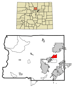 Location in Boulder County and the state of Colorado | |
| Coordinates: 40°5′59″N 105°9′37″W / 40.09972°N 105.16028°WCoordinates: 40°5′59″N 105°9′37″W / 40.09972°N 105.16028°W | |
| Country |
|
| State |
|
| County | Boulder[1] |
| Named for | Chief Niwot |
| Area | |
| • Total | 4.01 sq mi (10.38 km2) |
| • Land | 4.00 sq mi (10.35 km2) |
| • Water | 0.008 sq mi (0.02 km2) |
| Elevation[1] | 5,095 ft (1,553 m) |
| Population (2010) | |
| • Total | 4,006 |
| • Density | 1,002/sq mi (387.0/km2) |
| Time zone | Mountain (MST) (UTC-7) |
| • Summer (DST) | MDT (UTC-6) |
| ZIP codes[2] | 80503, 80544 |
| Area code(s) | 303 |
| FIPS code | 08-53780 |
| GNIS feature ID | 0204679 |
Niwot is a census-designated place (CDP) in Boulder County, Colorado, United States. The population was 4,006 at the 2010 census.[3] The Niwot Post Office has the ZIP Code 80544.[2]
This locality is named for Arapaho Chief Niwot, a tribal leader in the Boulder area during the nineteenth century.[4] The name means "left-handed". With a per capita income of $39,943, Niwot is ranked as the 17th wealthiest location in Colorado.
Additionally, this locality is recognized for being the headquarters of footwear company, Crocs, Inc.
Geography
Niwot is located at 40°5′59″N 105°9′37″W / 40.09972°N 105.16028°W (40.099855, -105.160305),[5] along State Highway 119, halfway between Boulder and Longmont.
According to the United States Census Bureau, the CDP has a total area of 4.0 square miles (10.4 km2), of which 0.008 square miles (0.02 km2), or 0.23%, is water.[3]
Demographics
As of the census[6] of 2000, there were 4,160 people, 1,502 households, and 1,094 families residing in the CDP. The population density was 1,026.4 people per square mile (396.6/km²). There were 1,546 housing units at an average density of 381.4 per square mile (147.4/km²). The racial makeup of the CDP was 94.52% White, 0.48% African American, 0.38% Native American, 2.16% Asian, 0.02% Pacific Islander, 1.06% from other races, and 1.37% from two or more races. Hispanic or Latino of any race were 3.39% of the population.
There were 1,502 households out of which 40.8% had children under the age of 18 living with them, 65.0% were married couples living together, 5.9% had a female householder with no husband present, and 27.1% were non-families. 21.4% of all households were made up of individuals and 3.3% had someone living alone who was 65 years of age or older. The average household size was 2.66 and the average family size was 3.15.
In the CDP the population was spread out with 28.5% under the age of 18, 4.8% from 18 to 24, 29.5% from 25 to 44, 31.3% from 45 to 64, and 5.9% who were 65 years of age or older. The median age was 40 years. For every 100 females there were 102.8 males. For every 100 females age 18 and over, there were 103.3 males.
The median income for a household in the CDP was $86,914, and the median income for a family was $100,120. Males had a median income of $81,813 versus $39,279 for females. The per capita income for the CDP was $39,943. About 2.5% of families and 5.6% of the population were below the poverty line, including 2.1% of those under age 18 and 2.0% of those age 65 or over.
Notable residents and facts
- Brian Dietzen, American actor who has played the supporting role of Jimmy Palmer on NCIS, since 2004. Dietzen attended Niwot High School and was the star of the drama department.
- Pete Wernick, five-string banjo player who has been involved in the bluegrass music scene since the 1970s
- In 2013 downtown Niwot was used as the set for the film Dear Eleanor which stars Jessica Alba, Luke Wilson, and many other notable actors. The filming took place in the heart of the town and was a spectacle for many of the residents. Director Kevin Spacey also ensured that a few local teens had the opportunity to be extras in the film.
- Niwot offers residents two public schools, the first being Niwot Elementary and the second being Niwot High School. Both schools are very well known in Colorado for producing highly successful students that continue on to impressive universities. Because of the good track record, both schools experience an overwhelming number of open-enrollment applications.
See also
References
- 1 2 "US Board on Geographic Names". United States Geological Survey. 2007-10-25. Retrieved 2008-01-31.
- 1 2 "ZIP Code Lookup" (JavaScript/HTML). United States Postal Service. December 14, 2006. Retrieved December 14, 2006.
- 1 2 "Geographic Identifiers: 2010 Demographic Profile Data (G001): Niwot CDP, Colorado". U.S. Census Bureau, American Factfinder. Retrieved October 17, 2013.
- ↑ Dawson, John Frank. Place names in Colorado: why 700 communities were so named, 150 of Spanish or Indian origin. Denver, CO: The J. Frank Dawson Publishing Co. p. 37.
- ↑ "US Gazetteer files: 2010, 2000, and 1990". United States Census Bureau. 2011-02-12. Retrieved 2011-04-23.
- ↑ "American FactFinder". United States Census Bureau. Retrieved 2008-01-31.
Municipalities and communities of Boulder County, Colorado, United States | ||
|---|---|---|
| Cities |  | |
| Towns | ||
| CDPs | ||
| Unincorporated communities | ||
| Ghost town | ||
| Footnotes | ‡This populated place also has portions in an adjacent county or counties | |