New Llano, Louisiana
| New Llano, Louisiana | |
| Town | |
| Country | United States |
|---|---|
| State | Louisiana |
| Parish | Vernon |
| Elevation | 217 ft (66.1 m) |
| Coordinates | 31°06′53″N 93°16′47″W / 31.11472°N 93.27972°WCoordinates: 31°06′53″N 93°16′47″W / 31.11472°N 93.27972°W |
| Area | 1.0 sq mi (2.6 km2) |
| - land | 1.0 sq mi (3 km2) |
| - water | 0.0 sq mi (0 km2), 0% |
| Population | 2,415 (2000) |
| Density | 2,488.0/sq mi (960.6/km2) |
| Timezone | CST (UTC-6) |
| - summer (DST) | CDT (UTC-5) |
| Area code | 337 |
 Location in Vernon Parish and the state of Louisiana. | |
.svg.png) Location of Louisiana in the United States | |
New Llano is a town in Vernon Parish, Louisiana, United States. The population was 2,415 at the 2000 census. It is part of the Fort Polk South Micropolitan Statistical Area.
Originally Stables, Louisiana, the town was renamed when 200 members of the Socialist commune Llano del Rio Cooperative Colony in California relocated to this site in 1917, giving the town its present name. It continued to function as a socialist commune with citizens pooling and sharing resources and wealth until 1939.
Geography
New Llano is located at 31°6′53″N 93°16′47″W / 31.11472°N 93.27972°W (31.114793, -93.279793).[1]
According to the United States Census Bureau, the town has a total area of 1.0 square mile (2.5 km²), all land.
Demographics
| Historical population | |||
|---|---|---|---|
| Census | Pop. | %± | |
| 1950 | 277 | — | |
| 1960 | 264 | −4.7% | |
| 1970 | 1,800 | 581.8% | |
| 1980 | 2,213 | 22.9% | |
| 1990 | 2,660 | 20.2% | |
| 2000 | 2,415 | −9.2% | |
| 2010 | 2,504 | 3.7% | |
| Est. 2015 | 2,468 | [2] | −1.4% |
As of the census[4] of 2000, there were 2,415 people, 925 households, and 640 families residing in the town. The population density was 2,488.0 people per square mile (961.3/km²). There were 1,037 housing units at an average density of 1,068.3 per square mile (412.8/km²). The racial makeup of the town was 46.09% White, 40.29% African American, 0.83% Native American, 3.77% Asian, 0.29% Pacific Islander, 4.10% from other races, and 4.64% from two or more races. Hispanic or Latino of any race were 8.57% of the population.
There were 925 households out of which 40.8% had children under the age of 18 living with them, 46.4% were married couples living together, 18.3% had a female householder with no husband present, and 30.8% were non-families. 24.4% of all households were made up of individuals and 5.1% had someone living alone who was 65 years of age or older. The average household size was 2.61 and the average family size was 3.11.
In the town the population was spread out with 30.8% under the age of 18, 10.6% from 18 to 24, 33.5% from 25 to 44, 19.7% from 45 to 64, and 5.3% who were 65 years of age or older. The median age was 29 years. For every 100 females there were 100.9 males. For every 100 females age 18 and over, there were 95.8 males.
The median income for a household in the town was $35,417, and the median income for a family was $34,271. Males had a median income of $26,563 versus $20,500 for females. The per capita income for the town was $15,902. About 13.5% of families and 15.6% of the population were below the poverty line, including 18.4% of those under age 18 and 13.9% of those age 65 or over.
References
- ↑ "US Gazetteer files: 2010, 2000, and 1990". United States Census Bureau. 2011-02-12. Retrieved 2011-04-23.
- ↑ "Annual Estimates of the Resident Population for Incorporated Places: April 1, 2010 to July 1, 2015". Retrieved July 2, 2016.
- ↑ "Census of Population and Housing". Census.gov. Retrieved June 4, 2015.
- ↑ "American FactFinder". United States Census Bureau. Retrieved 2008-01-31.
External links
- http://www.lpb.org/programs/utopia/history.html American Utopia: A Brief History of Llano del Rio Cooperative Colony
Municipalities and communities of Vernon Parish, Louisiana, United States | ||
|---|---|---|
| Cities | 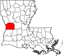 | |
| Towns | ||
| Villages | ||
| CDPs | ||
| Other unincorporated communities | ||