New Hampshire Route 104
| ||||
|---|---|---|---|---|
|
Map of central New Hampshire with NH 104 highlighted in red | ||||
| Route information | ||||
| Maintained by NHDOT | ||||
| Length: | 23.350 mi[1] (37.578 km) | |||
| Major junctions | ||||
| West end: |
| |||
|
| ||||
| East end: |
| |||
| Location | ||||
| Counties: | Merrimack, Grafton, Belknap | |||
| Highway system | ||||
| ||||

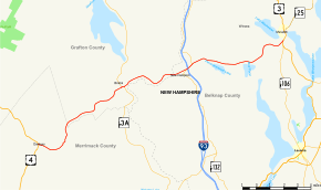
New Hampshire Route 104 (abbreviated NH 104) is a 23.350-mile-long (37.578 km) secondary east–west highway in central New Hampshire, United States. The highway runs from Danbury to Meredith on Lake Winnipesaukee in the Lakes Region.
The western terminus of NH 104 is in Danbury at U.S. Route 4. The eastern terminus is at U.S. Route 3 south of the town of Meredith, between Lake Winnipesaukee and Lake Waukewan. NH 104 is locally named the Ragged Mountain Highway between Danbury and Bristol.
Until the 1970s, NH 104 used the Smith River Road between Danbury and Bristol. This scenic, winding road parallels the Smith River. However it was a frustratingly slow drive as a main highway, so the new overland Ragged Mountain Highway was a welcome replacement route for NH 104, leaving the old Smith River Road as a popular route for recreational access to the river.
Major intersections
| County | Location[1][2] | mi[1][2] | km | Destinations | Notes |
|---|---|---|---|---|---|
| Merrimack | Danbury | 0.000 | 0.000 | Western terminus | |
| Grafton | Bristol | 9.176 | 14.767 | Western end of concurrency with NH 3A | |
| 9.372 | 15.083 | Eastern end of concurrency with NH 3A | |||
| Belknap | New Hampton | 14.097 | 22.687 | Western end of concurrency with NH 132 | |
| 14.863– 15.086 | 23.920– 24.279 | Exit 23 on I-93 | |||
| 15.475 | 24.905 | Eastern end of concurrency with NH 132 | |||
| Meredith | 23.350 | 37.578 | Eastern terminus | ||
1.000 mi = 1.609 km; 1.000 km = 0.621 mi
| |||||
References
- 1 2 3 Bureau of Planning & Community Assistance (February 20, 2015). "NH Public Roads". Concord, New Hampshire: New Hampshire Department of Transportation. Retrieved April 7, 2015.
- 1 2 Bureau of Planning & Community Assistance (April 3, 2015). "Nodal Reference 2015, State of New Hampshire". New Hampshire Department of Transportation. Retrieved April 7, 2015.