New Germany, Minnesota
| New Germany, Minnesota | |
|---|---|
| City | |
 Location of the city of New Germany within Carver County, Minnesota | |
| Coordinates: 44°53′5″N 93°57′59″W / 44.88472°N 93.96639°W | |
| Country | United States |
| State | Minnesota |
| County | Carver |
| Area[1] | |
| • Total | 1.00 sq mi (2.59 km2) |
| • Land | 1.00 sq mi (2.59 km2) |
| • Water | 0 sq mi (0 km2) |
| Elevation | 984 ft (300 m) |
| Population (2010)[2] | |
| • Total | 372 |
| • Estimate (2012[3]) | 375 |
| • Density | 372.0/sq mi (143.6/km2) |
| Time zone | Central (CST) (UTC-6) |
| • Summer (DST) | CDT (UTC-5) |
| ZIP code | 55367 |
| Area code(s) | 952 |
| FIPS code | 27-45556[4] |
| GNIS feature ID | 0648507[5] |
New Germany is a city in Carver County, Minnesota, United States. The population was 372 at the 2010 census.[6] A large share of the early settlers being natives of Germany caused the name to be selected.[7]
Geography
According to the United States Census Bureau, the city has a total area of 1.00 square mile (2.59 km2), all of it land.[1]
County Roads 30 and 33 are two of the main routes in the community. Minnesota State Highway 7 is in close proximity to the city.
Demographics
| Historical population | |||
|---|---|---|---|
| Census | Pop. | %± | |
| 1910 | 210 | — | |
| 1920 | 230 | 9.5% | |
| 1930 | 209 | −9.1% | |
| 1940 | 247 | 18.2% | |
| 1950 | 286 | 15.8% | |
| 1960 | 274 | −4.2% | |
| 1970 | 303 | 10.6% | |
| 1980 | 347 | 14.5% | |
| 1990 | 353 | 1.7% | |
| 2000 | 346 | −2.0% | |
| 2010 | 372 | 7.5% | |
| Est. 2015 | 389 | [8] | 4.6% |
2010 census
As of the census[2] of 2010, there were 372 people, 146 households, and 99 families residing in the city. The population density was 372.0 inhabitants per square mile (143.6/km2). There were 168 housing units at an average density of 168.0 per square mile (64.9/km2). The racial makeup of the city was 96.0% White, 0.3% Asian, 2.7% from other races, and 1.1% from two or more races. Hispanic or Latino of any race were 7.3% of the population.
There were 146 households of which 37.7% had children under the age of 18 living with them, 52.1% were married couples living together, 8.2% had a female householder with no husband present, 7.5% had a male householder with no wife present, and 32.2% were non-families. 26.0% of all households were made up of individuals and 8.2% had someone living alone who was 65 years of age or older. The average household size was 2.55 and the average family size was 3.09.
The median age in the city was 34.4 years. 29.3% of residents were under the age of 18; 4.7% were between the ages of 18 and 24; 32.3% were from 25 to 44; 23.7% were from 45 to 64; and 10.2% were 65 years of age or older. The gender makeup of the city was 51.3% male and 48.7% female.
2000 census
As of the census[4] of 2000, there were 346 people, 143 households, and 94 families residing in the city. The population density was 528.9 people per square mile (205.5/km²). There were 147 housing units at an average density of 224.7 per square mile (87.3/km²). The racial makeup of the city was 97.69% White, 2 African Americans, 1 Native American, and 3 from two or more races.
There were 143 households out of which 27.3% had children under the age of 18 living with them, 55.9% were married couples living together, 5.6% had a female householder with no husband present, and 33.6% were non-families. 32.2% of all households were made up of individuals and 19.6% had someone living alone who was 65 years of age or older. The average household size was 2.42 and the average family size was 2.98.
In the city the population was spread out with 23.7% under the age of 18, 7.5% from 18 to 24, 31.8% from 25 to 44, 17.9% from 45 to 64, and 19.1% who were 65 years of age or older. The median age was 37 years. For every 100 females there were 87.0 males. For every 100 females age 18 and over, there were 94.1 males.
The median income for a household in the city was $36,094, and the median income for a family was $45,625. Males had a median income of $29,750 versus $24,545 for females. The per capita income for the city was $16,314. About 9.5% of families and 14.4% of the population were below the poverty line, including 17.5% of those under age 18 and 33.8% of those age 65 or over.
Notable people
- New Germany is the birthplace of '"Mr. Jimmy"'.
- Dicephalic conjoined twins Abigail and Brittany Hensel are natives.
References
- 1 2 "US Gazetteer files 2010". United States Census Bureau. Retrieved 2012-11-13.
- 1 2 "American FactFinder". United States Census Bureau. Retrieved 2012-11-13.
- ↑ "Population Estimates". United States Census Bureau. Retrieved 2013-05-28.
- 1 2 "American FactFinder". United States Census Bureau. Retrieved 2008-01-31.
- ↑ "US Board on Geographic Names". United States Geological Survey. 2007-10-25. Retrieved 2008-01-31.
- ↑ "2010 Census Redistricting Data (Public Law 94-171) Summary File". American FactFinder. United States Census Bureau. Retrieved 27 April 2011.
- ↑ Upham, Warren (1920). Minnesota Geographic Names: Their Origin and Historic Significance. Minnesota Historical Society. p. 83.
- ↑ "Annual Estimates of the Resident Population for Incorporated Places: April 1, 2010 to July 1, 2015". Retrieved July 2, 2016.
- ↑ "Census of Population and Housing". Census.gov. Retrieved June 4, 2015.
Municipalities and communities of Carver County, Minnesota, United States | ||
|---|---|---|
| Cities | 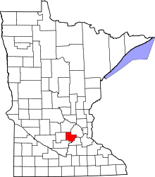 | |
| Townships | ||
| Unincorporated communities | ||
| Ghost town | ||
| Footnotes | ‡This populated place also has portions in an adjacent county or counties | |
Coordinates: 44°53′03″N 93°58′14″W / 44.88417°N 93.97056°W