New Boston, Texas
| New Boston, Texas | |
|---|---|
| City | |
 Location of New Boston, Texas | |
 | |
| Coordinates: 33°27′38″N 94°25′2″W / 33.46056°N 94.41722°WCoordinates: 33°27′38″N 94°25′2″W / 33.46056°N 94.41722°W | |
| Country | United States |
| State | Texas |
| County | Bowie |
| Area | |
| • Total | 3.3 sq mi (8.5 km2) |
| • Land | 3.3 sq mi (8.5 km2) |
| • Water | 0.0 sq mi (0.0 km2) |
| Elevation | 358 ft (109 m) |
| Population (2010) | |
| • Total | 4,550 |
| • Density | 1,383/sq mi (534.0/km2) |
| Time zone | Central (CST) (UTC-6) |
| • Summer (DST) | CDT (UTC-5) |
| 75501 | 75570 |
| Area code(s) | 903 |
| FIPS code | 48-50808[1] |
| GNIS feature ID | 1363692[2] |
| Website |
www |
New Boston is a city in Bowie County, Texas, United States. It was named after an early store keeper, W.J. Boston. It is part of the Texarkana, Texas - Texarkana, Arkansas Metropolitan Statistical Area. The population was 4,550 at the 2010 census.[3]
Geography
New Boston is located near the center of Bowie County at 33°27′38″N 94°25′2″W / 33.46056°N 94.41722°W (33.460551, -94.417246).[4] U.S. Route 82 passes through the center of the city, and Interstate 30 runs through the northern part of the city, with access from Exits 199 and 201. By either route it is 22 miles (35 km) east to Texarkana. I-30 leads southwest 40 miles (64 km) to Mount Pleasant, and US 82 leads west-northwest 70 miles (110 km) to Paris. Texas State Highway 8 leads south 4 miles (6.4 km) to Old Boston, the site of original town settlement in the 1800s, and north 7 miles (11 km) to the Red River and the border with the state of Arkansas. The Red River Army Depot borders the southeastern edge of New Boston.
According to the United States Census Bureau, the city has a total area of 3.3 square miles (8.5 km2), all of it land.[3]
Demographics
| Historical population | |||
|---|---|---|---|
| Census | Pop. | %± | |
| 1870 | 273 | — | |
| 1880 | 257 | −5.9% | |
| 1890 | 382 | 48.6% | |
| 1920 | 869 | — | |
| 1930 | 949 | 9.2% | |
| 1940 | 1,111 | 17.1% | |
| 1950 | 2,688 | 141.9% | |
| 1960 | 2,773 | 3.2% | |
| 1970 | 4,034 | 45.5% | |
| 1980 | 4,628 | 14.7% | |
| 1990 | 5,057 | 9.3% | |
| 2000 | 4,808 | −4.9% | |
| 2010 | 4,550 | −5.4% | |
| Est. 2015 | 4,688 | [5] | 3.0% |
As of the census[1] of 2000, there were 4,808 people, 1,968 households, and 1,334 families residing in the city. The population density was 1,377.1 people per square mile (531.9/km²). There were 2,229 housing units at an average density of 638.4 per square mile (246.6/km²). The racial makeup of the city was 79.49% White, 17.64% African American, 0.75% Native American, 0.27% Asian, 0.10% Pacific Islander, 0.44% from other races, and 1.31% from two or more races. Hispanic or Latino of any race were 1.46% of the population.
There were 1,968 households out of which 32.8% had children under the age of 18 living with them, 47.8% were married couples living together, 17.6% had a female householder with no husband present, and 32.2% were non-families. 30.1% of all households were made up of individuals and 15.5% had someone living alone who was 65 years of age or older. The average household size was 2.39 and the average family size was 2.96.
In the city the population was spread out with 26.6% under the age of 18, 7.8% from 18 to 24, 25.2% from 25 to 44, 21.5% from 45 to 64, and 18.8% who were 65 years of age or older. The median age was 38 years. For every 100 females there were 82.1 males. For every 100 females age 18 and over, there were 74.7 males.
The median income for a household in the city was $26,531, and the median income for a family was $38,542. Males had a median income of $29,940 versus $21,316 for females. The per capita income for the city was $14,190. About 11.6% of families and 15.0% of the population were below the poverty line, including 19.9% of those under age 18 and 8.9% of those age 65 or over.
Major highways in or near New Boston
History
The Red River Expedition (1806) was stopped by the Spanish in the vicinity of the town.
When the Missouri Pacific Railroad was being constructed 4 miles (6 km) north of the village of Boston (now Old Boston) in the summer of 1876, it was clear to many businessmen in the town that it would suffer a serious decline as a consequence of its distance from the line. At a mass meeting J. H. Smelser, a local resident and surveyor for the railroad, was selected to meet with railroad officials to secure the location of a depot at a point on the line nearest to Boston. The negotiations were successful, and in September 1876 lots were laid out and put up for sale on 100 acres (0.40 km2) that the railroad had purchased. Because most of those engaged in the project were from Boston, the new town was named New Boston. A post office was established in 1877 with L. C. DeMorse as postmaster. The town grew rapidly and by 1884 it had 400 residents, two churches, a school, several mills and gins, and a newspaper, the New Boston Herald, edited by W. W. West. A furniture factory and another newspaper, the Bowie County Populist, were added in the 1890s.
By 1900 the town had a population of 762. It grew slowly until the late 1920s, when a short-lived boom raised the population from 869 in 1925 to 1,300 in 1929. The population fell to 949 by 1931. During World War II the Lone Star Army Ammunition Plant and the Red River Army Depot were constructed just southeast of New Boston. The two massive military installations were probably responsible for the town's rapid growth in the 1940s. The population grew from 1,111 in 1940, then to 2,688 in 1950. In 1980 it reached 4,628. Although an International Paper mill, the Barry Telford state prison and a few smaller factories provided some industrial base for the town, New Boston depends heavily on the two military installations for its continued prosperity. The town had 5,057 residents in 1990 and 4,550 residents in 2010.
New Boston is known for its Pioneer Days Festival and Rodeo. The town-folk gather at the T&P Trailhead Park for entertainment such as carnival rides, street dances, live musical and comedy presentations.
Government and infrastructure
The Barry B. Telford Unit of the Texas Department of Criminal Justice is in an unincorporated area near New Boston.[7]
Courthouse
On March 4, 1986, a new modern county courthouse was dedicated in New Boston on the Interstate, but Boston remained the official county seat. The old Bowie County Courthouse, constructed in Boston in 1889 in the exact geographic center of the county, was abandoned after construction of the new building. On the night of August 13, 1987, the old courthouse was burned by an arsonist.
New Boston Small Business Association
Promoting Education, Arts and Entrepreneurship
Schools
New Boston is served by the New Boston Independent School District (NBISD) and home to the New Boston High School Lions.
Climate
The climate in this area is characterized by hot, humid summers and generally mild to cool winters. According to the Köppen Climate Classification system, New Boston has a humid subtropical climate, abbreviated "Cfa" on climate maps.[8]
Notable people
- Gary VanDeaver, pronounced (van dee ah ver) retiring New Boston school superintendent and incoming 2015 Republican member of the Texas House of Representatives from District 1, based in Bowie, Franklin, Lamar, and Red River counties.
- 1 2 "American FactFinder". United States Census Bureau. Retrieved 2008-01-31.
- ↑ "US Board on Geographic Names". United States Geological Survey. 2007-10-25. Retrieved 2008-01-31.
- 1 2 "Geographic Identifiers: 2010 Demographic Profile Data (G001): New Boston city, Texas". U.S. Census Bureau, American Factfinder. Retrieved April 16, 2014.
- ↑ "US Gazetteer files: 2010, 2000, and 1990". United States Census Bureau. 2011-02-12. Retrieved 2011-04-23.
- ↑ "Annual Estimates of the Resident Population for Incorporated Places: April 1, 2010 to July 1, 2015". Retrieved July 2, 2016.
- ↑ "Census of Population and Housing". Census.gov. Retrieved June 4, 2015.
- ↑ "Telford (TO)." Texas Department of Criminal Justice. Retrieved on September 5, 2015. "3899 Hwy 98, New Boston, TX 75570 "
- ↑ Climate Summary for New Boston, Texas
External links
- City of New Boston official website
- New Boston, Texas from the Handbook of Texas Online
Municipalities and communities of Bowie County, Texas, United States | ||
|---|---|---|
| Cities | 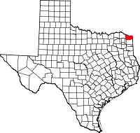 | |
| Unincorporated communities |
| |
| Footnotes | ‡This populated place also has portions in an adjacent county or counties | |