Maud, Texas
| Maud, Texas | |
|---|---|
| City | |
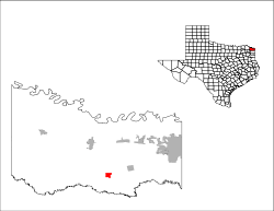
 Location of Maud, Texas | |
 | |
| Coordinates: 33°19′56″N 94°20′36″W / 33.33222°N 94.34333°WCoordinates: 33°19′56″N 94°20′36″W / 33.33222°N 94.34333°W | |
| Country | United States |
| State | Texas |
| County | Bowie |
| Area | |
| • Total | 1.5 sq mi (3.9 km2) |
| • Land | 1.5 sq mi (3.9 km2) |
| • Water | 0.0 sq mi (0.0 km2) |
| Elevation | 289 ft (88 m) |
| Population (2010) | |
| • Total | 1,056 |
| • Density | 708/sq mi (273.5/km2) |
| Time zone | Central (CST) (UTC-6) |
| • Summer (DST) | CDT (UTC-5) |
| ZIP code | 75567 |
| Area code(s) | 903 |
| FIPS code | 48-47088[1] |
| GNIS feature ID | 1374819[2] |
Maud is a city in Bowie County, Texas, United States. As of the 2010 census it had a population of 1,056.[3] It is part of the Texarkana, Texas - Texarkana, Arkansas Metropolitan Statistical Area.
Geography
Maud is located in southern Bowie County at 33°19′56″N 94°20′36″W / 33.33222°N 94.34333°W (33.332185, -94.343244).[4] U.S. Route 67 passes through the center of town, leading northeast 18 miles (29 km) to Texarkana and southwest 43 miles (69 km) to Mount Pleasant. Texas State Highway 8 leads south from Maud 23 miles (37 km) to Linden and north 13 miles (21 km) to New Boston. The city is 4 miles (6 km) north of Wright Patman Lake, a reservoir on the Sulphur River.
According to the United States Census Bureau, the city of Maud has a total area of 1.5 square miles (3.9 km2), all of it land.[3]
Demographics
| Historical population | |||
|---|---|---|---|
| Census | Pop. | %± | |
| 1950 | 713 | — | |
| 1960 | 915 | 28.3% | |
| 1970 | 1,107 | 21.0% | |
| 1980 | 1,059 | −4.3% | |
| 1990 | 1,049 | −0.9% | |
| 2000 | 1,028 | −2.0% | |
| 2010 | 1,056 | 2.7% | |
| Est. 2015 | 1,071 | [5] | 1.4% |
As of the census[1] of 2010, there were 1,056 people in the city. The population density was 691.3 people per square mile (266.4/km²). There were 473 housing units at an average density of 318.1/sq mi (122.6/km²). The racial makeup of the city was 90.76% White, 7.59% African American, 0.58% Native American, 0.10% Asian, 0.10% from other races, and 0.88% from two or more races. Hispanic or Latino of any race were 1.36% of the population.
There were 433 households out of which 28.4% had children under the age of 18 living with them, 47.8% were married couples living together, 11.1% had a female householder with no husband present, and 37.0% were non-families. 35.6% of all households were made up of individuals and 21.2% had someone living alone who was 65 years of age or older. The average household size was 2.37 and the average family size was 3.12.
In the city the population was spread out with 26.1% under the age of 18, 6.6% from 18 to 24, 25.4% from 25 to 44, 23.2% from 45 to 64, and 18.8% who were 65 years of age or older. The median age was 40 years. For every 100 females there were 95.1 males. For every 100 females age 18 and over, there were 83.1 males.
The median income for a household in the city was $29,773, and the median income for a family was $38,750. Males had a median income of $32,604 versus $20,536 for females. The per capita income for the city was $16,792. About 9.1% of families and 11.4% of the population were below the poverty line, including 12.2% of those under age 18 and 12.3% of those age 65 or over.
History
Maud is on the St. Louis Southwestern Railway near U.S. Highway 67 in southern Bowie County. The territory around Maud, known before the Republic of Texas era as the Red River Country, was among the earliest settled areas, but Spanish claims to the land, outlaws from the Neutral Ground, and general lawlessness discouraged extensive development. After the railroad reached the site in 1870, a community gradually began to emerge. The town was named for Maud Knapp, daughter of Samuel D. Knapp, the first postmaster and the donor of land for the townsite. A post office opened in 1881, closed the next year, then reopened in 1893. By 1910, the population of the town had reached 300, and by 1940 it had grown to 750. During World War II the Red River Army Depot and the Lone Star Army Ammunition Plant were built 6 miles (10 km) north of the community. These two facilities provided jobs for many Maud citizens. In 1982, Maud had eleven rated businesses and an estimated population of 1,059. The two military installations remained the largest employers of Maud residents. In 1990, the community population was 1,049.
Education
Maud is served by the Maud Independent School District.
Climate
The climate in this area is characterized by hot, humid summers and generally mild to cool winters. According to the Köppen Climate Classification system, Maud has a humid subtropical climate, abbreviated "Cfa" on climate maps.[7]
References
- 1 2 "American FactFinder". United States Census Bureau. Retrieved 2008-01-31.
- ↑ "US Board on Geographic Names". United States Geological Survey. 2007-10-25. Retrieved 2008-01-31.
- 1 2 "Geographic Identifiers: 2010 Demographic Profile Data (G001): Maud city, Texas". U.S. Census Bureau, American Factfinder. Retrieved April 15, 2014.
- ↑ "US Gazetteer files: 2010, 2000, and 1990". United States Census Bureau. 2011-02-12. Retrieved 2011-04-23.
- ↑ "Annual Estimates of the Resident Population for Incorporated Places: April 1, 2010 to July 1, 2015". Retrieved July 2, 2016.
- ↑ "Census of Population and Housing". Census.gov. Retrieved June 4, 2015.
- ↑ Climate Summary for Maud, Texas
Municipalities and communities of Bowie County, Texas, United States | ||
|---|---|---|
| Cities | 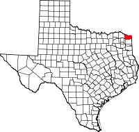 | |
| Unincorporated communities |
| |
| Footnotes | ‡This populated place also has portions in an adjacent county or counties | |