Nesika Beach, Oregon
| Nesika Beach, Oregon | |
|---|---|
| Census-designated place | |
|
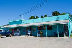
Store at Nesika Beach | |
 Nesika Beach  Nesika Beach Location within the state of Oregon | |
| Coordinates: 42°30′23″N 124°24′44″W / 42.50639°N 124.41222°WCoordinates: 42°30′23″N 124°24′44″W / 42.50639°N 124.41222°W | |
| Country | United States |
| State | Oregon |
| County | Curry |
| Area | |
| • Total | 2.28 sq mi (5.91 km2) |
| • Land | 2.28 sq mi (5.91 km2) |
| • Water | 0.0 sq mi (0.0 km2) |
| Elevation | 68 ft (21 m) |
| Population (2010) | |
| • Total | 463 |
| • Density | 203/sq mi (78.4/km2) |
| Time zone | Pacific (PST) (UTC-8) |
| • Summer (DST) | PDT (UTC-7) |
| ZIP code | 97444 |
| Area code(s) | 458 and 541 |
| FIPS code | 41-51950 |
| GNIS feature ID | 1146782 |
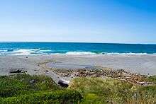
Nesika Beach is census-designated place and unincorporated community in Curry County, Oregon, United States.[1] It is located 8 miles (13 km) north of Gold Beach on the Oregon Coast. As of the 2010 census it had a population of 463.[2]
Nesika means "we", "us", or "our" in Chinook Jargon.[3]
See also
Nesika Beach
References
- ↑ "Nesika Beach". Geographic Names Information System. United States Geological Survey. November 28, 1980. Retrieved 2011-01-21.
- ↑ "Geographic Identifiers: 2010 Demographic Profile Data (G001): Nesika Beach CDP, Oregon". U.S. Census Bureau, American Factfinder. Retrieved March 10, 2015.
- ↑ "Provincial Nesika Awards". Embrace BC. Retrieved 2011-01-21.
Municipalities and communities of Curry County, Oregon, United States | ||
|---|---|---|
| Cities | 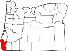 | |
| CDPs | ||
| Other unincorporated communities | ||
This article is issued from Wikipedia - version of the 7/30/2016. The text is available under the Creative Commons Attribution/Share Alike but additional terms may apply for the media files.