Nenjiang County
| Nenjiang County 嫩江县 | |
|---|---|
| County | |
 Nenjiang as shown on a 1734 French map | |
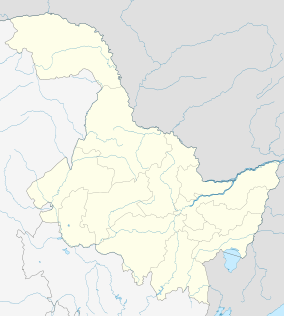 Nenjiang Location in Heilongjiang | |
| Coordinates: 49°11′N 125°13′E / 49.183°N 125.217°ECoordinates: 49°11′N 125°13′E / 49.183°N 125.217°E | |
| Country | People's Republic of China |
| Province | Heilongjiang |
| Prefecture-level city | Heihe |
| County seat | Nenjiang Town |
| Area | |
| • Total | 15,360 km2 (5,930 sq mi) |
| Elevation | 230 m (750 ft) |
| Population | |
| • Total | 500,000 |
| • Density | 33/km2 (84/sq mi) |
| Time zone | China Standard (UTC+8) |
| Postal code | 161400 |
| Area code(s) | 0456 |
Nenjiang County (simplified Chinese: 嫩江县; traditional Chinese: 嫩江縣; pinyin: Nènjiāng Xiàn) is a county under the administration of Heihe City in northwestern Heilongjiang province, China. It is located on the river of the same name (Nen River), which also forms part of the provincial border with Inner Mongolia, more than 200 kilometres (120 mi) southwest of the urban area of Heihe. The county seat is a town of the same name (嫩江镇).
Land area 15,360 square kilometres (5,930 sq mi), population 500,000.
History
Nenjiang town (also known as Mergen at the time) was the capital (seat of the Military Governor) of Heilongjiang Province in 1690-1699.[1]
Geography and climate
Nenjiang has a monsoon-influenced humid continental climate (Köppen Dwb), with long, harsh, but dry winters, and short, warm summers. The monthly 24-hour average temperature ranges from −24.1 °C (−11.4 °F) in January to 20.9 °C (69.6 °F) in July; the year averages out at only 0.38 °C (32.7 °F). Around 80% of the annual precipitation occurs from June to September. With monthly percent possible sunshine ranging from 53% in July to 74% in February, sunshine is generous year-round, totalling 2,726 hours annually.
| Climate data for Nenjiang County (1971−2000) | |||||||||||||
|---|---|---|---|---|---|---|---|---|---|---|---|---|---|
| Month | Jan | Feb | Mar | Apr | May | Jun | Jul | Aug | Sep | Oct | Nov | Dec | Year |
| Average high °C (°F) | −17.3 (0.9) |
−10.8 (12.6) |
−0.9 (30.4) |
10.9 (51.6) |
19.7 (67.5) |
25.0 (77) |
26.5 (79.7) |
24.5 (76.1) |
18.5 (65.3) |
8.6 (47.5) |
−5 (23) |
−15.2 (4.6) |
7.0 (44.7) |
| Average low °C (°F) | −30.1 (−22.2) |
−26.1 (−15) |
−15.2 (4.6) |
−3.1 (26.4) |
4.6 (40.3) |
11.7 (53.1) |
15.5 (59.9) |
12.9 (55.2) |
5.4 (41.7) |
−4 (25) |
−17 (1) |
−26.9 (−16.4) |
−6 (21.2) |
| Average precipitation mm (inches) | 3.1 (0.122) |
2.3 (0.091) |
4.8 (0.189) |
21.5 (0.846) |
32.0 (1.26) |
84.4 (3.323) |
143.6 (5.654) |
105.2 (4.142) |
61.7 (2.429) |
22.3 (0.878) |
6.4 (0.252) |
4.7 (0.185) |
492.0 (19.37) |
| Average precipitation days (≥ 0.1 mm) | 6.4 | 4.1 | 4.6 | 7.5 | 8.3 | 13.2 | 14.3 | 13.1 | 9.8 | 6.8 | 5.5 | 7.3 | 100.9 |
| Average relative humidity (%) | 73 | 69 | 59 | 51 | 48 | 66 | 78 | 79 | 72 | 61 | 67 | 73 | 66.3 |
| Mean monthly sunshine hours | 179.3 | 209.1 | 257.5 | 239.4 | 281.9 | 279.0 | 258.6 | 257.5 | 225.2 | 208.1 | 175.0 | 155.3 | 2,725.9 |
| Percent possible sunshine | 67 | 74 | 70 | 59 | 60 | 58 | 53 | 58 | 60 | 62 | 64 | 61 | 62.2 |
| Source: China Meteorological Administration | |||||||||||||
References
Heilongjiang topics | |
|---|---|
| General | |
| Geography | |
| Education | |
| Visitor attractions | |
| |