Bayan County
See also: Bayan (disambiguation)
| Bayan County 巴彦县 | |
|---|---|
| County | |
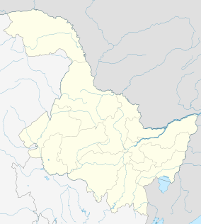 Bayan Location in Heilongjiang | |
| Coordinates: 46°04′55″N 127°24′22″E / 46.082°N 127.406°ECoordinates: 46°04′55″N 127°24′22″E / 46.082°N 127.406°E[1] | |
| Country | People's Republic of China |
| Province | Heilongjiang |
| Sub-provincial city | Harbin |
| Divisions |
10 towns 8 townships |
| Seat | Bayan Town (巴彦镇) |
| Area[2] | |
| • Total | 3,137.7 km2 (1,211.5 sq mi) |
| Elevation | 136 m (446 ft) |
| Population (2010)[3] | |
| • Total | 590,555 |
| • Density | 190/km2 (490/sq mi) |
| Time zone | China Standard (UTC+8) |
| Postal code | 1518XX |
| Area code(s) | 0451 |
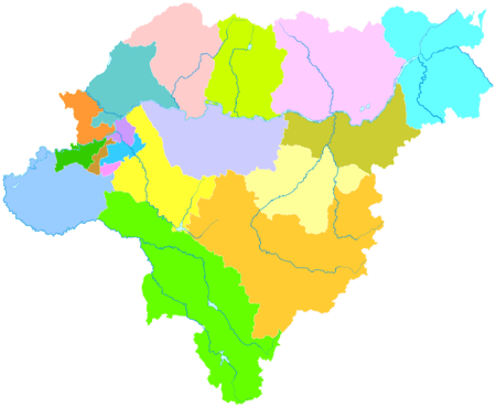
| Harbin district map | |
Bayan County (simplified Chinese: 巴彦县; traditional Chinese: 巴彦縣; pinyin: Bāyàn Xiàn) is under the administration of Harbin, the capital of Heilongjiang province, People's Republic of China. It borders Mulan County to the east, Bin County to the south, Hulan District to the west, as well as the prefecture-level city of Suihua to the north.
Administrative divisions
There are ten towns and eight townships in the county:[4]
Towns (镇)
- Bayan Town (巴彦镇)
- Xinglong (兴隆镇)
- Xiji (西集镇)
- Waxing (洼兴镇)
- Longquan (龙泉镇)
- Bayangang (巴彦港镇)
- Longmiao (龙庙镇)
- Wanfa (万发镇)
- Tianzeng (天增镇)
- Heishan (黑山镇)
Townships (乡)
- Songhuajiang Township (松花江乡)
- Fujiang Township (富江乡)
- Huashan Township (华山乡)
- Fengle Township (丰乐乡)
- Dexiang Township (德祥乡)
- Hongguang Township (红光乡)
- Shanhou Township (山后乡)
- Zhendong Township (镇东乡)
Demographics
The population of the district was 677,955 in 1999.[5]
Notes and references
- ↑ Google (2014-07-02). "Bayan" (Map). Google Maps. Google. Retrieved 2014-07-02.
- ↑ Harbin Statistical Yearbook 2011 (《哈尔滨统计年鉴2011》). Accessed 8 July 2014.
- ↑ 2010 Census Harbin primary statistics report (《哈尔滨市2010年第六次全国人口普查主要数据公报》). Accessed 8 July 2014.
- ↑ 2011年统计用区划代码和城乡划分代码:巴彦县 (in Chinese). National Bureau of Statistics of the People's Republic of China. Retrieved 2013-01-27.
- ↑ National Population Statistics Materials by County and City - 1999 Period, in China County & City Population 1999, Harvard China Historical GIS
This article is issued from Wikipedia - version of the 10/29/2016. The text is available under the Creative Commons Attribution/Share Alike but additional terms may apply for the media files.