Daoli District
| Daoli 道里区 | |
|---|---|
| District | |
 | |
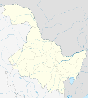 Daoli Location in Heilongjiang | |
| Coordinates: 45°45′20″N 126°37′00″E / 45.7556°N 126.6168°ECoordinates: 45°45′20″N 126°37′00″E / 45.7556°N 126.6168°E[1] | |
| Country | People's Republic of China |
| Province | Heilongjiang |
| Sub-provincial city | Harbin |
| Subdivisions |
18 subdistricts 4 towns 1 township |
| Area[2] | |
| • Total | 479.2 km2 (185.0 sq mi) |
| Elevation | 130 m (430 ft) |
| Population (2010)[3] | |
| • Total | 923,762 |
| • Density | 1,900/km2 (5,000/sq mi) |
| Time zone | China Standard (UTC+8) |
| Area code(s) | 0451 |
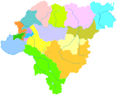
| Harbin district map | |
| Website |
hrbdl |
Daoli District (simplified Chinese: 道里区; traditional Chinese: 道里區; pinyin: Dàolǐ Qū) is one of nine districts of Harbin, the capital of Heilongjiang province, People's Republic of China, forming part of the city's urban core. It is located on the Songhua River. It borders the districts of Songbei to the north, Daowai to the northeast, Nangang to the east, and Shuangcheng to the south, as well as the prefecture-level city of Suihua to the northwest.
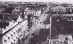
Nowadays, Daoli District is also famous because of Central Street (中央路; Zhōngyāng Lù; Russian: Китайская улица), which is one of the main business streets in Harbin.
Administrative divisions
There are 18 subdistricts, four town, and one township in the district:[4]
Subdistricts (街道)
|
|
Towns (镇)
- Taiping (太平镇)
- Xinfa (新发镇)
- Xinnong (新农镇)
- Yushu (榆树镇)
Township (乡)
- Qunli Township (群力乡)
References
- ↑ Google (2014-07-02). "Daoli Government" (Map). Google Maps. Google. Retrieved 2014-07-02.
- ↑ Harbin Statistical Yearbook 2011 (《哈尔滨统计年鉴2011》). Accessed 8 July 2014.
- ↑ 2010 Census Harbin primary statistics report (《哈尔滨市2010年第六次全国人口普查主要数据公报》). Accessed 8 July 2014.
- ↑ 2011年统计用区划代码和城乡划分代码:道里区 (in Chinese). National Bureau of Statistics of the People's Republic of China. Retrieved 2013-01-29.
External links
This article is issued from Wikipedia - version of the 10/29/2016. The text is available under the Creative Commons Attribution/Share Alike but additional terms may apply for the media files.