Navy Nagar
| Navy Nagar नेव्ही नगर | |
|---|---|
| Neighbourhood | |
|
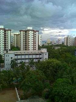
Navy Nagar as viewed from Cody | |
 Navy Nagar | |
| Coordinates: 18°54′04″N 72°48′36″E / 18.9012°N 72.8101°ECoordinates: 18°54′04″N 72°48′36″E / 18.9012°N 72.8101°E | |
| Country | India |
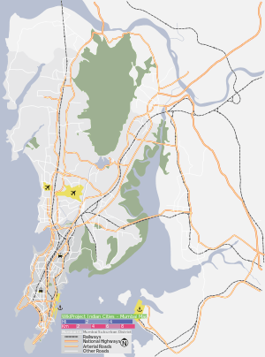
| State | Maharashtra |
| District | Mumbai City |
| Metro | Mumbai |
| Zone | 1 |
| Ward | A |
| Government | |
| • Body | MCGM |
| Elevation | 4 m (13 ft) |
| Languages | |
| • Official | Marathi |
| Time zone | IST (UTC+5:30) |
| PIN | 400 005 |
| Lok Sabha constituency | Mumbai South |
| Vidhan Sabha constituency | Colaba |
| Civic agency | MCGM |
Navy Nagar is a cantonment area in Mumbai, established in 1796.[1] The area is owned and managed solely by the Indian Navy and entry to this area is restricted. Entry and exit points to the area are heavily manned by Naval Police.
Overview
It is located at the extreme south of the city, connected to it through Colaba Causeway. Entry is restricted to the area. The area houses the residences of Naval officers and sailors. The Navy Nagar is situated in two different phases one is old navy nagar and another is new navy nagar. The new navy nagar are situated with several 14 storeys buildings with few old buildings. Within it are enclaved the Tata Institute of Fundamental Research, the institute which does research in higher sciences and the Indian Meteorological Department office of Colaba. Many important officials of the Indian Navy have been known to reside in the cantonment.
Navy Nagar is maintained by the Navy and the law and order is handled by the Naval Police and Military Police. The area is well maintained and has a large amount of greenery including an 18-hole golf course.
During the British rule, the area was known as Duxbury, and had an airstrip. It was also known to be unsafe as there was a jungle. The Afghan Church was one of the earliest structures built there, and the spire was used by sailors to get their bearing. It is Asia's largest Naval armed forces personnel's residential base.
School
Within its premises it has four schools:
- Naval Children School Mumbai
- Kendriya Vidyalaya No 1
- Kendriya Vidyalaya No 2
- Army Public School
- Guru Nanak High School
There is also one school, Kendriya Vidyalaya No 3, located at R.C. Church
Transport
The area is well connected by the public transport of B.E.S.T buses. The nearest railway stations to the area are Churchgate Station and the Chhatrapati Shivaji Terminus Station.