| [3] |
Name on the Register[4] |
Image |
Date listed[5] |
Location |
City or town |
Description |
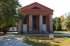
|---|
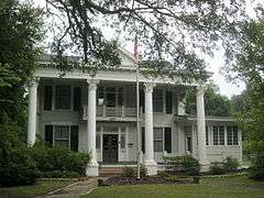
| 1 |
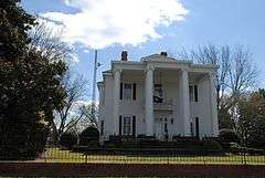
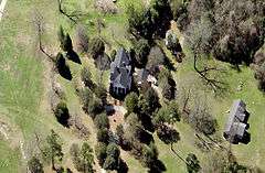
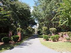
Borough House Plantation |
|
000000001972-03-23-0000March 23, 1972
(#72001224) |
South Carolina Highway 261, 0.8 miles north of its intersection with Secondary Road 76/3 78
33°57′14″N 80°32′16″W / 33.953889°N 80.537778°W / 33.953889; -80.537778 (Borough House Plantation) |
Stateburg |
|
| 2 |
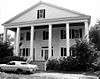
J. Clinton Brogdon House |
|
000000001993-07-01-0000July 1, 1993
(#93000585) |
3755 Boots Branch Rd.
33°48′34″N 80°15′52″W / 33.809444°N 80.264444°W / 33.809444; -80.264444 (J. Clinton Brogdon House) |
Sumter |
|
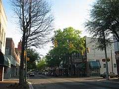
| 3 |
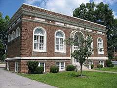
Carnegie Public Library |
|
000000001994-08-05-0000August 5, 1994
(#94000814) |
219 W. Liberty St.
33°55′14″N 80°20′47″W / 33.920556°N 80.346389°W / 33.920556; -80.346389 (Carnegie Public Library) |
Sumter |
|
| 4 |
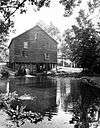
Ellerbe's Mill |
|
000000001974-11-20-0000November 20, 1974
(#74001880) |
About 3 miles south of Rembert off U.S. Route 521 on Rafting Creek
34°04′10″N 80°31′50″W / 34.06944444444445°N 80.53055555555555°W / 34.06944444444445; -80.53055555555555 (Ellerbe's Mill) |
Rembert |
|
| 5 |
Goodwill Parochial School |
|
000000001997-05-30-0000May 30, 1997
(#97000523) |
295 N. Brick Church Rd.
33°54′44″N 80°08′19″W / 33.912222°N 80.138611°W / 33.912222; -80.138611 (Goodwill Parochial School) |
Mayesville |
|
| 6 |
Heriot-Moise House |
|
000000001989-12-21-0000December 21, 1989
(#89002149) |
Junction of U.S. Route 401 and Brewington Rd.
33°57′36″N 80°18′28″W / 33.96°N 80.307778°W / 33.96; -80.307778 (Heriot-Moise House) |
Sumter |
|
| 7 |
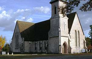
Holy Cross Episcopal Church |
|
000000001973-11-07-0000November 7, 1973
(#73001732) |
South Carolina Highway 261
33°57′45″N 80°31′55″W / 33.9625°N 80.531944°W / 33.9625; -80.531944 (Holy Cross Episcopal Church) |
Stateburg |
|
| 8 |
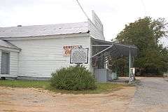
Lenoir Store |
|
000000001997-07-03-0000July 3, 1997
(#97000744) |
3240 Horatio Rd.
34°01′17″N 80°34′05″W / 34.021389°N 80.568056°W / 34.021389; -80.568056 (Lenoir Store) |
Horatio |
|
| 9 |
Lincoln High School |
Upload image |
000000002015-01-27-0000January 27, 2015
(#14001221) |
20-26 Council St.
33°55′08″N 80°20′49″W / 33.9190°N 80.3469°W / 33.9190; -80.3469 (Lincoln High School) |
Sumter |
|
| 10 |
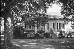
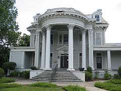
Magnolia Hall |
|
000000001999-09-02-0000September 2, 1999
(#99000101) |
2025 Horatio-Hagood Rd.
34°03′13″N 80°34′08″W / 34.053651°N 80.568779°W / 34.053651; -80.568779 (Magnolia Hall) |
Hagood |
|
| 11 |
Charles T. Mason House |
|
000000001997-07-03-0000July 3, 1997
(#97000745) |
111 Mason Croft
33°55′50″N 80°21′39″W / 33.930487°N 80.360791°W / 33.930487; -80.360791 (Charles T. Mason House) |
Sumter |
|
| 12 |
Mayesville Historic District |
|
000000001979-07-16-0000July 16, 1979
(#79002395) |
Irregular pattern along Lafayette St.
33°59′08″N 80°12′26″W / 33.98555555555556°N 80.20722222222223°W / 33.98555555555556; -80.20722222222223 (Mayesville Historic District) |
Mayesville |
|
| 13 |
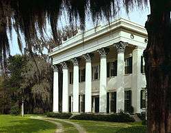
Millford Plantation |
|
000000001971-11-19-0000November 19, 1971
(#71000808) |
West of Pinewood on South Carolina Highway 261
33°44′54″N 80°32′15″W / 33.7484°N 80.53745°W / 33.7484; -80.53745 (Millford Plantation) |
Pinewood |
|
| 14 |
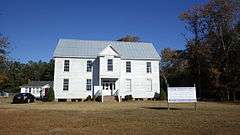
Myrtle Moor |
|
000000001983-01-13-0000January 13, 1983
(#83002210) |
Address Restricted
|
Sumter |
|
| 15 |
O'Donnell House |
|
000000001996-04-25-0000April 25, 1996
(#96000407) |
120 E. Liberty St.
33°55′10″N 80°20′21″W / 33.919444°N 80.339167°W / 33.919444; -80.339167 (O'Donnell House) |
Sumter |
|
| 16 |
Orange Grove |
|
000000001993-08-19-0000August 19, 1993
(#93000845) |
Junction of South Carolina Highways 43 (Black River Rd.) and 441
34°02′42″N 80°26′10″W / 34.045°N 80.436111°W / 34.045; -80.436111 (Orange Grove) |
Dalzell |
|
| 17 |
Pinewood Depot |
|
000000001997-06-10-0000June 10, 1997
(#97000535) |
Junction of East Ave. and Clarke St.
33°44′25″N 80°27′47″W / 33.740278°N 80.463056°W / 33.740278; -80.463056 (Pinewood Depot) |
Pinewood |
|
| 18 |
Poinsett State Park Historic District |
Upload image |
000000002016-05-31-0000May 31, 2016
(#16000311) |
6660 Poinsett Park Rd.
33°48′24″N 80°32′22″W / 33.806667°N 80.539444°W / 33.806667; -80.539444 (Poinsett State Park Historic District) |
Wedgefield |
|
| 19 |
Rip Raps Plantation |
|
000000001978-12-12-0000December 12, 1978
(#78002532) |
East of Sumter on South Carolina Highway 378
33°53′57″N 80°09′03″W / 33.8990339°N 80.150945°W / 33.8990339; -80.150945 (Rip Raps Plantation) |
Sumter |
|
| 20 |
St. Mark's Church |
|
000000001978-01-20-0000January 20, 1978
(#78002530) |
West of Pinewood on South Carolina Highway 51
33°44′50″N 80°30′40″W / 33.747222°N 80.511111°W / 33.747222; -80.511111 (St. Mark's Church) |
Pinewood |
|
| 21 |
Salem Black River Presbyterian Church |
|
000000001978-11-14-0000November 14, 1978
(#78003091) |
East of Sumter on U.S. Route 521
33°55′57″N 80°09′39″W / 33.9325°N 80.160833°W / 33.9325; -80.160833 (Salem Black River Presbyterian Church) |
Sumter |
|
| 22 |
Henry Lee Scarborough House |
|
000000001995-01-20-0000January 20, 1995
(#94001560) |
425 N. Main St.
33°55′42″N 80°20′26″W / 33.928333°N 80.340556°W / 33.928333; -80.340556 (Henry Lee Scarborough House) |
Sumter |
|
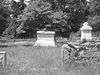
| 23 |
Singleton's Graveyard |
|
000000001976-05-13-0000May 13, 1976
(#76001713) |
6 miles south of Wedgefield off South Carolina Highway 261
33°49′52″N 80°33′15″W / 33.831111°N 80.554167°W / 33.831111; -80.554167 (Singleton's Graveyard) |
Wedgefield |
|
| 24 |
Stateburg Historic District |
|
000000001971-02-24-0000February 24, 1971
(#71000809) |
Roughly bounded by U.S. Route 76 and South Carolina Highways 261 and 441
33°58′13″N 80°30′51″W / 33.97019973°N 80.51407814°W / 33.97019973; -80.51407814 (Stateburg Historic District) |
Sumter |
|
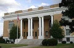
| 25 |
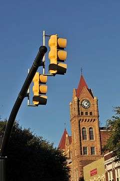
Sumter County Courthouse |
|
000000002004-06-16-0000June 16, 2004
(#04000619) |
141 N. Main St.
33°55′28″N 80°20′29″W / 33.924444°N 80.341389°W / 33.924444; -80.341389 (Sumter County Courthouse) |
Sumter |
|
| 26 |
Sumter Historic District |
|
000000001975-04-21-0000April 21, 1975
(#75001707) |
Commercial area centered around Main and Liberty Sts.
33°55′13″N 80°20′30″W / 33.920389°N 80.341694°W / 33.920389; -80.341694 (Sumter Historic District) |
Sumter |
|
| 27 |
Sumter Town Hall-Opera House |
|
000000001973-05-24-0000May 24, 1973
(#73001733) |
N. Main St.
33°55′15″N 80°20′30″W / 33.920833°N 80.341667°W / 33.920833; -80.341667 (Sumter Town Hall-Opera House) |
Sumter |
|
| 28 |
Temple Sinai |
|
000000001999-01-21-0000January 21, 1999
(#98001645) |
11 Church St.
33°55′18″N 80°20′48″W / 33.921667°N 80.346667°W / 33.921667; -80.346667 (Temple Sinai) |
Sumter |
|
| 29 |
Elizabeth White House |
|
000000001978-03-21-0000March 21, 1978
(#78002531) |
421 N. Main St.
33°55′41″N 80°20′27″W / 33.928056°N 80.340833°W / 33.928056; -80.340833 (Elizabeth White House) |
Sumter |
|
.jpg)