National Register of Historic Places listings in Greenwood County, South Carolina
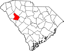
Location of Greenwood County in South Carolina
This is a list of the National Register of Historic Places listings in Greenwood County, South Carolina.
This is intended to be a complete list of the properties and districts on the National Register of Historic Places in Greenwood County, South Carolina, United States. The locations of National Register properties and districts for which the latitude and longitude coordinates are included below, may be seen in a map.[1]
There are 21 properties and districts listed on the National Register in the county, including 1 National Historic Landmark. Another property was once listed but has been removed.
- This National Park Service list is complete through NPS recent listings posted December 2, 2016.[2]
Current listings
| [3] |
Name on the Register[4] |
Image |
Date listed[5] |
Location |
City or town |
Description |
|---|
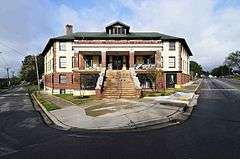
| 1 |
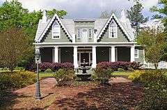
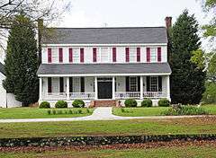
Barratt House |
|
000000001985-09-12-0000September 12, 1985
(#85002382) |
South Carolina Highway 67 and Bryan Dorn Rd.
34°06′37″N 82°07′39″W / 34.110278°N 82.1275°W / 34.110278; -82.1275 (Barratt House) |
Greenwood |
|
| 2 |
J. Wesley Brooks House |
|
000000001973-03-30-0000March 30, 1973
(#73001712) |
2 miles south of Greenwood on U.S. Route 25
34°08′18″N 82°07′48″W / 34.138333°N 82.13°W / 34.138333; -82.13 (J. Wesley Brooks House) |
Greenwood |
|
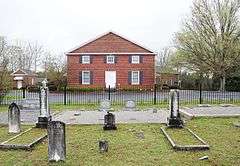
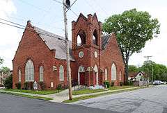
| 3 |
Greenville Presbyterian Church |
|
000000001998-05-20-0000May 20, 1998
(#98000561) |
Greenville Church Rd.
34°20′50″N 82°18′14″W / 34.347222°N 82.303889°W / 34.347222; -82.303889 (Greenville Presbyterian Church) |
Donalds |
|
| 4 |
Kinard House |
|
000000002007-03-07-0000March 7, 2007
(#07000119) |
227 W. Main St.
34°10′27″N 82°01′42″W / 34.174167°N 82.028333°W / 34.174167; -82.028333 (Kinard House) |
Ninety Six |
|
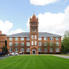
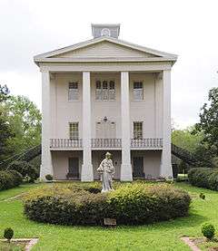
| 5 |
Lander College Old Main Building |
|
000000001984-08-02-0000August 2, 1984
(#84002046) |
Stanley Ave. and Lander St.
34°11′54″N 82°09′52″W / 34.198333°N 82.164444°W / 34.198333; -82.164444 (Lander College Old Main Building) |
Greenwood |
|
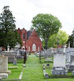
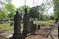
| 6 |
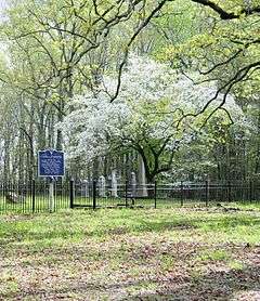
Magnolia Cemetery |
|
000000002004-06-09-0000June 9, 2004
(#04000590) |
416 Magnolia Ave.
34°11′27″N 82°09′16″W / 34.190833°N 82.154444°W / 34.190833; -82.154444 (Magnolia Cemetery) |
Greenwood |
|
| 7 |
Moore-Kinard House |
|
000000001983-08-04-0000August 4, 1983
(#83002198) |
U.S. Route 178 and S-24-44
34°05′18″N 82°02′34″W / 34.088333°N 82.042778°W / 34.088333; -82.042778 (Moore-Kinard House) |
Ninety Six |
|
| 8 |
Mt. Pisgah A.M.E. Church |
|
000000001979-08-16-0000August 16, 1979
(#79002384) |
Hackett Ave. and James St.
34°11′29″N 82°09′12″W / 34.191389°N 82.153333°W / 34.191389; -82.153333 (Mt. Pisgah A.M.E. Church) |
Greenwood |
|
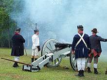
| 9 |
Ninety Six National Historic Site |
|
000000001969-12-03-0000December 3, 1969
(#69000169) |
2 miles south of Ninety Six between South Carolina Highways 27 and 248
34°09′19″N 82°00′46″W / 34.155278°N 82.012778°W / 34.155278; -82.012778 (Ninety Six National Historic Site) |
Ninety Six |
|
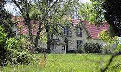
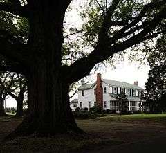
| 10 |
The Oaks |
|
000000002010-12-17-0000December 17, 2010
(#10001040) |
114 Old Puckett's Ferry Rd.
34°15′25″N 82°05′05″W / 34.256944°N 82.084722°W / 34.256944; -82.084722 (The Oaks) |
Coronaca vicinity |
|
| 11 |
Old Cokesbury and Masonic Female College and Conference School |
|
000000001970-08-25-0000August 25, 1970
(#70000589) |
North of Greenwood at the junction of South Carolina Highways 246 and 254
34°16′29″N 82°13′03″W / 34.274722°N 82.2175°W / 34.274722; -82.2175 (Old Cokesbury and Masonic Female College and Conference School) |
Cokesbury |
|
| 12 |
Old Greenwood Cemetery |
|
000000002002-03-01-0000March 1, 2002
(#02000115) |
503 E. Cambridge Ave.
34°11′50″N 82°09′12″W / 34.197222°N 82.153333°W / 34.197222; -82.153333 (Old Greenwood Cemetery) |
Greenwood |
|
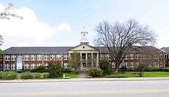
| 13 |
Old Greenwood High School |
|
000000001985-10-10-0000October 10, 1985
(#85003120) |
857 S. Main St.
34°11′08″N 82°09′29″W / 34.185556°N 82.158056°W / 34.185556; -82.158056 (Old Greenwood High School) |
Greenwood |
|
| 14 |
James C. Self House |
Upload image |
000000001987-11-20-0000November 20, 1987
(#87002064) |
595 N. Mathis St.
34°11′38″N 82°10′54″W / 34.193889°N 82.181667°W / 34.193889; -82.181667 (James C. Self House) |
Greenwood |
|
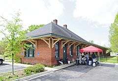
| 15 |
Southern Railway Depot |
|
000000002011-10-06-0000October 6, 2011
(#11000731) |
99 South Carolina Highway 34
34°10′29″N 82°01′27″W / 34.174722°N 82.024167°W / 34.174722; -82.024167 (Southern Railway Depot) |
Ninety Six |
|
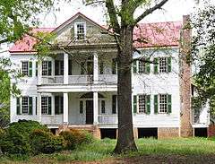
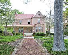
| 16 |
Stony Point |
|
000000001975-06-20-0000June 20, 1975
(#75001700) |
North of Greenwood at the junction of South Carolina Highways 39 and 246
34°16′44″N 82°07′33″W / 34.278889°N 82.125833°W / 34.278889; -82.125833 (Stony Point) |
Greenwood |
|
| 17 |
Sunnyside |
|
000000001978-11-14-0000November 14, 1978
(#78002515) |
105 Dargan Ave.
34°11′07″N 82°09′08″W / 34.185278°N 82.152222°W / 34.185278; -82.152222 (Sunnyside) |
Greenwood |
|
| 18 |
Tabernacle Cemetery |
|
000000002008-08-01-0000August 1, 2008
(#08000736) |
Tabernacle Cemetery Rd., just east of South Carolina Highway 254
34°16′00″N 82°11′02″W / 34.266667°N 82.183889°W / 34.266667; -82.183889 (Tabernacle Cemetery) |
Greenwood |
|
| 19 |
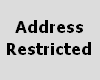
Trapp and Chandler Pottery Site (38GN169) |
|
000000001986-01-06-0000January 6, 1986
(#86000043) |
Address Restricted
|
Kirksey |
|
| 20 |
Vance-Maxwell House |
|
000000001982-03-05-0000March 5, 1982
(#82003866) |
158 E. Cambridge St.
34°11′42″N 82°09′33″W / 34.195°N 82.159167°W / 34.195; -82.159167 (Vance-Maxwell House) |
Greenwood |
|
| 21 |
Ware Shoals Inn |
|
000000002007-11-01-0000November 1, 2007
(#07001130) |
1 Greenwood Ave., N.
34°23′38″N 82°14′49″W / 34.393889°N 82.246944°W / 34.393889; -82.246944 (Ware Shoals Inn) |
Ware Shoals |
|
| [3] |
Name on the Register |
Image |
Date listed | Date removed |
Location |
City or town |
Summary |
|---|
| 1 |
Benjamin Mays Birthplace |
Upload image |
000000001998-05-18-0000May 18, 1998
(#98000414) | 000000002005-12-08-0000December 8, 2005 |
0.5 mi NW of jct. of US 179 and Scott Ferry Rd.
|
Epworth |
It was moved to Greenwood |
See also
References
- ↑ The latitude and longitude information provided in this table was derived originally from the National Register Information System, which has been found to be fairly accurate for about 99% of listings. For about 1% of NRIS original coordinates, experience has shown that one or both coordinates are typos or otherwise extremely far off; some corrections may have been made. A more subtle problem causes many locations to be off by up to 150 yards, depending on location in the country: most NRIS coordinates were derived from tracing out latitude and longitudes off of USGS topographical quadrant maps created under the North American Datum of 1927, which differs from the current, highly accurate WGS84 GPS system used by most on-line maps. Chicago is about right, but NRIS longitudes in Washington are higher by about 4.5 seconds, and are lower by about 2.0 seconds in Maine. Latitudes differ by about 1.0 second in Florida. Some locations in this table may have been corrected to current GPS standards.
- ↑ "National Register of Historic Places: Weekly List Actions". National Park Service, United States Department of the Interior. Retrieved on December 2, 2016.
- 1 2 Numbers represent an ordering by significant words. Various colorings, defined here, differentiate National Historic Landmarks and historic districts from other NRHP buildings, structures, sites or objects.
- ↑ National Park Service (2009-03-13). "National Register Information System". National Register of Historic Places. National Park Service.
- ↑ The eight-digit number below each date is the number assigned to each location in the National Register Information System database, which can be viewed by clicking the number.
|
|---|
|
| Topics | | |
|---|
|
Lists
by county | |
|---|
|
| Lists by city | |
|---|
|
| Other lists | |
|---|
|
|
.jpg)