| [3] |
Name on the Register |
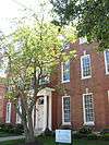
Image |
Date listed[4] |
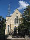
Location |
Description |
|---|
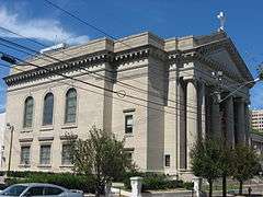
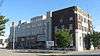
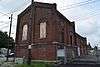
| 1 |
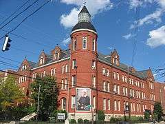
Adath Israel Temple |
|
000000001974-12-31-0000December 31, 1974
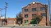
(#74000882) |
834 S. 3rd St.
38°14′35″N 85°45′27″W / 38.243056°N 85.757500°W / 38.243056; -85.757500 (Adath Israel Temple) |
|
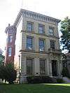
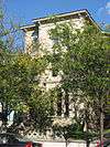
| 2 |
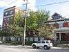
Bayly-Schroering House |
|
000000001978-11-14-0000November 14, 1978
(#78001345) |
1012 S. 4th St.
38°14′18″N 85°45′37″W / 38.238389°N 85.760278°W / 38.238389; -85.760278 (Bayly-Schroering House) |
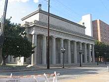
|
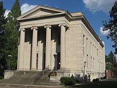
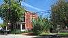
| 3 |
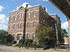
Board of Extension of the Methodist Episcopal Church, South |
|
000000001983-06-03-0000June 3, 1983
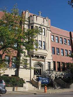
(#83002636) |
1115 S. 4th St.
38°14′13″N 85°45′33″W / 38.236833°N 85.759167°W / 38.236833; -85.759167 (Board of Extension of the Methodist Episcopal Church, South) |
|
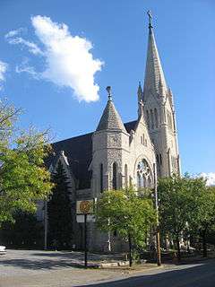
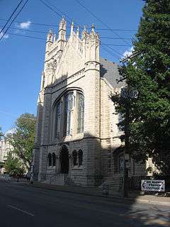
| 4 |
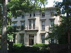
Calvary Episcopal Church |
|
000000001978-01-18-0000January 18, 1978
(#78001347) |
821 S. 4th St.
38°14′36″N 85°45′31″W / 38.243333°N 85.758611°W / 38.243333; -85.758611 (Calvary Episcopal Church) |
|
| 5 |
Church of the Messiah |
|
000000001976-04-21-0000April 21, 1976
(#76000903) |
805 S. 4th St.
38°14′38″N 85°45′30″W / 38.243889°N 85.758333°W / 38.243889; -85.758333 (Church of the Messiah) |
|
| 6 |
College Street Presbyterian Church |
|
000000001978-11-29-0000November 29, 1978
(#78001350) |
113 W. College St.
38°14′36″N 85°45′17″W / 38.243333°N 85.754722°W / 38.243333; -85.754722 (College Street Presbyterian Church) |
|
| 7 |
Cornwall and Brown Houses |
|
000000001978-07-19-0000July 19, 1978
(#78001351) |
957 S. 4th St.
38°14′23″N 85°45′33″W / 38.239722°N 85.759167°W / 38.239722; -85.759167 (Cornwall and Brown Houses) |
|
| 8 |
District #1 |
|
000000001983-06-03-0000June 3, 1983
(#83002655) |
S. Brook and E. Breckinridge St.
38°14′29″N 85°45′05″W / 38.241389°N 85.751389°W / 38.241389; -85.751389 (District #1) |
|
| 9 |
District #2 |
|
000000001983-06-03-0000June 3, 1983
(#83002656) |
W. Breckinridge St. and S. 2nd St.
38°14′31″N 85°45′22″W / 38.241944°N 85.756111°W / 38.241944; -85.756111 (District #2) |
|
| 10 |
William J. Dodd Residence |
|
000000002010-08-05-0000August 5, 2010
(#10000530) |
1448 St. James Court
38°13′39″N 85°45′50″W / 38.227500°N 85.763889°W / 38.227500; -85.763889 (William J. Dodd Residence) |
|
| 11 |
D.H. Ewing & Sons Creamery |
|
000000001983-06-03-0000June 3, 1983
(#83002662) |
981 S. 3rd St.
38°14′20″N 85°45′28″W / 38.238889°N 85.757778°W / 38.238889; -85.757778 (D.H. Ewing & Sons Creamery) |
|
| 12 |
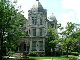
The Filson Club |
|
000000002013-06-20-0000June 20, 2013
(#13000476) |
118 W. Breckinridge St.
38°14′28″N 85°45′19″W / 38.241111°N 85.755139°W / 38.241111; -85.755139 (The Filson Club) |
|
| 13 |
First Christian Church |
|
000000001979-07-16-0000July 16, 1979
(#79001005) |
850 S. 4th St.
38°14′32″N 85°45′34″W / 38.242222°N 85.759444°W / 38.242222; -85.759444 (First Christian Church) |
|
| 14 |
First Street District |
|
000000001984-07-14-0000July 14, 1984
(#84001555) |
Roughly bounded by E. Breckinridge, E. Kentucky, and Interstate 65
38°14′26″N 85°45′15″W / 38.240556°N 85.754167°W / 38.240556; -85.754167 (First Street District) |
|
| 15 |
Fourth Avenue Methodist Episcopal Church |
|
000000001979-07-16-0000July 16, 1979
(#79001006) |
318 W. St. Catherine St.
38°14′14″N 85°45′35″W / 38.237222°N 85.759722°W / 38.237222; -85.759722 (Fourth Avenue Methodist Episcopal Church) |
|
| 16 |
Harig, Koop & Company-Columbia Mantel Company |
|
000000001996-03-14-0000March 14, 1996
(#96000279) |
845 S. 9th St.
38°14′36″N 85°46′01″W / 38.243333°N 85.766944°W / 38.243333; -85.766944 (Harig, Koop & Company-Columbia Mantel Company) |
|
| 17 |
Jewish Hospital Complex |
|
000000001994-07-22-0000July 22, 1994
(#94000732) |
236 E. Kentucky St.
38°14′16″N 85°45′05″W / 38.237778°N 85.751389°W / 38.237778; -85.751389 (Jewish Hospital Complex) |
|
| 18 |
Kentucky Street School |
|
000000001983-06-03-0000June 3, 1983
(#83002691) |
119 E. Kentucky St.
38°14′19″N 85°45′13″W / 38.238611°N 85.753611°W / 38.238611; -85.753611 (Kentucky Street School) |
|
| 19 |
Landward House |
|
000000001973-09-20-0000September 20, 1973
(#73000809) |
1385-1387 S. 4th St.
38°13′46″N 85°45′39″W / 38.229444°N 85.760833°W / 38.229444; -85.760833 (Landward House) |
|
| 20 |
Louisville Gas and Electric Company Service Station Complex |
|
000000002015-03-17-0000March 17, 2015
(#15000082) |
1228 S. 7th St.
38°14′03″N 85°45′56″W / 38.2343°N 85.7655°W / 38.2343; -85.7655 (Louisville Gas and Electric Company Service Station Complex) |
|
| 21 |
Louisville Male High School |
|
000000001979-04-18-0000April 18, 1979
(#79001011) |
911 S. Brook St.
38°14′26″N 85°45′08″W / 38.240556°N 85.752222°W / 38.240556; -85.752222 (Louisville Male High School) |
|
| 22 |
Louisville War Memorial Auditorium |
|
000000001977-12-27-0000December 27, 1977
(#77000625) |
970 S. 4th St.
38°14′22″N 85°45′36″W / 38.239444°N 85.76°W / 38.239444; -85.76 (Louisville War Memorial Auditorium) |
|
| 23 |
Dr. J.B. Marvin House |
|
000000001983-06-03-0000June 3, 1983
(#83002700) |
809 S. 4th St.
38°14′38″N 85°45′31″W / 38.243889°N 85.758611°W / 38.243889; -85.758611 (Dr. J.B. Marvin House) |
|
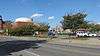
| 24 |
Old Louisville Residential District |
|
000000001975-02-07-0000February 7, 1975
(#75000772) |
Irregular pattern roughly bounded by S. 7th St. on the west, North-South Expressway (Interstate 65) on the east, Kentucky St. on the north, and Avery St. on the south; also roughly bounded by Interstate 65 and 7th, Kentucky, and Avery Sts.
38°13′46″N 85°45′33″W / 38.229444°N 85.759167°W / 38.229444; -85.759167 (Old Louisville Residential District) |
Second set of boundaries represents a boundary increase of 000000001984-07-12-0000July 12, 1984
|
| 25 |
The Olympic |
|
000000002007-07-09-0000July 9, 2007
(#07000677) |
223 W. Breckinridge St.
38°14′31″N 85°45′26″W / 38.241944°N 85.757222°W / 38.241944; -85.757222 (The Olympic) |
|
| 26 |
Porter-Todd House |
|
000000001979-04-30-0000April 30, 1979
(#79001013) |
929 S. 4th St.
38°14′24″N 85°45′33″W / 38.240000°N 85.759167°W / 38.240000; -85.759167 (Porter-Todd House) |
|
| 27 |
Presentation Academy |
|
000000001978-12-22-0000December 22, 1978
(#78001364) |
861 S. 4th St.
38°14′32″N 85°45′32″W / 38.242222°N 85.758889°W / 38.242222; -85.758889 (Presentation Academy) |
|
| 28 |
Rauchfuss Houses |
|
000000001982-08-12-0000August 12, 1982
(#82002716) |
837-847 S. Brook St.
38°14′29″N 85°45′08″W / 38.241389°N 85.752222°W / 38.241389; -85.752222 (Rauchfuss Houses) |
|
| 29 |
St. James-Belgravia Historic District |
|
000000001972-12-05-0000December 5, 1972
(#72000538) |
Roughly bounded by Central Park, S. 4th, S. 6th, and Hill Sts.
38°13′40″N 85°45′48″W / 38.227778°N 85.763333°W / 38.227778; -85.763333 (St. James-Belgravia Historic District) |
|
| 30 |
Steam Engine Company No. 7 |
|
000000001980-11-07-0000November 7, 1980
(#80001631) |
821 S. 6th St.
38°14′38″N 85°45′43″W / 38.243750°N 85.761944°W / 38.243750; -85.761944 (Steam Engine Company No. 7) |
|
| 31 |
Thierman Apartments |
|
000000001983-06-03-0000June 3, 1983
(#83002740) |
416-420 W. Breckinridge St.
38°14′30″N 85°45′36″W / 38.241667°N 85.760000°W / 38.241667; -85.760000 (Thierman Apartments) |
|
| 32 |
Tompkins-Buchanan House |
|
000000001977-04-27-0000April 27, 1977
(#77000628) |
851 S. 4th St.
38°14′33″N 85°45′32″W / 38.242500°N 85.758889°W / 38.242500; -85.758889 (Tompkins-Buchanan House) |
|