National Register of Historic Places listings in Hancock County, Mississippi
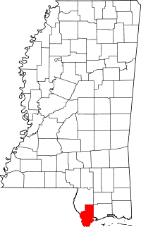
Location of Hancock County in Mississippi
This is a list of the National Register of Historic Places listings in Hancock County, Mississippi.
This is intended to be a complete list of the properties and districts on the National Register of Historic Places in Hancock County, Mississippi, United States. Latitude and longitude coordinates are provided for many National Register properties and districts; these locations may be seen together in a map.[1]
There are 17 properties and districts listed on the National Register in the county, including 1 National Historic Landmark. Another 4 properties were once listed but have been removed.
- This National Park Service list is complete through NPS recent listings posted December 16, 2016.[2]
Current listings
| [3] | Name on the Register[4] | Image | Date listed[5] | Location | City or town | Description |
|---|---|---|---|---|---|---|
| 1 | Beach Boulevard Historic District | Upload image | (#80002239) |
Roughly bounded by Beach Boulevard, Necaise Ave., Seminary Dr., and 2nd and 3rd Sts. 30°18′24″N 89°20′30″W / 30.306667°N 89.341667°W |
Bay St. Louis | |
| 2 | Building at 242 St. Charles Street |  |
(#80002240) |
242 St. Charles St. 30°18′12″N 89°20′35″W / 30.30322°N 89.34305°W |
Bay St. Louis | |
| 3 | Claiborne Site (22Ha501) | Upload image | (#82000574) |
Address Restricted |
Pearlington | |
| 4 | House at 5098 MS 604 | Upload image | (#15000985) |
5098 MS 604 30°14′34″N 89°36′34″W / 30.242693°N 89.609546°W |
Pearlington | |
| 5 | Jackson Landing Site | Upload image | (#73001009) |
Address Restricted |
Pearlington | |
| 6 | Main Street Historic District |  |
(#80002241) |
Main St. 30°18′56″N 89°20′37″W / 30.315556°N 89.343611°W |
Bay St. Louis | |
| 7 | Nugent Site (22HA592) | Upload image | (#88000307) |
Address Restricted |
Kiln | |
| 8 | Old Bay St. Louis Historic District | Upload image | (#10000441) |
Roughly bounded by Beach Boulevard and 3rd St. on the east, Breath Ln. and Highway 90 on the north, Seminary Dr., St. Francis St., and Old Spanish Trail on the west, and Carre Ct., Washington St., and Bookter St. on the south 30°18′32″N 89°19′48″W / 30.308889°N 89.33°W |
Bay St. Louis | |
| 9 | Rocket Propulsion Test Complex |  |
(#85002805) |
National Space Technology Laboratories 30°21′56″N 89°35′13″W / 30.365556°N 89.586944°W |
Bay St. Louis | |
| 10 | SJ Mound (22HA594) | Upload image | (#88000304) |
Address Restricted |
Pearlington | |
| 11 | Sycamore Street Historic District | Upload image | (#80002242) |
Sycamore St. 30°18′31″N 89°20′39″W / 30.308611°N 89.344167°W |
Bay St. Louis | |
| 12 | Three Sisters Shell Midden (22-Ha-596) | Upload image | (#88001138) |
Address Restricted |
Pearlington | |
| 13 | Up the Tree Shell Midden (22HA595) | Upload image | (#88000306) |
Address Restricted |
Pearlington | |
| 14 | Washington Street Historic District | Upload image | (#80002243) |
Washington St. 30°18′24″N 89°20′30″W / 30.306667°N 89.341667°W |
Bay St. Louis | |
| 15 | Waveland Elementary School |  |
(#14000273) |
335 Coleman Ave. 30°17′11″N 89°22′28″W / 30.286299°N 89.374382°W |
Waveland | Now houses the Ground Zero Hurricane Museum |
| 16 | Webb School/Gulf Coast Community Action Agency |  |
(#86003554) |
300 3rd St. 30°18′16″N 89°20′19″W / 30.3044°N 89.33853°W |
Bay St. Louis | |
| 17 | Williams Site (22-Ha-585) | Upload image | (#88001137) |
Address Restricted |
Pearlington |
Former listings
| [3] | Name on the Register | Image | Date listed | Date removed | Location | City or town | Summary |
|---|---|---|---|---|---|---|---|
| 1 | Glen Oaks | Upload image | (#86003271) | 972 South Beach Boulevard |
Bay St. Louis | Also known as the Kimbrough House. Destroyed by Hurricane Katrina in 2005.[6] | |
| 2 | Onward Oaks | Upload image | (#96001265) | 972 South Beach Boulevard |
Bay St. Louis | Suffered major damage from Hurricane Camille in 1969. Destroyed by Hurricane Katrina in 2005.[7] | |
| 3 | Taylor House | Upload image | (#86003273) | 808 North Beach Boulevard |
Bay St. Louis | Destroyed by Hurricane Katrina in 2005.[8] | |
| 4 | Taylor School | Upload image | (#87000209) | 116 Leonard Street |
Bay St. Louis | Destroyed by Hurricane Katrina in 2005.[9] |
See also
| Wikimedia Commons has media related to National Register of Historic Places in Hancock County, Mississippi. |
- List of National Historic Landmarks in Mississippi
- National Register of Historic Places listings in Mississippi
References
- ↑ The latitude and longitude information provided in this table was derived originally from the National Register Information System, which has been found to be fairly accurate for about 99% of listings. For about 1% of NRIS original coordinates, experience has shown that one or both coordinates are typos or otherwise extremely far off; some corrections may have been made. A more subtle problem causes many locations to be off by up to 150 yards, depending on location in the country: most NRIS coordinates were derived from tracing out latitude and longitudes off of USGS topographical quadrant maps created under the North American Datum of 1927, which differs from the current, highly accurate WGS84 GPS system used by most on-line maps. Chicago is about right, but NRIS longitudes in Washington are higher by about 4.5 seconds, and are lower by about 2.0 seconds in Maine. Latitudes differ by about 1.0 second in Florida. Some locations in this table may have been corrected to current GPS standards.
- ↑ "National Register of Historic Places: Weekly List Actions". National Park Service, United States Department of the Interior. Retrieved on December 16, 2016.
- 1 2 Numbers represent an ordering by significant words. Various colorings, defined here, differentiate National Historic Landmarks and historic districts from other NRHP buildings, structures, sites or objects.
- ↑ National Park Service (2009-03-13). "National Register Information System". National Register of Historic Places. National Park Service.
- ↑ The eight-digit number below each date is the number assigned to each location in the National Register Information System database, which can be viewed by clicking the number.
- ↑
- ↑
- ↑
- ↑
| Topics | |
|---|---|
| Lists by states |
|
| Lists by insular areas | |
| Lists by associated states | |
| Other areas | |
| |
Municipalities and communities of Hancock County, Mississippi, United States | ||
|---|---|---|
| Cities | | |
| CDPs | ||
| Unincorporated communities | ||
This article is issued from Wikipedia - version of the 7/16/2016. The text is available under the Creative Commons Attribution/Share Alike but additional terms may apply for the media files.