Mount Morris, Michigan
| City of Mount Morris | |
|---|---|
| City | |
 Location of Mount Morris within Genesee County, Michigan | |
| Coordinates: 43°7′12″N 83°42′47″W / 43.12000°N 83.71306°W | |
| Country | United States |
| State | Michigan |
| County | Genesee |
| Government | |
| • Mayor | Daniel J. Lavelle |
| Area[1] | |
| • Total | 1.20 sq mi (3.11 km2) |
| • Land | 1.20 sq mi (3.11 km2) |
| • Water | 0 sq mi (0 km2) |
| Elevation | 774 ft (236 m) |
| Population (2010)[2] | |
| • Total | 3,086 |
| • Estimate (2012[3]) | 3,029 |
| • Density | 2,571.7/sq mi (992.9/km2) |
| Time zone | EST (UTC-5) |
| • Summer (DST) | EDT (UTC-4) |
| ZIP code | 48458 |
| Area code(s) | 810 |
| FIPS code | 26-55960[4] |
| GNIS feature ID | 0632820[5] |
Mount Morris is a city in Genesee County in the U.S. state of Michigan. The population was 3,086 at the 2010 census. The city is adjacent to Mount Morris Township, but is politically independent.
History
Benjamin Pearson was the first settler in the area in 1833. In 1836, Frederick Walker was the first to settle within the future village site. A post office named Mount Morris was established on July 11, 1837, with Charles N. Beecher as the first postmaster. The name of the office was changed to Genesee on January 19, 1839, and back to Mount Morris on April 25, 1857. The name became Mount Morris Station on April 17, 1865 and finally back to Mount Morris on March 9, 1874. Development was spurred with the building of a line of the Pere Marquette Railway (now owned by Saginaw Bay Southern Railway) in 1857. The settlement was first platted as Dover in 1862 and was incorporated as the village of Mount Morris in 1867. It reincorporated as a city in 1929. It was named after Mount Morris, New York, because many of the early settlers had come from there.[6] The current mayor of Mount Morris is Mayor Daniel J. Lavelle.
Geography
According to the United States Census Bureau, the city has a total area of 1.20 square miles (3.11 km2), all land.[1]
Demographics
| Historical population | |||
|---|---|---|---|
| Census | Pop. | %± | |
| 1880 | 502 | — | |
| 1890 | 351 | −30.1% | |
| 1900 | 416 | 18.5% | |
| 1910 | 513 | 23.3% | |
| 1920 | 1,174 | 128.8% | |
| 1930 | 1,982 | 68.8% | |
| 1940 | 2,237 | 12.9% | |
| 1950 | 2,890 | 29.2% | |
| 1960 | 3,484 | 20.6% | |
| 1970 | 3,778 | 8.4% | |
| 1980 | 3,246 | −14.1% | |
| 1990 | 3,292 | 1.4% | |
| 2000 | 3,194 | −3.0% | |
| 2010 | 3,086 | −3.4% | |
| Est. 2015 | 2,964 | [7] | −4.0% |
Coordinates: 43°07′N 83°42′W / 43.117°N 83.700°W
2010 census
As of the census[2] of 2010, there were 3,086 people, 1,317 households, and 780 families residing in the city. The population density was 2,571.7 inhabitants per square mile (992.9/km2). There were 1,505 housing units at an average density of 1,254.2 per square mile (484.2/km2). The racial makeup of the city was 80.1% White, 13.4% African American, 0.6% Native American, 0.5% Asian, 1.1% from other races, and 4.3% from two or more races. Hispanic or Latino of any race were 4.4% of the population.
There were 1,317 households of which 35.9% had children under the age of 18 living with them, 31.4% were married couples living together, 22.0% had a female householder with no husband present, 5.8% had a male householder with no wife present, and 40.8% were non-families. 34.2% of all households were made up of individuals and 9.3% had someone living alone who was 65 years of age or older. The average household size was 2.34 and the average family size was 2.98.
The median age in the city was 34 years. 27.1% of residents were under the age of 18; 9.6% were between the ages of 18 and 24; 28.2% were from 25 to 44; 25.8% were from 45 to 64; and 9.4% were 65 years of age or older. The gender makeup of the city was 46.2% male and 53.8% female.
As of 2013, estimates show drastic changes from 2000. The median income for a household in the city was $21,778, and the median income for a family was $28,864. For full-time, year-round workers, males had a median income of $51,467 versus $29,455 for females. The per capita income for the city was $13,340. About 34.6% of families and 38.4% of the population were below the poverty line, including 57.6% of those under age 18 and 9.6% of those age 65 or over.
2000 census
As of the census[4] of 2000, there were 3,194 people, 1,312 households, and 826 families residing in the city. The population density was 2,660 inhabitants per square mile (1,030/km2). There were 1,402 housing units at an average density of 1,167.6 per square mile (450.8/km2). The racial makeup of the city was 93.14% White, 3.07% African American, 0.59% Native American, 0.41% Asian, 0.03% Pacific Islander, 0.63% from other races, and 2.13% from two or more races. Hispanic or Latino of any race were 2.22% of the population.
There were 1,312 households out of which 35.1% had children under the age of 18 living with them, 41.4% were married couples living together, 17.2% had a female householder with no husband present, and 37.0% were non-families. 30.5% of all households were made up of individuals and 10.5% had someone living alone who was 65 years of age or older. The average household size was 2.43 and the average family size was 3.04.
In the city the population was spread out with 27.9% under the age of 18, 11.2% from 18 to 24, 30.9% from 25 to 44, 19.7% from 45 to 64, and 10.2% who were 65 years of age or older. The median age was 32 years. For every 100 females there were 91.0 males. For every 100 females age 18 and over, there were 85.9 males.
The median income for a household in the city was $32,617, and the median income for a family was $36,389. Males had a median income of $31,318 versus $23,828 for females. The per capita income for the city was $19,132. About 13.0% of families and 14.5% of the population were below the poverty line, including 25.1% of those under age 18 and none of those age 65 or over.
References
- 1 2 "US Gazetteer files 2010". United States Census Bureau. Retrieved 2012-11-25.
- 1 2 "American FactFinder". United States Census Bureau. Retrieved 2012-11-25.
- ↑ "Population Estimates". United States Census Bureau. Retrieved 2013-06-03.
- 1 2 "American FactFinder". United States Census Bureau. Retrieved 2008-01-31.
- ↑ "US Board on Geographic Names". United States Geological Survey. 2007-10-25. Retrieved 2008-01-31.
- ↑ Romig, Walter (1986) [1973]. Michigan Place Names. Detroit, Michigan: Wayne State University Press. ISBN 0-8143-1838-X.
- ↑ "Annual Estimates of the Resident Population for Incorporated Places: April 1, 2010 to July 1, 2015". Retrieved July 2, 2016.
- ↑ "Census of Population and Housing". Census.gov. Retrieved June 4, 2015.
Municipalities and communities of Genesee County, Michigan, United States | ||
|---|---|---|
| Cities | 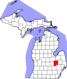 | |
| Villages | ||
| Charter townships | ||
| General law townships | ||
| CDPs | ||
| Other unincorporated communities | ||
| Footnotes | ‡This populated place also has portions in an adjacent county or counties | |