Flushing, Michigan
| City of Flushing | |
|---|---|
| City | |
 Location of Flushing within Genesee County, Michigan | |
| Coordinates: 43°3′47″N 83°51′4″W / 43.06306°N 83.85111°W | |
| Country | United States |
| State | Michigan |
| County | Genesee |
| Platted | 1840 |
| Incorporated village | 1877 |
| City Status | 1964 |
| Government | |
| • Type | Council-manager |
| • Mayor | Kevin Keane |
| • Mayor Pro-Tem | Richard Bade |
| • City Manager | Brad Barrett |
| Area[1] | |
| • Total | 3.79 sq mi (9.82 km2) |
| • Land | 3.62 sq mi (9.38 km2) |
| • Water | 0.17 sq mi (0.44 km2) 4.49% |
| Elevation | 699 ft (213 m) |
| Population (2010)[2] | |
| • Total | 8,389 |
| • Estimate (2012[3]) | 8,247 |
| • Density | 2,317.4/sq mi (894.8/km2) |
| Time zone | EST (UTC-5) |
| • Summer (DST) | EDT (UTC-4) |
| ZIP code | 48433 |
| Area code(s) | 810 |
| FIPS code | 26-29200[4] |
| GNIS feature ID | 0626199[5] |
| Website | flushingcity.com |
Flushing is a city in Genesee County in the U.S. state of Michigan. The population was 8,389 at the 2010 census. Flushing is considered a suburb of Flint. It is situated within the survey area of Flushing Charter Township, but is administratively autonomous.
The city was named after the township after the name Dover was turned down for the township by the state legislature as it was already being used by another township. Instead the legislature selected Flushing.[6]
History
In 1835, Charles Seymour purchased land here. Horace Jerome came in 1836 for water power. The duo ran a sawmill. In 1840, the community was platted by Seymour. Charles sold out to his brother James Seymour in 1843. James then made a second plat in 1847.[6] Previous to 1866, district 2 was formed with the community was a part of the district. On July 30, 1873, village women formed the Flushing Ladies' Association.[7]
In 1874, a subscription private fire department, the Wolverine Fire Company, was formed with 35 members and Arza N. Niles as first chief engineer. Wolverine paid for a small engine designed by Captain Haas of Flint of his own design and patent.[7]
Flushing was incorporated as a village on March 21, 1877 with its first election held on May 8, 1877. Oscar F. Clarke was elected as the first village president. After incorporation, the fire company turned over its equipment to the village. In 1878, the Haas engine was instrument in containing a major fire in the business district to just a saloon and hotel. The Flushing Patrol, the village's first professional newspaper, was founded on October 18 1878 by D. C. Ashun.[7]
Geography
The Flint River flows through Flushing.
According to the United States Census Bureau, the city has a total area of 3.79 square miles (9.82 km2), of which 3.62 square miles (9.38 km2) is land and 0.17 square miles (0.44 km2) is water.[1]
Demographics
| Historical population | |||
|---|---|---|---|
| Census | Pop. | %± | |
| 1860 | 406 | — | |
| 1870 | 687 | 69.2% | |
| 1880 | 690 | 0.4% | |
| 1890 | 965 | 39.9% | |
| 1900 | 900 | −6.7% | |
| 1910 | 938 | 4.2% | |
| 1920 | 1,169 | 24.6% | |
| 1930 | 1,723 | 47.4% | |
| 1940 | 1,806 | 4.8% | |
| 1950 | 2,226 | 23.3% | |
| 1960 | 3,761 | 69.0% | |
| 1970 | 7,190 | 91.2% | |
| 1980 | 8,624 | 19.9% | |
| 1990 | 8,542 | −1.0% | |
| 2000 | 8,348 | −2.3% | |
| 2010 | 8,389 | 0.5% | |
| Est. 2015 | 8,086 | [8] | −3.6% |
2010 census
As of the census[2] of 2010, there were 8,389 people, 3,574 households, and 2,307 families residing in the city. The population density was 2,317.4 inhabitants per square mile (894.8/km2). There were 3,816 housing units at an average density of 1,054.1 per square mile (407.0/km2). The racial makeup of the city was 94.8% White, 2.4% African American, 0.4% Native American, 0.4% Asian, 0.3% from other races, and 1.6% from two or more races. Hispanic or Latino of any race were 2.2% of the population.
There were 3,574 households of which 28.0% had children under the age of 18 living with them, 48.3% were married couples living together, 12.4% had a female householder with no husband present, 3.9% had a male householder with no wife present, and 35.5% were non-families. 32.7% of all households were made up of individuals and 17.1% had someone living alone who was 65 years of age or older. The average household size was 2.30 and the average family size was 2.90.
The median age in the city was 45.1 years. 21.7% of residents were under the age of 18; 7.4% were between the ages of 18 and 24; 20.8% were from 25 to 44; 28.4% were from 45 to 64; and 21.7% were 65 years of age or older. The gender makeup of the city was 46.1% male and 53.9% female.
2000 census
As of the census[4] of 2000, there were 8,348 people, 3,435 households, and 2,366 families residing in the city. The population density was 1,936.7 per square mile (747.8/km²). There were 3,558 housing units at an average density of 825.4 per square mile (318.7/km²). The racial makeup of the city was 96.98% White, 0.63% African American, 0.32% Native American, 0.40% Asian, 0.04% Pacific Islander, 0.37% from other races, and 1.26% from two or more races. Hispanic or Latino of any race were 1.61% of the population.
There were 3,435 households out of which 29.7% had children under the age of 18 living with them, 55.8% were married couples living together, 10.2% had a female householder with no husband present, and 31.1% were non-families. 28.4% of all households were made up of individuals and 14.3% had someone living alone who was 65 years of age or older. The average household size was 2.38 and the average family size was 2.92.
In the city the population was spread out with 23.0% under the age of 18, 6.5% from 18 to 24, 24.5% from 25 to 44, 26.3% from 45 to 64, and 19.7% who were 65 years of age or older. The median age was 43 years. For every 100 females there were 84.8 males. For every 100 females age 18 and over, there were 80.7 males.
The median income for a household in the city was $54,010, and the median income for a family was $64,726. Males had a median income of $52,794 versus $31,502 for females. The per capita income for the city was $24,697. About 4.4% of families and 4.7% of the population were below the poverty line, including 6.3% of those under age 18 and 6.9% of those age 65 or over.
Coordinates: 43°3′47″N 83°51′4″W / 43.06306°N 83.85111°W
References
- 1 2 "US Gazetteer files 2010". United States Census Bureau. Retrieved 2012-11-25.
- 1 2 "American FactFinder". United States Census Bureau. Retrieved 2012-11-25.
- ↑ "Population Estimates". United States Census Bureau. Retrieved 2013-06-03.
- 1 2 "American FactFinder". United States Census Bureau. Retrieved 2008-01-31.
- ↑ "US Board on Geographic Names". United States Geological Survey. 2007-10-25. Retrieved 2008-01-31.
- 1 2 Romig, Walter (October 1, 1986) [1973]. Michigan Place Names: The History of the Founding and the Naming of More Than Five Thousand Past and Present Michigan Communities. Great Lakes Books Series (Paperback). Detroit, Michigan: Wayne State University Press. p. 201. ISBN 081431838X. ISBN 978-0814318386.
- 1 2 3 Ellis, Franklin (1879). History of Genesee county, Michigan. With illustrations and biographical sketches of its prominent men and pioneers. Philadelphia, PA.: Everts & Abbott. pp. 274–276.
- ↑ "Annual Estimates of the Resident Population for Incorporated Places: April 1, 2010 to July 1, 2015". Retrieved July 2, 2016.
- ↑ "Census of Population and Housing". Census.gov. Retrieved June 4, 2015.
Municipalities and communities of Genesee County, Michigan, United States | ||
|---|---|---|
| Cities | 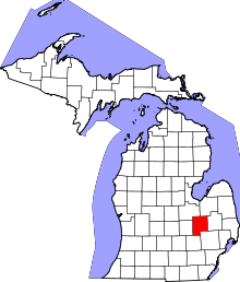 | |
| Villages | ||
| Charter townships | ||
| General law townships | ||
| Unincorporated communities | ||
| Footnotes | ‡This populated place also has portions in an adjacent county or counties | |