Burton, Michigan
| City of Burton | |
|---|---|
| City | |
 Location of Burton, Michigan | |
| Coordinates: 42°59′28″N 83°38′7″W / 42.99111°N 83.63528°WCoordinates: 42°59′28″N 83°38′7″W / 42.99111°N 83.63528°W | |
| Country | United States |
| State | Michigan |
| County | Genesee |
| Settled | 1831 |
| Township Organized | 1855/1856 |
| Incorporated | 1972 |
| Government | |
| • Type | Strong Mayor-Council |
| • Mayor | Paula Zelenko[1] |
| • Council President | Tom Martinbianco |
| • Vice President | Danny Wells |
| • Council | Ellen Ellenburg |
| • Council | Vaughn Smith |
| Area[2] | |
| • Total | 23.43 sq mi (60.68 km2) |
| • Land | 23.36 sq mi (60.50 km2) |
| • Water | 0.07 sq mi (0.18 km2) |
| Elevation | 771 ft (235 m) |
| Population (2010)[3] | |
| • Total | 29,999 |
| • Estimate (2012[4]) | 29,432 |
| • Density | 1,284.2/sq mi (495.8/km2) |
| Time zone | EST (UTC-5) |
| • Summer (DST) | EDT (UTC-4) |
| ZIP code | 48439, 48509, 48519, 48529 |
| Area code(s) | 810 |
| FIPS code | 26-12060 |
| GNIS feature ID | 1675445[5] |
| Website | burtonmi.gov |
Burton is a city in Genesee County in the state of Michigan and a suburb of Flint. The population was 29,999 at the 2010 census, making Burton the second largest city in Genesee County.
Neighborhoods
- Belsay is on Belsay Road at the rail track north of I-69 and Court Street and south of Davison Road.43°01′35″N 83°35′45″W / 43.02639°N 83.59583°W.[6][7]
- Lapeer Heights is at Belsay Road and Roberta Road and south of Lapeer Road.43°00′31″N 83°35′42″W / 43.00861°N 83.59500°W.[6][8]
History
Although there were Native Americans and trappers whom lived on land earlier, and even some who attempted to settle by there,[9][10] many of the original settlers of Burton came from the towns of Adams and Henderson in Jefferson County, New York. For 20 years, this area was known as the Atherton settlement, after brothers Shubael and Perus Atherton and nephew Pliny Atherton Skinner (and later joined by another brother, Adonijah), who settled on the Thread Creek in 1835.[11] Atherton descendants still live in Burton in 2014.
The City of Burton was organized as Burton Township, in 1855. Burton Township had first been a part of who got what taxable land. The North part of Burton was part of Kearsley Township along with the Southern part of Genesee Township from 1839 until 1843 when the township was merged back (for school purposes) into Flint Township.[10][11] When the City of Flint incorporated, Burton Township was separated from Flint Township by the Genesee County Board of Supervisors on October 12, 1855, although the first township meeting did not take place until April 7, 1856, which is sometimes taken as the actual date of organization.[11] Over the years, large portions of the northern and western sides of the township were annexed by the City of Flint for revenues. On May 16, 1972, township residents voted to incorporate and the City of Burton was officially formed July 1 of that year.[12]
Geography
According to the United States Census Bureau, the city has a total area of 23.43 square miles (60.68 km2), of which 23.36 square miles (60.50 km2) is land and 0.07 square miles (0.18 km2) is water.[2]
Demographics
| Historical population | |||
|---|---|---|---|
| Census | Pop. | %± | |
| 1880 | 1,363 | — | |
| 1890 | 1,233 | −9.5% | |
| 1900 | 1,145 | −7.1% | |
| 1910 | 987 | −13.8% | |
| 1920 | 2,154 | 118.2% | |
| 1930 | 6,727 | 212.3% | |
| 1940 | 10,909 | 62.2% | |
| 1950 | 18,171 | 66.6% | |
| 1960 | 29,700 | 63.4% | |
| 1970 | 32,540 | 9.6% | |
| 1980 | 29,976 | −7.9% | |
| 1990 | 27,617 | −7.9% | |
| 2000 | 30,308 | 9.7% | |
| 2010 | 29,999 | −1.0% | |
| Est. 2015 | 28,788 | [13] | −4.0% |
| Township until after 1970 census. 2012 Estimate[15] | |||
2010 census
As of the census[3] of 2010, there were 29,999 people, 11,964 households, and 8,041 families residing in the city. The population density was 1,284.2 inhabitants per square mile (495.8/km2). There were 13,075 housing units at an average density of 559.7 per square mile (216.1/km2). The racial makeup of the city was 88.1% White, 7.3% African American, 0.6% Native American, 0.6% Asian, 0.7% from other races, and 2.5% from two or more races. Hispanic or Latino of any race were 3.1% of the population.
There were 11,964 households of which 33.1% had children under the age of 18 living with them, 45.2% were married couples living together, 16.3% had a female householder with no husband present, 5.7% had a male householder with no wife present, and 32.8% were non-families. 27.0% of all households were made up of individuals and 10.3% had someone living alone who was 65 years of age or older. The average household size was 2.50 and the average family size was 3.00.
The median age in the city was 38.6 years. 24% of residents were under the age of 18; 8.8% were between the ages of 18 and 24; 25.9% were from 25 to 44; 28% were from 45 to 64; and 13.2% were 65 years of age or older. The gender makeup of the city was 48.8% male and 51.2% female.
2000 census
As of the census of 2000, there were 30,308 people, 11,699 households, and 8,165 families residing in the city. The population density was 1,291.3 per square mile (498.6/km²). There were 12,348 housing units at an average density of 526.1 per square mile (203.1/km²). The racial makeup of the city was 92.09% White, 3.55% African American, 0.76% Native American, 0.74% Asian, 0.03% Pacific Islander, 0.81% from other races, and 2.04% from two or more races. Hispanic or Latino of any race were 2.33% of the population.
There were 11,699 households out of which 35.0% had children under the age of 18 living with them, 51.8% were married couples living together, 12.8% had a female householder with no husband present, and 30.2% were non-families. 25.3% of all households were made up of individuals and 9.0% had someone living alone who was 65 years of age or older. The average household size was 2.58 and the average family size was 3.08.
In the city the population was spread out with 27.4% under the age of 18, 8.4% from 18 to 24, 32.0% from 25 to 44, 21.0% from 45 to 64, and 11.2% who were 65 years of age or older. The median age was 35 years. For every 100 females there were 95.8 males. For every 100 females age 18 and over, there were 92.7 males.
The median income for a household in the city was $44,050, and the median income for a family was $50,332. Males had a median income of $41,433 versus $27,601 for females. The per capita income for the city was $20,548. About 5.5% of families and 8.7% of the population were below the poverty line, including 8.6% of those under age 18 and 9.5% of those age 65 or over.
Education
There are three public school districts currently organized within the Burton city limits. These are Atherton Community Schools (being the 1st school started in 1836 by Betsy Atherton and still serving the community today, and placed in the Library of Congress in 2011 being 175 years old),[16] Bendle Public Schools and Bentley Community Schools. Parts of the City are served by Carman-Ainsworth Community Schools, Davison Community Schools, Grand Blanc Community Schools and Kearsley Community Schools.[17]
Climate
This climatic region is typified by large seasonal temperature differences, with warm to hot (and often humid) summers and cold (sometimes severely cold) winters. According to the Köppen Climate Classification system, Burton has a humid continental climate, abbreviated "Dfb" on climate maps.[18]
References
- ↑ Acosta, Roberto (January 3, 2011). "Paula Zelenko officially becomes Burton's newest mayor". The Flint Journal. Retrieved 13 April 2011.
- 1 2 "US Gazetteer files 2010". United States Census Bureau. Archived from the original on 2012-01-24. Retrieved 2012-11-25.
- 1 2 "American FactFinder". United States Census Bureau. Retrieved 2012-11-25.
- ↑ "Population Estimates". United States Census Bureau. Archived from the original on 2013-06-17. Retrieved 2013-06-03.
- ↑ "US Board on Geographic Names". United States Geological Survey. 2007-10-25. Retrieved 2008-01-31.
- 1 2 Genesee County Map. J. Shively. State of Michigan Department of Information Technology Technology Center for Genographic Information. September 2007.
- ↑ U.S. Geological Survey Geographic Names Information System: Belsay, Michigan
- ↑ U.S. Geological Survey Geographic Names Information System: Lapeer Heights, Michigan
- ↑ Ellis, Franklin (1879). History of Genesee county, Michigan. With illustrations and biographical sketches of its prominent men and pioneers. Philadelphia: Everts & Abbott. p. 345.
- 1 2 Wood, Edwin O. (1916). History of Genesee County, Michigan, Her People, Industries and Institutions. Michigan Historical Commission.
- 1 2 3 Ellis, Franklin (1879). History of Genesee county, Michigan. With illustrations and biographical sketches of its prominent men and pioneers. Philadelphia, PA.: Everts & Abbott. p. 345.
- ↑ SECTION 14.6. Effective Date of Charter. City of Burton 1972 Charter.
- ↑ "Annual Estimates of the Resident Population for Incorporated Places: April 1, 2010 to July 1, 2015". Retrieved July 2, 2016.
- ↑ United States Census Bureau. "Census of Population and Housing". Archived from the original on May 11, 2015. Retrieved February 24, 2014.
- ↑ "Annual Estimates of the Resident Population: April 1, 2010 to July 1, 2012". Retrieved February 24, 2014.
- ↑ . Mlive.com Atherton Schools Marking 175,
- ↑ Genesee ISD Map. J. Shively. State of Michigan. Department of Information Technology Center for Geographic Information.
- ↑ Climate Summary for Burton, Michigan
External links
- City of Burton
- A History of Burton from History of Genesee county, Michigan. With illustrations and biographical sketches of its prominent men and pioneers, Ellis, Franklin, 1828-1885.
Municipalities and communities of Genesee County, Michigan, United States | ||
|---|---|---|
| Cities | 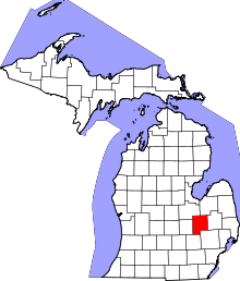 | |
| Villages | ||
| Charter townships | ||
| General law townships | ||
| Unincorporated communities | ||
| Footnotes | ‡This populated place also has portions in an adjacent county or counties | |