Morrice, Michigan
| Morrice, Michigan | |
|---|---|
| Village | |
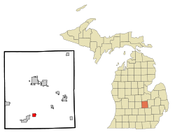 Location of Morrice, Michigan | |
| Coordinates: 42°50′17″N 84°10′42″W / 42.83806°N 84.17833°W | |
| Country | United States |
| State | Michigan |
| County | Shiawassee |
| Settled | 1837 |
| Incorporation | 1884 |
| Government | |
| • Type | President-council |
| • President | Harold Dickerson |
| Area[1] | |
| • Total | 1.38 sq mi (3.57 km2) |
| • Land | 1.30 sq mi (3.37 km2) |
| • Water | 0.08 sq mi (0.21 km2) |
| Elevation | 889 ft (271 m) |
| Population (2010)[2] | |
| • Total | 927 |
| • Estimate (2012[3]) | 906 |
| • Density | 713.1/sq mi (275.3/km2) |
| Time zone | Eastern (EST) (UTC-5) |
| • Summer (DST) | EDT (UTC-4) |
| ZIP code | 48857 |
| Area code(s) | 517 |
| FIPS code | 26-55560[4] |
| GNIS feature ID | 0632707[5] |
Morrice is a village located within Perry Township in Shiawassee County, of the U.S. state of Michigan. The population was 927 at the 2010 census. The center of population of Michigan is located in Morrice .
History
The village was named for William Morrice, a pioneer settler from Aberdeenshire, Scotland, who moved in 1837 to the area that would become the village.[6]
Geography
According to the United States Census Bureau, the village has a total area of 1.38 square miles (3.57 km2), of which 1.30 square miles (3.37 km2) is land and 0.08 square miles (0.21 km2) is water.[1]
Demographics
| Historical population | |||
|---|---|---|---|
| Census | Pop. | %± | |
| 1880 | 229 | — | |
| 1890 | 422 | 84.3% | |
| 1900 | 476 | 12.8% | |
| 1910 | 470 | −1.3% | |
| 1920 | 372 | −20.9% | |
| 1930 | 370 | −0.5% | |
| 1940 | 462 | 24.9% | |
| 1950 | 501 | 8.4% | |
| 1960 | 530 | 5.8% | |
| 1970 | 734 | 38.5% | |
| 1980 | 733 | −0.1% | |
| 1990 | 630 | −14.1% | |
| 2000 | 882 | 40.0% | |
| 2010 | 927 | 5.1% | |
| Est. 2015 | 897 | [7] | −3.2% |
2010 census
As of the census[2] of 2010, there were 927 people, 367 households, and 239 families residing in the village. The population density was 713.1 inhabitants per square mile (275.3/km2). There were 404 housing units at an average density of 310.8 per square mile (120.0/km2). The racial makeup of the village was 97.0% White, 0.1% African American, 0.6% Native American, 0.1% Asian, 0.3% from other races, and 1.8% from two or more races. Hispanic or Latino of any race were 1.6% of the population.
There were 367 households of which 37.6% had children under the age of 18 living with them, 46.3% were married couples living together, 12.0% had a female householder with no husband present, 6.8% had a male householder with no wife present, and 34.9% were non-families. 30.0% of all households were made up of individuals and 13.9% had someone living alone who was 65 years of age or older. The average household size was 2.53 and the average family size was 3.12.
The median age in the village was 32.6 years. 28.7% of residents were under the age of 18; 8.3% were between the ages of 18 and 24; 30.6% were from 25 to 44; 20.1% were from 45 to 64; and 12.4% were 65 years of age or older. The gender makeup of the village was 50.8% male and 49.2% female.
2000 census
As of the census[4] of 2000, there were 882 people, 316 households, and 232 families residing in the village. The population density was 837.4 per square mile (324.3/km²). There were 348 housing units at an average density of 330.4 per square mile (128.0/km²). The racial makeup of the village was 95.58% White, 0.68% African American, 0.68% Native American, 0.34% Asian, 0.57% from other races, and 2.15% from two or more races. Hispanic or Latino of any race were 1.70% of the population.
There were 316 households out of which 42.4% had children under the age of 18 living with them, 55.7% were married couples living together, 11.7% had a female householder with no husband present, and 26.3% were non-families. 19.3% of all households were made up of individuals and 6.3% had someone living alone who was 65 years of age or older. The average household size was 2.79 and the average family size was 3.20.
In the village the population was spread out with 32.2% under the age of 18, 9.0% from 18 to 24, 35.0% from 25 to 44, 17.7% from 45 to 64, and 6.1% who were 65 years of age or older. The median age was 30 years. For every 100 females there were 100.5 males. For every 100 females age 18 and over, there were 96.1 males.
The median income for a household in the village was $40,417, and the median income for a family was $42,000. Males had a median income of $34,886 versus $24,196 for females. The per capita income for the village was $17,423. About 4.3% of families and 5.1% of the population were below the poverty line, including 6.7% of those under age 18 and 7.4% of those age 65 or over.
References
- 1 2 "US Gazetteer files 2010". United States Census Bureau. Retrieved 2012-11-25.
- 1 2 "American FactFinder". United States Census Bureau. Retrieved 2012-11-25.
- ↑ "Population Estimates". United States Census Bureau. Retrieved 2013-06-03.
- 1 2 "American FactFinder". United States Census Bureau. Retrieved 2008-01-31.
- ↑ "US Board on Geographic Names". United States Geological Survey. 2007-10-25. Retrieved 2008-01-31.
- ↑ "Ghost towns and post offices of Shiawassee County". The Argus-Press. September 15, 2000. p. 3. Retrieved 30 April 2015.
- ↑ "Annual Estimates of the Resident Population for Incorporated Places: April 1, 2010 to July 1, 2015". Retrieved July 2, 2016.
- ↑ "Census of Population and Housing". Census.gov. Retrieved June 4, 2015.
External links
Coordinates: 42°50′19″N 84°10′42″W / 42.83861°N 84.17833°W
Municipalities and communities of Shiawassee County, Michigan, United States | ||
|---|---|---|
| Cities | 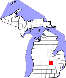 | |
| Villages | ||
| Charter townships | ||
| General law townships | ||
| Unincorporated communities | ||
| Footnotes | ‡This populated place also has portions in an adjacent county | |