Corunna, Michigan
| Corunna, Michigan | |
|---|---|
| City | |
 Location of Corunna, Michigan | |
| Coordinates: 42°58′53″N 84°7′6″W / 42.98139°N 84.11833°W | |
| Country | United States |
| State | Michigan |
| County | Shiawassee |
| Area[1] | |
| • Total | 3.26 sq mi (8.44 km2) |
| • Land | 3.19 sq mi (8.26 km2) |
| • Water | 0.07 sq mi (0.18 km2) |
| Elevation | 745 ft (227 m) |
| Population (2010)[2] | |
| • Total | 3,497 |
| • Estimate (2012[3]) | 3,431 |
| • Density | 1,096.2/sq mi (423.2/km2) |
| Time zone | Eastern (EST) (UTC-5) |
| • Summer (DST) | EDT (UTC-4) |
| ZIP code | 48817 |
| Area code(s) | 989 |
| FIPS code | 26-18300[4] |
| GNIS feature ID | 0623856[5] |
| Website | City of Corunna |
Corunna /kəˈrʌnə/ is a city in the U.S. state of Michigan. The population was 3,497 at the 2010 census. It is the county seat of Shiawassee County.[6] The city is located within Caledonia Charter Township, although it is an independent political entity.
Andrew Parsons, tenth Michigan Governor (March 8, 1853 - January 3, 1855), was a long-time resident of Corunna. A historical marker commemorating Parsons in Corunna was erected in 1969.[7]
History
Corunna was platted in 1837.[8] It was made the county seat in 1840, incorporated as a village in 1858 and made a city in 1869.[9]
Geography
According to the United States Census Bureau, the city has a total area of 3.26 square miles (8.44 km2), of which 3.19 square miles (8.26 km2) is land and 0.07 square miles (0.18 km2) is water.[1]
Major highways
Demographics
| Historical population | |||
|---|---|---|---|
| Census | Pop. | %± | |
| 1860 | 684 | — | |
| 1870 | 1,408 | 105.8% | |
| 1880 | 1,501 | 6.6% | |
| 1890 | 1,382 | −7.9% | |
| 1900 | 1,510 | 9.3% | |
| 1910 | 1,384 | −8.3% | |
| 1920 | 1,571 | 13.5% | |
| 1930 | 1,936 | 23.2% | |
| 1940 | 2,017 | 4.2% | |
| 1950 | 2,358 | 16.9% | |
| 1960 | 2,764 | 17.2% | |
| 1970 | 2,829 | 2.4% | |
| 1980 | 3,206 | 13.3% | |
| 1990 | 3,091 | −3.6% | |
| 2000 | 3,381 | 9.4% | |
| 2010 | 3,497 | 3.4% | |
| Est. 2015 | 3,404 | [10] | −2.7% |
2010 census
As of the census[2] of 2010, there were 3,497 people, 1,384 households, and 851 families residing in the city. The population density was 1,096.2 inhabitants per square mile (423.2/km2). There were 1,519 housing units at an average density of 476.2 per square mile (183.9/km2). The racial makeup of the city was 95.0% White, 1.2% African American, 0.4% Native American, 1.3% Asian, 0.6% from other races, and 1.5% from two or more races. Hispanic or Latino of any race were 2.4% of the population.
There were 1,384 households of which 33.5% had children under the age of 18 living with them, 39.0% were married couples living together, 17.7% had a female householder with no husband present, 4.8% had a male householder with no wife present, and 38.5% were non-families. 32.0% of all households were made up of individuals and 9.9% had someone living alone who was 65 years of age or older. The average household size was 2.34 and the average family size was 2.94.
The median age in the city was 36 years. 23.6% of residents were under the age of 18; 11.6% were between the ages of 18 and 24; 25.4% were from 25 to 44; 24.6% were from 45 to 64; and 14.7% were 65 years of age or older. The gender makeup of the city was 47.8% male and 52.2% female.
2000 census
As of the census[4] of 2000, there were 3,381 people, 1,320 households, and 819 families residing in the city. The population density was 1,095.0 per square mile (422.5/km²). There were 1,407 housing units at an average density of 455.7 per square mile (175.8/km²). The racial makeup of the city was 96.36% White, 1.06% African American, 0.65% Native American, 0.21% Asian, 0.56% from other races, and 1.15% from two or more races. Hispanic or Latino of any race were 2.54% of the population.
There were 1,320 households out of which 32.3% had children under the age of 18 living with them, 43.4% were married couples living together, 14.1% had a female householder with no husband present, and 37.9% were non-families. 32.1% of all households were made up of individuals and 11.7% had someone living alone who was 65 years of age or older. The average household size was 2.33 and the average family size was 2.94.
In the city the population was spread out with 23.0% under the age of 18, 12.8% from 18 to 24, 28.5% from 25 to 44, 19.8% from 45 to 64, and 15.9% who were 65 years of age or older. The median age was 35 years. For every 100 females there were 93.5 males. For every 100 females age 18 and over, there were 88.4 males.
The median income for a household in the city was $29,831, and the median income for a family was $41,705. Males had a median income of $29,668 versus $22,875 for females. The per capita income for the city was $17,053. About 10.0% of families and 12.0% of the population were below the poverty line, including 14.1% of those under age 18 and 13.9% of those age 65 or over.
Film
In 2005, filmmaker Bryan McGuire produced/directed/wrote a documentary chronicling what life in Corunna is like entitled Stay on the Tarvey. The film included interviews with current and former residents and explored topics such as race relations, family values and "hickdom".
Notable people
- Earl Rapp, pitcher for five Major League Baseball teams, member of Pacific Coast League Hall of Fame
See also
- Corunna Coal Company - Michigan's first coal mine.
References
Notes
- 1 2 "US Gazetteer files 2010". United States Census Bureau. Archived from the original on 2012-07-14. Retrieved 2012-11-25.
- 1 2 "American FactFinder". United States Census Bureau. Retrieved 2012-11-25.
- ↑ "Population Estimates". United States Census Bureau. Archived from the original on 2013-06-17. Retrieved 2013-06-03.
- 1 2 "American FactFinder". United States Census Bureau. Archived from the original on 2013-09-11. Retrieved 2008-01-31.
- ↑ U.S. Geological Survey Geographic Names Information System: Corunna, Michigan
- ↑ "Find a County". National Association of Counties. Archived from the original on 2011-05-31. Retrieved 2011-06-07.
- ↑ "Michigan Historical Marker: Governor Andrew Parsons". michmarkers.com.
- ↑ "Ghost towns and post offices of Shiawassee County". The Argus-Press. September 15, 2000. p. 3. Retrieved 30 April 2015.
- ↑ Romig 1986, p. 135.
- ↑ "Annual Estimates of the Resident Population for Incorporated Places: April 1, 2010 to July 1, 2015". Retrieved July 2, 2016.
- ↑ "Census of Population and Housing". Census.gov. Archived from the original on May 11, 2015. Retrieved June 4, 2015.
Sources
- Romig, Walter (October 1, 1986) [1973]. Michigan Place Names: The History of the Founding and the Naming of More Than Five Thousand Past and Present Michigan Communities. Great Lakes Books Series (Paperback). Detroit, Michigan: Wayne State University Press. ISBN 0-8143-1838-X. ISBN 978-0814318386.
External links
Coordinates: 42°58′55″N 84°07′04″W / 42.98194°N 84.11778°W
Municipalities and communities of Shiawassee County, Michigan, United States | ||
|---|---|---|
| Cities | 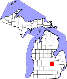 | |
| Villages | ||
| Charter townships | ||
| General law townships | ||
| Unincorporated communities | ||
| Footnotes | ‡This populated place also has portions in an adjacent county | |